Property Record
446 Benton Rd, North Haverhill, NH 03774


This Property Is For Sale
NEARBY LISTINGS FOR SALE OR LEASE
-
-
View all North Haverhill listings for sale on LoopNet.com
Property Detail
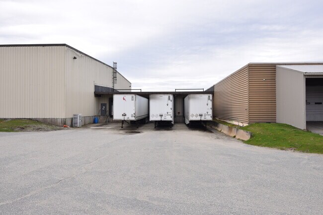
446 Benton Rd
Industrialgeneral
Grafton
X
New Hampshire
33009C0360E
10 AC
2024
Concord/New Hampshire North Area
2024
Other Market Areas
960600
Claremont-Lebanon, NH-VT
62,364 SF
HVHL-000409-000024
DEMOGRAPHICS near 446 Benton Rd
1 Mile
3 Mile
5 Mile
2024 Total Population
543
1,831
5,820
2029 Population
570
1,913
6,079
Pop Growth 2024-2029
+ 4.97%
+ 4.48%
+ 4.45%
Average Age
46
46
46
2024 Total Households
230
783
2,513
HH Growth 2024-2029
+ 4.78%
+ 4.21%
+ 4.22%
Median Household Inc
$59,582
$61,146
$58,402
Avg Household Size
2.20
2.20
2.20
2024 Avg HH Vehicles
2.00
2.00
2.00
Median Home Value
$178,357
$192,253
$189,897
Median Year Built
1973
1976
1974
Nearby Places
Map Layers
Map Styles
 Street
 Aerial
- Restaurants
- Banks
- Shops
- Fitness
- Groceries
Nearby Properties
Address
Land Use
TOTAL SIZE
Lot Size
Zoning
Address
Land Use
TOTAL SIZE
Lot Size
Zoning
92,913 SF
9.30 AC
200 OU
Address
Land Use
TOTAL SIZE
Lot Size
Zoning
13,216 SF
13.80 AC
401 NO
Address
Land Use
TOTAL SIZE
Lot Size
Zoning
59,884 SF
30 AC
401 NO
Address
Land Use
TOTAL SIZE
Lot Size
Zoning
41,048 SF
10.50 AC
200 OU
Address
Land Use
TOTAL SIZE
Lot Size
Zoning
1,487 SF
221.80 AC
200 OU
Address
Land Use
TOTAL SIZE
Lot Size
Zoning
2,039 SF
31.14 AC
401 NO
Address
Land Use
TOTAL SIZE
Lot Size
Zoning
15,374 SF
2.70 AC
401 NO
Address
Land Use
TOTAL SIZE
Lot Size
Zoning
22,042 SF
4.23 AC
450 NO
Address
Land Use
TOTAL SIZE
Lot Size
Zoning
4,637 SF
13.76 AC
401 NO
Address
Land Use
TOTAL SIZE
Lot Size
Zoning
23,065 SF
10 AC
450 NO
Address
Land Use
TOTAL SIZE
Lot Size
Zoning
52,368 SF
9.60 AC
401 NO
Address
Land Use
TOTAL SIZE
Lot Size
Zoning
33,158 SF
1.11 AC
Address
Land Use
TOTAL SIZE
Lot Size
Zoning
10,300 SF
1.86 AC
200 OU
Address
Land Use
TOTAL SIZE
Lot Size
Zoning
960 SF
37 AC
200 OU
Address
Land Use
TOTAL SIZE
Lot Size
Zoning
8,521 SF
1.80 AC
401 NO
Address
Land Use
TOTAL SIZE
Lot Size
Zoning
9,888 SF
0.82 AC
200 OU
Address
Land Use
TOTAL SIZE
Lot Size
Zoning
2,639 SF
140.47 AC
200 OU
Address
Land Use
TOTAL SIZE
Lot Size
Zoning
3,463 SF
6.08 AC
200 OU
Address
Land Use
TOTAL SIZE
Lot Size
Zoning
4,400 SF
1.28 AC
401 NO
Address
Land Use
TOTAL SIZE
Lot Size
Zoning
14,808 SF
2.10 AC
401 NO
Address
Land Use
TOTAL SIZE
Lot Size
Zoning
3,492 SF
11 AC
200 OU
Address
Land Use
TOTAL SIZE
Lot Size
Zoning
6.93 AC
401 NO
Address
Land Use
TOTAL SIZE
Lot Size
Zoning
5,738 SF
1.45 AC
401 NO
Address
Land Use
TOTAL SIZE
Lot Size
Zoning
4,333 SF
2.50 AC
401 NO
Address
Land Use
TOTAL SIZE
Lot Size
Zoning
4,362 SF
1.60 AC
401 NO
Address
Land Use
TOTAL SIZE
Lot Size
Zoning
2,465 SF
0.93 AC
401 NO
Address
Land Use
TOTAL SIZE
Lot Size
Zoning
5,276 SF
1.10 AC
200 OU
Address
Land Use
TOTAL SIZE
Lot Size
Zoning
7,241 SF
0.34 AC
401 NO
Address
Land Use
TOTAL SIZE
Lot Size
Zoning
6,218 SF
2.60 AC
401 NO
The World's #1 Commercial Real Estate Marketplace
Connect with us
© 2025 CoStar Group
The information above has been obtained from sources believed reliable. While we do not doubt its accuracy we have not verified it and make no guarantee, warranty or representation about it. It is your responsibility to independently confirm its accuracy and completeness. Any projections, opinions, assumptions, or estimates used are for example only and do not represent the current or future performance of the property. The value of this transaction to you depends on tax and other factors which should be evaluated by your tax, financial, and legal advisors. You and your advisors should conduct a careful, independent investigation of the property to determine to your satisfaction the suitability of the property for your needs.