Property Record
446 N Blythe Ave, Fresno, CA 93706
NEARBY LISTINGS FOR SALE OR LEASE
Property Detail
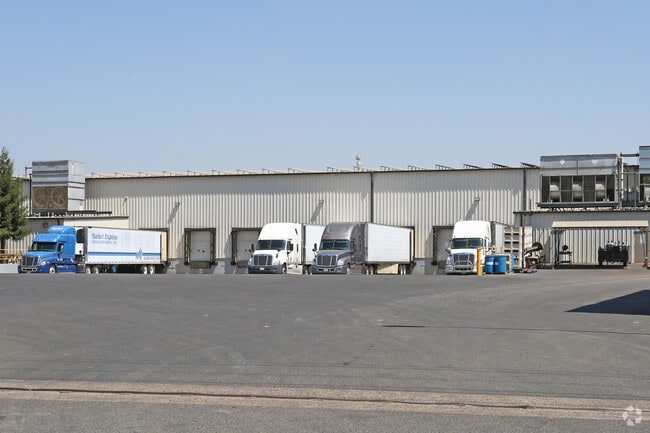
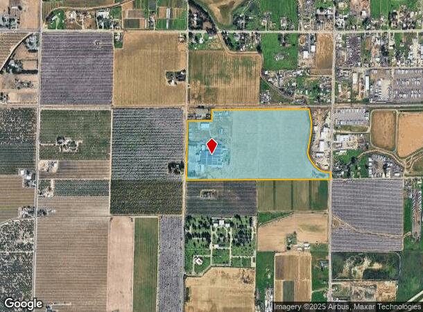
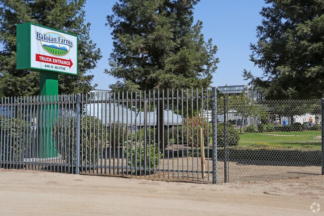
446 N Blythe Ave
326-050-23S
SUR RTS 63.59 ACS IN S1/2 OF NE1/4 SEC 2 T14R19
Industrialgeneral
Fresno
X
California
06019C2105H
63.59 AC
2025
Southwest Fresno
2025
Fresno
008600
Fresno, CA
106,740 SF
DEMOGRAPHICS near 446 N Blythe Ave
1 Mile
3 Mile
5 Mile
2024 Total Population
1,114
46,714
179,056
2029 Population
1,121
47,456
182,613
Pop Growth 2024-2029
+ 0.63%
+ 1.59%
+ 1.99%
Average Age
36
34
35
2024 Total Households
307
13,402
56,129
HH Growth 2024-2029
+ 0.65%
+ 1.56%
+ 1.99%
Median Household Inc
$67,682
$57,535
$50,337
Avg Household Size
3.50
3.40
3.00
2024 Avg HH Vehicles
2.00
2.00
2.00
Median Home Value
$345,833
$270,519
$268,795
Median Year Built
1978
1982
1972
Nearby Places
Map Layers
Map Styles
 Street
 Aerial
- Restaurants
- Banks
- Shops
- Fitness
- Groceries
PUBLIC TRANSPORTATION
COMMUTER RAIL
DRIVE
WALK
Distance
10 min
7.3 mi
AIRPORT
Fresno Yosemite International
DRIVE
WALK
Distance
Fresno Yosemite International
16 min
11.0 mi
Nearby Properties
Address
Land Use
TOTAL SIZE
Lot Size
Zoning
Address
Land Use
TOTAL SIZE
Lot Size
Zoning
159,822 SF
9.67 AC
R2
Address
Land Use
TOTAL SIZE
Lot Size
Zoning
71,384 SF
6.34 AC
IL
Address
Land Use
TOTAL SIZE
Lot Size
Zoning
32,156 SF
2.60 AC
C6
Address
Land Use
TOTAL SIZE
Lot Size
Zoning
103,088 SF
5.41 AC
R3
Address
Land Use
TOTAL SIZE
Lot Size
Zoning
84,309 SF
3.97 AC
R3
Address
Land Use
TOTAL SIZE
Lot Size
Zoning
74,212 SF
4.38 AC
R3
Address
Land Use
TOTAL SIZE
Lot Size
Zoning
86,559 SF
5.40 AC
R3
Address
Land Use
TOTAL SIZE
Lot Size
Zoning
127,758 SF
7.82 AC
R3
Address
Land Use
TOTAL SIZE
Lot Size
Zoning
45,376 SF
4.47 AC
CM
Address
Land Use
TOTAL SIZE
Lot Size
Zoning
63,250 SF
3.67 AC
C6
Address
Land Use
TOTAL SIZE
Lot Size
Zoning
88,327 SF
7.61 AC
R2A
Address
Land Use
TOTAL SIZE
Lot Size
Zoning
44,423 SF
2.13 AC
C6
Address
Land Use
TOTAL SIZE
Lot Size
Zoning
50,318 SF
5.01 AC
C1
Address
Land Use
TOTAL SIZE
Lot Size
Zoning
123,727 SF
15.17 AC
CG
Address
Land Use
TOTAL SIZE
Lot Size
Zoning
60,438 SF
11.46 AC
M1
Address
Land Use
TOTAL SIZE
Lot Size
Zoning
61,950 SF
3.11 AC
R3
Address
Land Use
TOTAL SIZE
Lot Size
Zoning
61,950 SF
3.40 AC
R3
Address
Land Use
TOTAL SIZE
Lot Size
Zoning
47,175 SF
11.63 AC
M3
Address
Land Use
TOTAL SIZE
Lot Size
Zoning
26.15 AC
M3
Address
Land Use
TOTAL SIZE
Lot Size
Zoning
108,764 SF
12.84 AC
BP
Address
Land Use
TOTAL SIZE
Lot Size
Zoning
10,000 SF
3.83 AC
CM
Address
Land Use
TOTAL SIZE
Lot Size
Zoning
91,980 SF
5.83 AC
M1
Address
Land Use
TOTAL SIZE
Lot Size
Zoning
14,405 SF
1.46 AC
C1
Address
Land Use
TOTAL SIZE
Lot Size
Zoning
55,880 SF
4.64 AC
R2
Address
Land Use
TOTAL SIZE
Lot Size
Zoning
20,520 SF
0.95 AC
C6
Address
Land Use
TOTAL SIZE
Lot Size
Zoning
6,255 SF
1.09 AC
C6
Address
Land Use
TOTAL SIZE
Lot Size
Zoning
22.24 AC
M3
Address
Land Use
TOTAL SIZE
Lot Size
Zoning
176,596 SF
9.60 AC
C6
Address
Land Use
TOTAL SIZE
Lot Size
Zoning
49,471 SF
6.78 AC
M1
The World's #1 Commercial Real Estate Marketplace
Connect with us
© 2026 CoStar Group
The information above has been obtained from sources believed reliable. While we do not doubt its accuracy we have not verified it and make no guarantee, warranty or representation about it. It is your responsibility to independently confirm its accuracy and completeness. Any projections, opinions, assumptions, or estimates used are for example only and do not represent the current or future performance of the property. The value of this transaction to you depends on tax and other factors which should be evaluated by your tax, financial, and legal advisors. You and your advisors should conduct a careful, independent investigation of the property to determine to your satisfaction the suitability of the property for your needs.