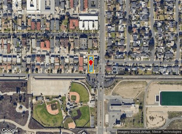
Property Record
4461 Farquhar Ave, Los Alamitos, CA 90720
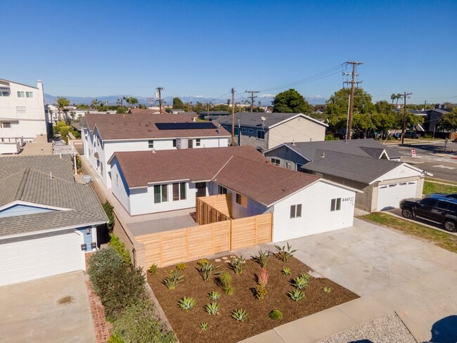
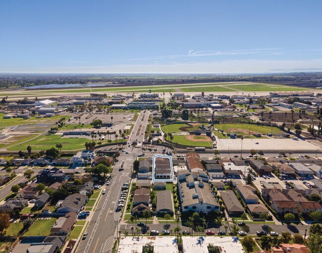
This Property Is For Sale
NEARBY LISTINGS FOR SALE OR LEASE
Property Detail
4461 Farquhar Ave
Anaheim-Santa Ana-Irvine, CA
Tract No. 740
222-132-25
N TR 740 BLK LOT 419
Multifamilydwelling
Orange
X
California
06059C0116J
419
2024
0.22 AC
2025
Los Alamitos
110015
Orange County (California)
4,020 SF
DEMOGRAPHICS near 4461 Farquhar Ave
1 Mile
3 Mile
5 Mile
2024 Total Population
11,174
171,830
513,546
2029 Population
11,109
170,751
511,059
Pop Growth 2024-2029
(0.58%)
(0.63%)
(0.48%)
Average Age
41
43
42
2024 Total Households
3,842
58,579
168,852
HH Growth 2024-2029
(0.60%)
(0.72%)
(0.62%)
Median Household Inc
$103,244
$112,745
$105,563
Avg Household Size
2.80
2.90
2.90
2024 Avg HH Vehicles
2.00
2.00
2.00
Median Home Value
$902,955
$845,401
$818,936
Median Year Built
1968
1966
1965
Nearby Places
Map Layers
Map Styles
 Street
 Aerial
- Restaurants
- Banks
- Shops
- Fitness
- Groceries
PUBLIC TRANSPORTATION
COMMUTER RAIL
Buena Park (91 Line - Southern California Regional Rail Authority (Metrolink), Orange County Line - Southern California Regional Rail Authority (Metrolink))
DRIVE
WALK
Distance
Buena Park (91 Line - Southern California Regional Rail Authority (Metrolink), Orange County Line - Southern California Regional Rail Authority (Metrolink))
17 min
9.5 mi
AIRPORT
Long Beach (Daugherty Field)
DRIVE
WALK
Distance
Long Beach (Daugherty Field)
13 min
7.9 mi
John Wayne/Orange County
DRIVE
WALK
Distance
John Wayne/Orange County
23 min
16.6 mi
Los Angeles International
DRIVE
WALK
Distance
Los Angeles International
37 min
26.7 mi
Freight Ports
Port of Long Beach
DRIVE
WALK
Distance
Port of Long Beach
20 min
9.4 mi
Nearby Properties
Address
Land Use
TOTAL SIZE
Lot Size
Zoning
Address
Land Use
TOTAL SIZE
Lot Size
Zoning
927.44 AC
Address
Land Use
TOTAL SIZE
Lot Size
Zoning
235,971 SF
10.58 AC
HGC4*
Address
Land Use
TOTAL SIZE
Lot Size
Zoning
1,226.28 AC
Address
Land Use
TOTAL SIZE
Lot Size
Zoning
22.31 AC
Address
Land Use
TOTAL SIZE
Lot Size
Zoning
13.97 AC
Address
Land Use
TOTAL SIZE
Lot Size
Zoning
210,000 SF
9.18 AC
PC3
Address
Land Use
TOTAL SIZE
Lot Size
Zoning
11.07 AC
Address
Land Use
TOTAL SIZE
Lot Size
Zoning
203,371 SF
0.14 AC
HGC4*
Address
Land Use
TOTAL SIZE
Lot Size
Zoning
Address
Land Use
TOTAL SIZE
Lot Size
Zoning
26,960 SF
64.86 AC
Address
Land Use
TOTAL SIZE
Lot Size
Zoning
8.09 AC
Address
Land Use
TOTAL SIZE
Lot Size
Zoning
120,094 SF
5.93 AC
Address
Land Use
TOTAL SIZE
Lot Size
Zoning
Address
Land Use
TOTAL SIZE
Lot Size
Zoning
3.97 AC
Address
Land Use
TOTAL SIZE
Lot Size
Zoning
Address
Land Use
TOTAL SIZE
Lot Size
Zoning
24.99 AC
Address
Land Use
TOTAL SIZE
Lot Size
Zoning
11.49 AC
Address
Land Use
TOTAL SIZE
Lot Size
Zoning
8.51 AC
Address
Land Use
TOTAL SIZE
Lot Size
Zoning
Address
Land Use
TOTAL SIZE
Lot Size
Zoning
105,069 SF
5.19 AC
Address
Land Use
TOTAL SIZE
Lot Size
Zoning
2,663 SF
1.43 AC
Address
Land Use
TOTAL SIZE
Lot Size
Zoning
17.50 AC
Address
Land Use
TOTAL SIZE
Lot Size
Zoning
83,600 SF
5.09 AC
R3
Address
Land Use
TOTAL SIZE
Lot Size
Zoning
165,343 SF
3.93 AC
Address
Land Use
TOTAL SIZE
Lot Size
Zoning
163,295 SF
6.17 AC
R3
Address
Land Use
TOTAL SIZE
Lot Size
Zoning
Address
Land Use
TOTAL SIZE
Lot Size
Zoning
105,549 SF
8.16 AC
Address
Land Use
TOTAL SIZE
Lot Size
Zoning
175,482 SF
3.13 AC
HGC4*
Address
Land Use
TOTAL SIZE
Lot Size
Zoning
Address
Land Use
TOTAL SIZE
Lot Size
Zoning
3.84 AC
The World's #1 Commercial Real Estate Marketplace
Connect with us
© 2025 CoStar Group
The information above has been obtained from sources believed reliable. While we do not doubt its accuracy we have not verified it and make no guarantee, warranty or representation about it. It is your responsibility to independently confirm its accuracy and completeness. Any projections, opinions, assumptions, or estimates used are for example only and do not represent the current or future performance of the property. The value of this transaction to you depends on tax and other factors which should be evaluated by your tax, financial, and legal advisors. You and your advisors should conduct a careful, independent investigation of the property to determine to your satisfaction the suitability of the property for your needs.