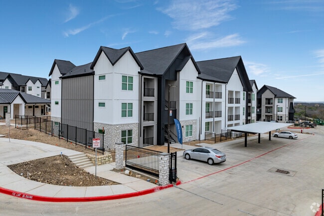
Property Record
4462 Wurzbach Rd, San Antonio, TX 78238
NEARBY LISTINGS FOR SALE OR LEASE
Property Detail
4462 Wurzbach Rd
San Antonio-New Braunfels, TX
Ncb 18110 ( Wurzbach Rd Apartments)
18107-017-0040
NCB 18110 ( WURZBACH RD APARTMENTS), BLOCK 20 LOT 9 2025 NEW PER PLAT 20003/1967-1968 FILED 8/23/24
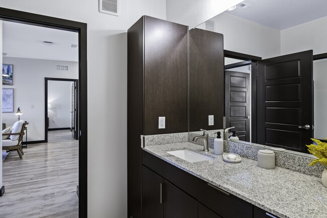
Multifamilydwelling
Bexar
X
Texas
48029C0380G
9
2024
14.51 AC
2025
Ingram Park
181705
San Antonio
286,146 SF
DEMOGRAPHICS near 4462 Wurzbach Rd
1 Mile
3 Mile
5 Mile
2024 Total Population
13,921
122,207
361,274
2029 Population
14,807
129,172
382,523
Pop Growth 2024-2029
+ 6.36%
+ 5.70%
+ 5.88%
Average Age
37
37
37
2024 Total Households
5,665
48,604
140,497
HH Growth 2024-2029
+ 6.71%
+ 5.95%
+ 6.16%
Median Household Inc
$56,579
$52,293
$52,613
Avg Household Size
2.40
2.50
2.50
2024 Avg HH Vehicles
2.00
2.00
2.00
Median Home Value
$175,222
$176,731
$177,537
Median Year Built
1989
1983
1984
Nearby Places
Map Layers
Map Styles
 Street
 Aerial
- Restaurants
- Banks
- Shops
- Fitness
- Groceries
PUBLIC TRANSPORTATION
AIRPORT
San Antonio International
DRIVE
WALK
Distance
San Antonio International
16 min
10.2 mi
Freight Ports
Calhoun Port
DRIVE
WALK
Distance
Calhoun Port
197 min
157.9 mi
Nearby Properties
Address
Land Use
TOTAL SIZE
Lot Size
Zoning
Address
Land Use
TOTAL SIZE
Lot Size
Zoning
339,795 SF
24.27 AC
Address
Land Use
TOTAL SIZE
Lot Size
Zoning
593,760 SF
69.28 AC
Address
Land Use
TOTAL SIZE
Lot Size
Zoning
370,870 SF
27.27 AC
Address
Land Use
TOTAL SIZE
Lot Size
Zoning
541,776 SF
22.15 AC
Address
Land Use
TOTAL SIZE
Lot Size
Zoning
118,393 SF
28.05 AC
Address
Land Use
TOTAL SIZE
Lot Size
Zoning
109,425 SF
30.63 AC
Address
Land Use
TOTAL SIZE
Lot Size
Zoning
275,270 SF
11.97 AC
Address
Land Use
TOTAL SIZE
Lot Size
Zoning
326,820 SF
12.57 AC
Address
Land Use
TOTAL SIZE
Lot Size
Zoning
284,359 SF
21.53 AC
Address
Land Use
TOTAL SIZE
Lot Size
Zoning
227,744 SF
3.99 AC
Address
Land Use
TOTAL SIZE
Lot Size
Zoning
239,623 SF
26.63 AC
Address
Land Use
TOTAL SIZE
Lot Size
Zoning
213,968 SF
21.30 AC
Address
Land Use
TOTAL SIZE
Lot Size
Zoning
253,862 SF
14.78 AC
Address
Land Use
TOTAL SIZE
Lot Size
Zoning
495,484 SF
5.81 AC
Address
Land Use
TOTAL SIZE
Lot Size
Zoning
451,205 SF
33.82 AC
Address
Land Use
TOTAL SIZE
Lot Size
Zoning
264,676 SF
11.91 AC
Address
Land Use
TOTAL SIZE
Lot Size
Zoning
285,150 SF
13.62 AC
Address
Land Use
TOTAL SIZE
Lot Size
Zoning
308,010 SF
9.93 AC
Address
Land Use
TOTAL SIZE
Lot Size
Zoning
228,973 SF
11.23 AC
Address
Land Use
TOTAL SIZE
Lot Size
Zoning
340,653 SF
19.27 AC
Address
Land Use
TOTAL SIZE
Lot Size
Zoning
8,508 SF
3.34 AC
Address
Land Use
TOTAL SIZE
Lot Size
Zoning
243,251 SF
10 AC
Address
Land Use
TOTAL SIZE
Lot Size
Zoning
221,778 SF
16.31 AC
Address
Land Use
TOTAL SIZE
Lot Size
Zoning
161,000 SF
10.32 AC
Address
Land Use
TOTAL SIZE
Lot Size
Zoning
536,162 SF
25.11 AC
Address
Land Use
TOTAL SIZE
Lot Size
Zoning
299,088 SF
15.66 AC
Address
Land Use
TOTAL SIZE
Lot Size
Zoning
291,385 SF
16.19 AC
Address
Land Use
TOTAL SIZE
Lot Size
Zoning
388,553 SF
29 AC
Address
Land Use
TOTAL SIZE
Lot Size
Zoning
226,172 SF
5.80 AC
Address
Land Use
TOTAL SIZE
Lot Size
Zoning
441,830 SF
21.50 AC
The World's #1 Commercial Real Estate Marketplace
Connect with us
© 2026 CoStar Group
The information above has been obtained from sources believed reliable. While we do not doubt its accuracy we have not verified it and make no guarantee, warranty or representation about it. It is your responsibility to independently confirm its accuracy and completeness. Any projections, opinions, assumptions, or estimates used are for example only and do not represent the current or future performance of the property. The value of this transaction to you depends on tax and other factors which should be evaluated by your tax, financial, and legal advisors. You and your advisors should conduct a careful, independent investigation of the property to determine to your satisfaction the suitability of the property for your needs.