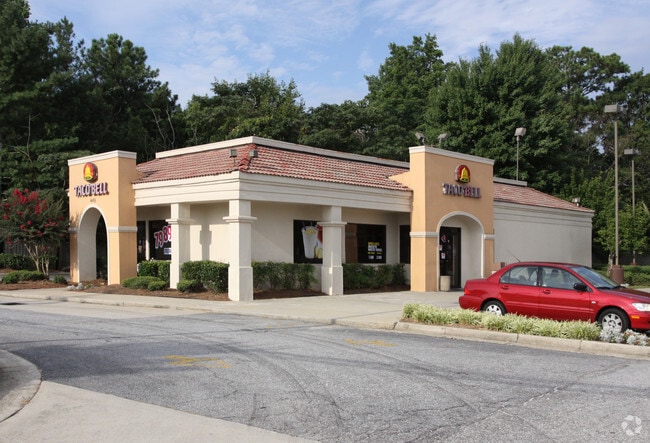
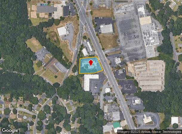
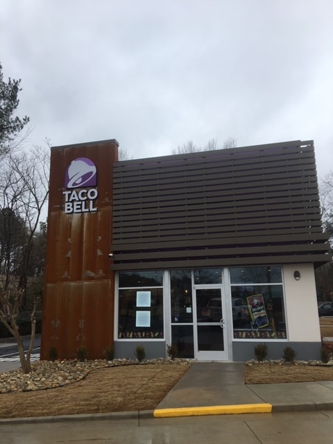
Property Record
4465 Jonesboro Rd, Forest Park, GA 30297

NEARBY LISTINGS FOR SALE OR LEASE
Property Detail
4465 Jonesboro Rd
13-0017C-00B-002
Prepared Del Taco Surv
Restaurantdrivein
Clayton
X
Georgia
13063C0038F
17
2025
0.92 AC
2025
Forest Park/Morrow
040310
Atlanta
1,960 SF
Atlanta-Sandy Springs-Roswell, GA
DEMOGRAPHICS near 4465 Jonesboro Rd
1 Mile
3 Mile
5 Mile
2024 Total Population
11,182
44,819
152,059
2029 Population
11,156
45,326
153,646
Pop Growth 2024-2029
(0.23%)
+ 1.13%
+ 1.04%
Average Age
35
35
36
2024 Total Households
3,775
15,591
55,048
HH Growth 2024-2029
(0.21%)
+ 1.45%
+ 1.16%
Median Household Inc
$38,184
$39,947
$44,226
Avg Household Size
2.90
2.80
2.70
2024 Avg HH Vehicles
2.00
2.00
2.00
Median Home Value
$87,772
$143,362
$162,729
Median Year Built
1966
1971
1978
Nearby Places
Map Layers
Map Styles
 Street
 Aerial
- Restaurants
- Banks
- Shops
- Fitness
- Groceries
PUBLIC TRANSPORTATION
AIRPORT
Hartsfield - Jackson Atlanta International
DRIVE
WALK
Distance
Hartsfield - Jackson Atlanta International
11 min
4.4 mi
Freight Ports
Georgia Ports - Savannah
DRIVE
WALK
Distance
Georgia Ports - Savannah
268 min
238.4 mi
SALE & LEASE HISTORY
LISTING DATE
SALE/LEASE

Nov 07, 2019
For Sale
Jul 08, 2019
For Sale
Nearby Properties
Address
Land Use
TOTAL SIZE
Lot Size
Zoning
Address
Land Use
TOTAL SIZE
Lot Size
Zoning
666,576 SF
63.38 AC
I
Address
Land Use
TOTAL SIZE
Lot Size
Zoning
318.25 AC
HI
Address
Land Use
TOTAL SIZE
Lot Size
Zoning
570,146 SF
42.33 AC
I
Address
Land Use
TOTAL SIZE
Lot Size
Zoning
20,964 SF
70.93 AC
I
Address
Land Use
TOTAL SIZE
Lot Size
Zoning
42,671 SF
56.11 AC
I
Address
Land Use
TOTAL SIZE
Lot Size
Zoning
848,420 SF
48.96 AC
I
Address
Land Use
TOTAL SIZE
Lot Size
Zoning
873,223 SF
60.88 AC
I
Address
Land Use
TOTAL SIZE
Lot Size
Zoning
596 SF
57.40 AC
RM
Address
Land Use
TOTAL SIZE
Lot Size
Zoning
513,124 SF
19.05 AC
I2
Address
Land Use
TOTAL SIZE
Lot Size
Zoning
278,866 SF
7.59 AC
CR
Address
Land Use
TOTAL SIZE
Lot Size
Zoning
298,264 SF
0.90 AC
C
Address
Land Use
TOTAL SIZE
Lot Size
Zoning
210,538 SF
101.40 AC
X
Address
Land Use
TOTAL SIZE
Lot Size
Zoning
105,260 SF
12.67 AC
C
Address
Land Use
TOTAL SIZE
Lot Size
Zoning
212,048 SF
110.06 AC
HI
Address
Land Use
TOTAL SIZE
Lot Size
Zoning
161,920 SF
14.26 AC
I
Address
Land Use
TOTAL SIZE
Lot Size
Zoning
24.09 AC
I
Address
Land Use
TOTAL SIZE
Lot Size
Zoning
96,028 SF
21.02 AC
I
Address
Land Use
TOTAL SIZE
Lot Size
Zoning
365,298 SF
22.51 AC
I
Address
Land Use
TOTAL SIZE
Lot Size
Zoning
220,000 SF
54.68 AC
I
Address
Land Use
TOTAL SIZE
Lot Size
Zoning
308,683 SF
41.30 AC
C
Address
Land Use
TOTAL SIZE
Lot Size
Zoning
298,674 SF
14.35 AC
I
Address
Land Use
TOTAL SIZE
Lot Size
Zoning
167,008 SF
36.21 AC
HI
Address
Land Use
TOTAL SIZE
Lot Size
Zoning
59,807 SF
43.70 AC
X
Address
Land Use
TOTAL SIZE
Lot Size
Zoning
123,747 SF
3.98 AC
Address
Land Use
TOTAL SIZE
Lot Size
Zoning
422,480 SF
19.42 AC
HI
Address
Land Use
TOTAL SIZE
Lot Size
Zoning
402,544 SF
20.43 AC
I1
Address
Land Use
TOTAL SIZE
Lot Size
Zoning
240 SF
27 AC
HI
Address
Land Use
TOTAL SIZE
Lot Size
Zoning
44,365 SF
17.77 AC
M
Address
Land Use
TOTAL SIZE
Lot Size
Zoning
474,830 SF
28.39 AC
I1
Address
Land Use
TOTAL SIZE
Lot Size
Zoning
411,859 SF
15.80 AC
I
The World's #1 Commercial Real Estate Marketplace
Connect with us
© 2025 CoStar Group
The information above has been obtained from sources believed reliable. While we do not doubt its accuracy we have not verified it and make no guarantee, warranty or representation about it. It is your responsibility to independently confirm its accuracy and completeness. Any projections, opinions, assumptions, or estimates used are for example only and do not represent the current or future performance of the property. The value of this transaction to you depends on tax and other factors which should be evaluated by your tax, financial, and legal advisors. You and your advisors should conduct a careful, independent investigation of the property to determine to your satisfaction the suitability of the property for your needs.