Property Record
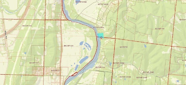
4471 E Miami River Rd, Cleves, OH 45002

Property Detail
4471 E Miami River Rd
Cincinnati, OH-KY-IN
EAST MIAMI RIVER RD 5.359ACS PT LOT 8 J MATSONS EST SUB
570-0200-0088
HAMILTON
Residentialacreage
Ohio
AE The base floodplain where base flood elevations are provided. AE Zones are now used on new format FIRMs instead of A1-A30 Zones.
8
2025
5.36 AC
2025
Forest Park/West
020403
Cincinnati/Dayton
NEARBY LISTINGS FOR SALE OR LEASE
DEMOGRAPHICS near 4471 E Miami River Rd
1 mile
3 mile
5 mile
2025 Total Population
810
16,192
45,121
2030 Population
834
16,291
45,482
Pop Growth 2025-2030
+ 2.96%
+ 0.61%
+ 0.80%
Average Age
40
41
42
2025 Total Households
294
5,992
17,177
HH Growth 2025-2030
+ 3.06%
+ 0.53%
+ 0.71%
Median Household Inc
$119,999
$88,011
$90,931
Avg Household Size
2.70
2.60
2.60
2025 Avg HH Vehicles
3.00
2.00
2.00
Median Home Value
$413,587
$315,316
$288,967
Median Year Built
1994
1990
1986
Nearby Places
Map Layers
Map Styles
 Street
 Aerial
Transit
 Traffic
 Biking
Places
Listings with unknown addresses are not visible on the map
- Restaurants
- Banks
- Shops
- Fitness
- Groceries
PUBLIC TRANSPORTATION
AIRPORT
Cincinnati/Northern Kentucky International
Drive
Walk
Distance
Cincinnati/Northern Kentucky International
42 min
24.8 mi
Freight Ports
Port of Toledo
Drive
Walk
Distance
Port of Toledo
253 min
212.6 mi
SALE & LEASE HISTORY
LISTING DATE
SALE/LEASE

Jul 10, 2017
For Sale
Nearby Properties
Address
Land Use
TOTAL SIZE
Lot Size
Zoning
Address
Land Use
TOTAL SIZE
Lot Size
Zoning
42.35 AC
Address
Land Use
TOTAL SIZE
Lot Size
Zoning
83.15 AC
Address
Land Use
TOTAL SIZE
Lot Size
Zoning
1,966 SF
74.07 AC
Address
Land Use
TOTAL SIZE
Lot Size
Zoning
37,169 SF
12.82 AC
A
Address
Land Use
TOTAL SIZE
Lot Size
Zoning
4,439 SF
1,059.01 AC
AA
Address
Land Use
TOTAL SIZE
Lot Size
Zoning
17.44 AC
AA
Address
Land Use
TOTAL SIZE
Lot Size
Zoning
2,700 SF
5.30 AC
A
Address
Land Use
TOTAL SIZE
Lot Size
Zoning
10.52 AC
Address
Land Use
TOTAL SIZE
Lot Size
Zoning
26,900 SF
15.31 AC
Address
Land Use
TOTAL SIZE
Lot Size
Zoning
69.35 AC
Address
Land Use
TOTAL SIZE
Lot Size
Zoning
Address
Land Use
TOTAL SIZE
Lot Size
Zoning
72,541 SF
6.01 AC
Address
Land Use
TOTAL SIZE
Lot Size
Zoning
45.41 AC
Address
Land Use
TOTAL SIZE
Lot Size
Zoning
Address
Land Use
TOTAL SIZE
Lot Size
Zoning
52.39 AC
Address
Land Use
TOTAL SIZE
Lot Size
Zoning
4,679 SF
1.95 AC
Address
Land Use
TOTAL SIZE
Lot Size
Zoning
16.30 AC
Address
Land Use
TOTAL SIZE
Lot Size
Zoning
1.40 AC
Address
Land Use
TOTAL SIZE
Lot Size
Zoning
3,360 SF
55.67 AC
Address
Land Use
TOTAL SIZE
Lot Size
Zoning
Address
Land Use
TOTAL SIZE
Lot Size
Zoning
Address
Land Use
TOTAL SIZE
Lot Size
Zoning
9,000 SF
17.22 AC
ACUP
Address
Land Use
TOTAL SIZE
Lot Size
Zoning
1,546 SF
1.02 AC
Address
Land Use
TOTAL SIZE
Lot Size
Zoning
11,453 SF
3.50 AC
EE
Address
Land Use
TOTAL SIZE
Lot Size
Zoning
1.97 AC
Address
Land Use
TOTAL SIZE
Lot Size
Zoning
Address
Land Use
TOTAL SIZE
Lot Size
Zoning
50,600 SF
4.78 AC
Address
Land Use
TOTAL SIZE
Lot Size
Zoning
1.44 AC
Address
Land Use
TOTAL SIZE
Lot Size
Zoning
Address
Land Use
TOTAL SIZE
Lot Size
Zoning
The World's #1 Commercial Real Estate Marketplace
Connect with us
© 2026 CoStar Group
The information above has been obtained from sources believed reliable. While we do not doubt its accuracy we have not verified it and make no guarantee, warranty or representation about it. It is your responsibility to independently confirm its accuracy and completeness. Any projections, opinions, assumptions, or estimates used are for example only and do not represent the current or future performance of the property. The value of this transaction to you depends on tax and other factors which should be evaluated by your tax, financial, and legal advisors. You and your advisors should conduct a careful, independent investigation of the property to determine to your satisfaction the suitability of the property for your needs.