Property Record
4475 Mahoning Ave, Youngstown, OH 44515


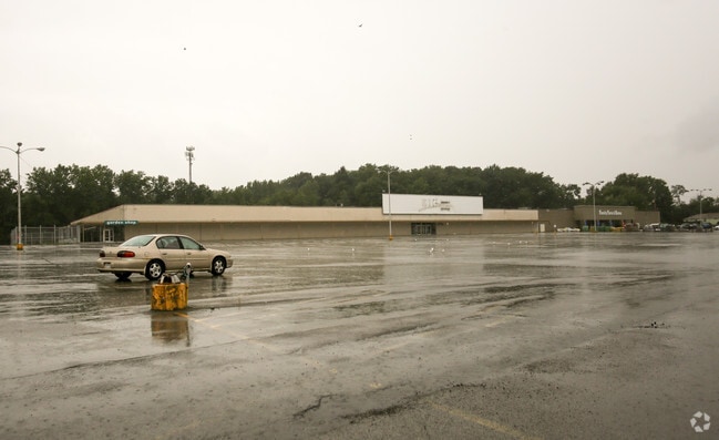
Property Detail
4475 Mahoning Ave
Youngstown-Warren, OH
LOT 1 TOO LARGE FOR DIMENSIONS U HAUL PLAT NO 1
48-014-0-059.00-0
Mahoning
Departmentstore
Ohio
B2
1
2025
12.88 AC
2025
Austintown
812601
Youngstown/Warren/Boardman
46,928 SF
NEARBY LISTINGS FOR SALE OR LEASE
DEMOGRAPHICS near 4475 Mahoning Ave
1 mile
3 mile
5 mile
2025 Total Population
9,533
46,784
104,509
2030 Population
9,401
46,140
103,724
Pop Growth 2025-2030
(1.38%)
(1.38%)
(0.75%)
Average Age
40
43
42
2025 Total Households
4,715
21,224
44,984
HH Growth 2025-2030
(1.63%)
(1.46%)
(0.83%)
Median Household Inc
$41,568
$48,781
$48,033
Avg Household Size
2.00
2.10
2.20
2025 Avg HH Vehicles
2.00
2.00
2.00
Median Home Value
$125,084
$135,310
$136,293
Median Year Built
1961
1962
1959
Nearby Places
Map Layers
Map Styles
 Street
 Aerial
Layers
 Traffic
 Biking
Places
Listings with unknown addresses are not visible on the map
- Restaurants
- Banks
- Shops
- Fitness
- Groceries
SALE & LEASE HISTORY
LISTING DATE
SALE/LEASE

Sep 24, 2016
For Sale
Nearby Properties
Address
Land Use
TOTAL SIZE
Lot Size
Zoning
Address
Land Use
TOTAL SIZE
Lot Size
Zoning
178,531 SF
189.16 AC
Address
Land Use
TOTAL SIZE
Lot Size
Zoning
188,134 SF
12.60 AC
R1
Address
Land Use
TOTAL SIZE
Lot Size
Zoning
127,210 SF
12.43 AC
R1
Address
Land Use
TOTAL SIZE
Lot Size
Zoning
227,713 SF
15.07 AC
Address
Land Use
TOTAL SIZE
Lot Size
Zoning
122,806 SF
9.46 AC
R1
Address
Land Use
TOTAL SIZE
Lot Size
Zoning
332,914 SF
54 AC
R1
Address
Land Use
TOTAL SIZE
Lot Size
Zoning
446,250 SF
43.88 AC
Address
Land Use
TOTAL SIZE
Lot Size
Zoning
101,687 SF
9.93 AC
Address
Land Use
TOTAL SIZE
Lot Size
Zoning
78,660 SF
22.36 AC
R3
Address
Land Use
TOTAL SIZE
Lot Size
Zoning
54,767 SF
16 AC
B2
Address
Land Use
TOTAL SIZE
Lot Size
Zoning
470,857 SF
18.81 AC
I2
Address
Land Use
TOTAL SIZE
Lot Size
Zoning
103,976 SF
16.14 AC
PUD
Address
Land Use
TOTAL SIZE
Lot Size
Zoning
89,325 SF
28.74 AC
Address
Land Use
TOTAL SIZE
Lot Size
Zoning
123,472 SF
28.58 AC
R3
Address
Land Use
TOTAL SIZE
Lot Size
Zoning
58,282 SF
24.96 AC
Address
Land Use
TOTAL SIZE
Lot Size
Zoning
70,544 SF
7.62 AC
B2
Address
Land Use
TOTAL SIZE
Lot Size
Zoning
63,713 SF
7.38 AC
Address
Land Use
TOTAL SIZE
Lot Size
Zoning
110,387 SF
20 AC
R3
Address
Land Use
TOTAL SIZE
Lot Size
Zoning
89,623 SF
20.45 AC
ASER
Address
Land Use
TOTAL SIZE
Lot Size
Zoning
106,276 SF
10.86 AC
Address
Land Use
TOTAL SIZE
Lot Size
Zoning
15,120 SF
15.07 AC
B2
Address
Land Use
TOTAL SIZE
Lot Size
Zoning
95,231 SF
37.75 AC
ASER
Address
Land Use
TOTAL SIZE
Lot Size
Zoning
382,202 SF
18.29 AC
I2
Address
Land Use
TOTAL SIZE
Lot Size
Zoning
81,954 SF
15 AC
R3
Address
Land Use
TOTAL SIZE
Lot Size
Zoning
49,659 SF
19.52 AC
R3
Address
Land Use
TOTAL SIZE
Lot Size
Zoning
23,603 SF
8.87 AC
B2
Address
Land Use
TOTAL SIZE
Lot Size
Zoning
114,617 SF
18.07 AC
B2
Address
Land Use
TOTAL SIZE
Lot Size
Zoning
70,713 SF
7.73 AC
B2
Address
Land Use
TOTAL SIZE
Lot Size
Zoning
200,160 SF
19.03 AC
Address
Land Use
TOTAL SIZE
Lot Size
Zoning
58,663 SF
24.53 AC
ASER
The World's #1 Commercial Real Estate Marketplace
Connect with us
© 2026 CoStar Group
The information above has been obtained from sources believed reliable. While we do not doubt its accuracy we have not verified it and make no guarantee, warranty or representation about it. It is your responsibility to independently confirm its accuracy and completeness. Any projections, opinions, assumptions, or estimates used are for example only and do not represent the current or future performance of the property. The value of this transaction to you depends on tax and other factors which should be evaluated by your tax, financial, and legal advisors. You and your advisors should conduct a careful, independent investigation of the property to determine to your satisfaction the suitability of the property for your needs.