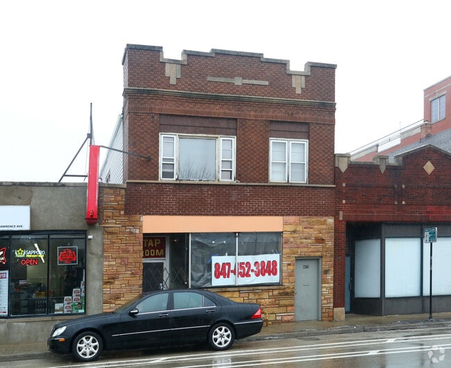
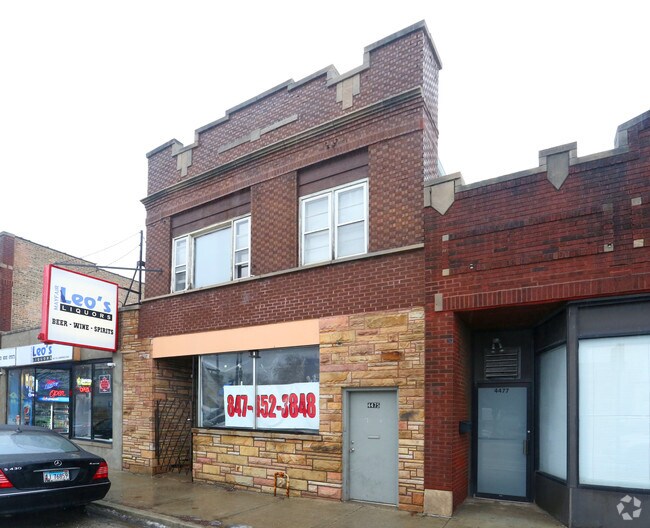
Property Record
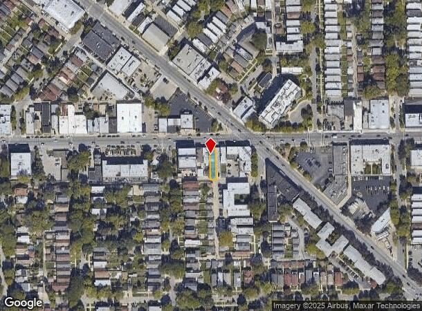
4475 W Lawrence Ave, Chicago, IL 60630
Current Lease Availabilities
NEARBY LISTINGS FOR SALE OR LEASE
Property Detail
4475 W Lawrence Ave
Chicago-Naperville-Elgin, IL-IN-WI
Crandells Sub
13-15-105-005-0000
L.C. (CRANDELLS) SUB OF BLKS 3 & 18 OF MONTROSE SUB O F & EH LT 1 IN SCHOOL TRUSTEES SUB E 40 ACS OF NH SEC 16 NW NH SW SEC 1
Miscresidentialimprovement
Cook
X
Illinois
17031C0403J
1
2023
0.07 AC
2024
Northwest City
160100
Chicago
7,700 SF
DEMOGRAPHICS near 4475 W Lawrence Ave
1 Mile
3 Mile
5 Mile
2024 Total Population
35,005
345,412
1,045,785
2029 Population
33,103
326,077
997,329
Pop Growth 2024-2029
(5.43%)
(5.60%)
(4.63%)
Average Age
40
39
39
2024 Total Households
13,130
128,660
422,768
HH Growth 2024-2029
(5.77%)
(5.97%)
(4.77%)
Median Household Inc
$82,062
$77,667
$76,417
Avg Household Size
2.60
2.60
2.40
2024 Avg HH Vehicles
1.00
1.00
1.00
Median Home Value
$369,701
$369,352
$361,486
Median Year Built
1946
1947
1948
Nearby Places
- Restaurants
- Banks
- Shops
- Fitness
- Groceries
PUBLIC TRANSPORTATION
TRANSIT/SUBWAY
Montrose Station (Blue Line) (Blue Line - Chicago Transit Authority "L" Trains (The "L"))
DRIVE
WALK
Distance
Montrose Station (Blue Line) (Blue Line - Chicago Transit Authority "L" Trains (The "L"))
5 min
13 min
0.7 mi
Mayfair Station (Milwaukee District North Line - Northeast Illinois Regional Commuter Railroad (Metra))
DRIVE
WALK
Distance
Mayfair Station (Milwaukee District North Line - Northeast Illinois Regional Commuter Railroad (Metra))
3 min
17 min
0.9 mi
COMMUTER RAIL
Mayfair Station (Milwaukee District North Line - Northeast Illinois Regional Commuter Railroad (Metra))
DRIVE
WALK
Distance
Mayfair Station (Milwaukee District North Line - Northeast Illinois Regional Commuter Railroad (Metra))
3 min
16 min
0.8 mi
Forest Glen Station (Milwaukee District North Line - Northeast Illinois Regional Commuter Railroad (Metra))
DRIVE
WALK
Distance
Forest Glen Station (Milwaukee District North Line - Northeast Illinois Regional Commuter Railroad (Metra))
3 min
1.2 mi
AIRPORT
Chicago O'Hare International
DRIVE
WALK
Distance
Chicago O'Hare International
38 min
12.2 mi
Chicago Midway International
DRIVE
WALK
Distance
Chicago Midway International
29 min
15.3 mi
Nearby Properties
Address
Land Use
TOTAL SIZE
Lot Size
Zoning
Address
Land Use
TOTAL SIZE
Lot Size
Zoning
Address
Land Use
TOTAL SIZE
Lot Size
Zoning
21.56 AC
RS-2
Address
Land Use
TOTAL SIZE
Lot Size
Zoning
PD 184
Address
Land Use
TOTAL SIZE
Lot Size
Zoning
237,832 SF
14.04 AC
PD 418
Address
Land Use
TOTAL SIZE
Lot Size
Zoning
190,011 SF
5.90 AC
PD 353
Address
Land Use
TOTAL SIZE
Lot Size
Zoning
170,538 SF
0.76 AC
PD 112
Address
Land Use
TOTAL SIZE
Lot Size
Zoning
331,294 SF
13.03 AC
PD 439
Address
Land Use
TOTAL SIZE
Lot Size
Zoning
1.04 AC
PD 130
Address
Land Use
TOTAL SIZE
Lot Size
Zoning
201,600 SF
1.93 AC
PD 92
Address
Land Use
TOTAL SIZE
Lot Size
Zoning
9.38 AC
PD 1179,PO
Address
Land Use
TOTAL SIZE
Lot Size
Zoning
2.25 AC
PD 612
Address
Land Use
TOTAL SIZE
Lot Size
Zoning
139.71 AC
PD 184
Address
Land Use
TOTAL SIZE
Lot Size
Zoning
15,600 SF
0.77 AC
M1-1
Address
Land Use
TOTAL SIZE
Lot Size
Zoning
100,900 SF
4.85 AC
PD 1415
Address
Land Use
TOTAL SIZE
Lot Size
Zoning
340,838 SF
31 AC
PD 1411
Address
Land Use
TOTAL SIZE
Lot Size
Zoning
382,635 SF
5.90 AC
M1-1
Address
Land Use
TOTAL SIZE
Lot Size
Zoning
63,700 SF
7.42 AC
PD 796
Address
Land Use
TOTAL SIZE
Lot Size
Zoning
24,400 SF
0.50 AC
B3-2
Address
Land Use
TOTAL SIZE
Lot Size
Zoning
78,410 SF
4.87 AC
PD 171
Address
Land Use
TOTAL SIZE
Lot Size
Zoning
0.43 AC
RS-2
Address
Land Use
TOTAL SIZE
Lot Size
Zoning
67,588 SF
2.50 AC
PD 415
Address
Land Use
TOTAL SIZE
Lot Size
Zoning
83,288 SF
13.43 AC
RT-4
Address
Land Use
TOTAL SIZE
Lot Size
Zoning
47,014 SF
0.57 AC
B3-2
Address
Land Use
TOTAL SIZE
Lot Size
Zoning
43,750 SF
1.19 AC
B1-1
Address
Land Use
TOTAL SIZE
Lot Size
Zoning
68,831 SF
3.11 AC
PD 353
Address
Land Use
TOTAL SIZE
Lot Size
Zoning
92,380 SF
7.28 AC
RS-2
Address
Land Use
TOTAL SIZE
Lot Size
Zoning
1.20 AC
PD 92
Address
Land Use
TOTAL SIZE
Lot Size
Zoning
116,624 SF
6.16 AC
PD 439
Address
Land Use
TOTAL SIZE
Lot Size
Zoning
0.44 AC
RS-3
Address
Land Use
TOTAL SIZE
Lot Size
Zoning
217,117 SF
7.54 AC
The World's #1 Commercial Real Estate Marketplace
Connect with us
© 2025 CoStar Group
The information above has been obtained from sources believed reliable. While we do not doubt its accuracy we have not verified it and make no guarantee, warranty or representation about it. It is your responsibility to independently confirm its accuracy and completeness. Any projections, opinions, assumptions, or estimates used are for example only and do not represent the current or future performance of the property. The value of this transaction to you depends on tax and other factors which should be evaluated by your tax, financial, and legal advisors. You and your advisors should conduct a careful, independent investigation of the property to determine to your satisfaction the suitability of the property for your needs.