Property Record
448 E Paradise Ave, Visalia, CA 93277
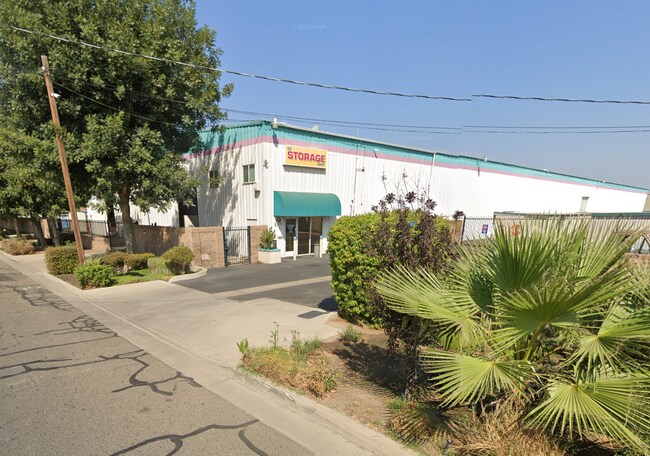

Property Detail
448 E Paradise Ave
097-262-010-000
POR SW/4 32-18-25
Warehouse
Tulare
IL
California
C and X Area of minimal flood hazard, usually depicted on FIRMs as above the 500-year flood level.
4.03 AC
2024
Southwest Visalia
2025
Visalia/Porterville
001701
Visalia, CA
37,440 SF
NEARBY LISTINGS FOR SALE OR LEASE
DEMOGRAPHICS near 448 E Paradise Ave
1 mile
3 mile
5 mile
2025 Total Population
16,057
108,947
166,781
2030 Population
16,327
111,249
170,520
Pop Growth 2025-2030
+ 1.68%
+ 2.11%
+ 2.24%
Average Age
37
37
36
2025 Total Households
5,738
35,951
54,141
HH Growth 2025-2030
+ 1.62%
+ 2.11%
+ 2.23%
Median Household Inc
$59,904
$80,343
$85,462
Avg Household Size
2.70
2.90
3.00
2025 Avg HH Vehicles
2.00
2.00
2.00
Median Home Value
$322,803
$347,908
$372,483
Median Year Built
1974
1982
1987
Nearby Places
Map Layers
Map Styles
 Street
 Aerial
Layers
 Traffic
 Biking
Places
Listings with unknown addresses are not visible on the map
- Restaurants
- Banks
- Shops
- Fitness
- Groceries
PUBLIC TRANSPORTATION
AIRPORT
Fresno Yosemite International
Drive
Walk
Distance
Fresno Yosemite International
59 min
45.4 mi
Nearby Properties
Address
Land Use
TOTAL SIZE
Lot Size
Zoning
Address
Land Use
TOTAL SIZE
Lot Size
Zoning
393,784 SF
17.79 AC
CR
Address
Land Use
TOTAL SIZE
Lot Size
Zoning
47,768 SF
6.76 AC
RM2
Address
Land Use
TOTAL SIZE
Lot Size
Zoning
123.41 AC
Address
Land Use
TOTAL SIZE
Lot Size
Zoning
159,023 SF
14.82 AC
CR
Address
Land Use
TOTAL SIZE
Lot Size
Zoning
146,890 SF
11.73 AC
CCM
Address
Land Use
TOTAL SIZE
Lot Size
Zoning
91,492 SF
4.80 AC
RM3
Address
Land Use
TOTAL SIZE
Lot Size
Zoning
148,667 SF
11.35 AC
CR
Address
Land Use
TOTAL SIZE
Lot Size
Zoning
61,587 SF
0.43 AC
PA
Address
Land Use
TOTAL SIZE
Lot Size
Zoning
4.24 AC
Address
Land Use
TOTAL SIZE
Lot Size
Zoning
185,883 SF
9.97 AC
CSO
Address
Land Use
TOTAL SIZE
Lot Size
Zoning
134,561 SF
11.55 AC
CR
Address
Land Use
TOTAL SIZE
Lot Size
Zoning
92,298 SF
7.32 AC
CR
Address
Land Use
TOTAL SIZE
Lot Size
Zoning
56,384 SF
9.14 AC
Address
Land Use
TOTAL SIZE
Lot Size
Zoning
126,532 SF
8.63 AC
RM2
Address
Land Use
TOTAL SIZE
Lot Size
Zoning
47,242 SF
3.94 AC
QP-PA
Address
Land Use
TOTAL SIZE
Lot Size
Zoning
103,000 SF
11.17 AC
CCM
Address
Land Use
TOTAL SIZE
Lot Size
Zoning
78,751 SF
2.67 AC
R-M-2
Address
Land Use
TOTAL SIZE
Lot Size
Zoning
54,674 SF
1.26 AC
CDT
Address
Land Use
TOTAL SIZE
Lot Size
Zoning
134,055 SF
3.49 AC
CDT
Address
Land Use
TOTAL SIZE
Lot Size
Zoning
5.85 AC
RM2
Address
Land Use
TOTAL SIZE
Lot Size
Zoning
82,200 SF
6.29 AC
CSO
Address
Land Use
TOTAL SIZE
Lot Size
Zoning
87,160 SF
0.75 AC
PA
Address
Land Use
TOTAL SIZE
Lot Size
Zoning
69,120 SF
5.23 AC
CR
Address
Land Use
TOTAL SIZE
Lot Size
Zoning
28,557 SF
2.88 AC
CR
Address
Land Use
TOTAL SIZE
Lot Size
Zoning
83,011 SF
4.46 AC
QP
Address
Land Use
TOTAL SIZE
Lot Size
Zoning
88,589 SF
7.98 AC
CR
Address
Land Use
TOTAL SIZE
Lot Size
Zoning
133,910 SF
14.35 AC
CSO
Address
Land Use
TOTAL SIZE
Lot Size
Zoning
41,073 SF
3.30 AC
CR
The World's #1 Commercial Real Estate Marketplace
Connect with us
© 2026 CoStar Group
The information above has been obtained from sources believed reliable. While we do not doubt its accuracy we have not verified it and make no guarantee, warranty or representation about it. It is your responsibility to independently confirm its accuracy and completeness. Any projections, opinions, assumptions, or estimates used are for example only and do not represent the current or future performance of the property. The value of this transaction to you depends on tax and other factors which should be evaluated by your tax, financial, and legal advisors. You and your advisors should conduct a careful, independent investigation of the property to determine to your satisfaction the suitability of the property for your needs.