Property Record
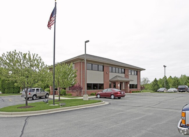
448 Falcon Ridge Dr, Burlington, WI 53105


NEARBY LISTINGS FOR SALE OR LEASE
Property Detail
448 Falcon Ridge Dr
Racine, WI
Certified Survey Map No 3196
206-031928025010
PT NW1/4 CSM 2173 V6 P665 LOT 1 EXC V3181P605 FROM 206031928019010 & 29001000 IN 99 FOR 2000 ROLL **TOTAL ACRES** 1.13 PT TO
Commercialnec
Racine
X
Wisconsin
55101C0134E
1
2024
0.13 AC
2024
Racine West
002401
Milwaukee/Madison
6,048 SF
DEMOGRAPHICS near 448 Falcon Ridge Dr
1 Mile
3 Mile
5 Mile
2024 Total Population
2,677
15,762
22,984
2029 Population
2,703
15,711
22,884
Pop Growth 2024-2029
+ 0.97%
(0.32%)
(0.44%)
Average Age
41
41
42
2024 Total Households
1,075
6,432
9,315
HH Growth 2024-2029
+ 0.84%
(0.37%)
(0.48%)
Median Household Inc
$88,527
$83,433
$83,774
Avg Household Size
2.40
2.40
2.40
2024 Avg HH Vehicles
2.00
2.00
2.00
Median Home Value
$326,829
$274,376
$287,250
Median Year Built
1978
1974
1975
Nearby Places
Map Layers
Map Styles
 Street
 Aerial
- Restaurants
- Banks
- Shops
- Fitness
- Groceries
PUBLIC TRANSPORTATION
AIRPORT
General Mitchell International
DRIVE
WALK
Distance
General Mitchell International
49 min
28.4 mi
Freight Ports
Port Milwaukee
DRIVE
WALK
Distance
Port Milwaukee
49 min
31.2 mi
Nearby Properties
Address
Land Use
TOTAL SIZE
Lot Size
Zoning
Address
Land Use
TOTAL SIZE
Lot Size
Zoning
164,700 SF
0.97 AC
Address
Land Use
TOTAL SIZE
Lot Size
Zoning
6.08 AC
Address
Land Use
TOTAL SIZE
Lot Size
Zoning
42.50 AC
Address
Land Use
TOTAL SIZE
Lot Size
Zoning
155,078 SF
27.98 AC
Address
Land Use
TOTAL SIZE
Lot Size
Zoning
22.08 AC
Address
Land Use
TOTAL SIZE
Lot Size
Zoning
48,105 SF
0.39 AC
Address
Land Use
TOTAL SIZE
Lot Size
Zoning
15,776 SF
8.97 AC
Address
Land Use
TOTAL SIZE
Lot Size
Zoning
11.76 AC
Address
Land Use
TOTAL SIZE
Lot Size
Zoning
69,915 SF
0.54 AC
Address
Land Use
TOTAL SIZE
Lot Size
Zoning
48,326 SF
5.65 AC
Address
Land Use
TOTAL SIZE
Lot Size
Zoning
13,616 SF
6.19 AC
Address
Land Use
TOTAL SIZE
Lot Size
Zoning
62.77 AC
Address
Land Use
TOTAL SIZE
Lot Size
Zoning
Address
Land Use
TOTAL SIZE
Lot Size
Zoning
39,600 SF
0.47 AC
Address
Land Use
TOTAL SIZE
Lot Size
Zoning
12.03 AC
Address
Land Use
TOTAL SIZE
Lot Size
Zoning
22,670 SF
4.22 AC
Address
Land Use
TOTAL SIZE
Lot Size
Zoning
6.89 AC
Address
Land Use
TOTAL SIZE
Lot Size
Zoning
99,779 SF
0.75 AC
Address
Land Use
TOTAL SIZE
Lot Size
Zoning
40,432 SF
3.84 AC
Address
Land Use
TOTAL SIZE
Lot Size
Zoning
Address
Land Use
TOTAL SIZE
Lot Size
Zoning
952 SF
0.79 AC
Address
Land Use
TOTAL SIZE
Lot Size
Zoning
10.12 AC
Address
Land Use
TOTAL SIZE
Lot Size
Zoning
21,564 SF
0.95 AC
Address
Land Use
TOTAL SIZE
Lot Size
Zoning
68,900 SF
6.29 AC
Address
Land Use
TOTAL SIZE
Lot Size
Zoning
Address
Land Use
TOTAL SIZE
Lot Size
Zoning
13,200 SF
17.20 AC
Address
Land Use
TOTAL SIZE
Lot Size
Zoning
155.53 AC
Address
Land Use
TOTAL SIZE
Lot Size
Zoning
24,495 SF
0.55 AC
Address
Land Use
TOTAL SIZE
Lot Size
Zoning
14.78 AC
The World's #1 Commercial Real Estate Marketplace
Connect with us
© 2026 CoStar Group
The information above has been obtained from sources believed reliable. While we do not doubt its accuracy we have not verified it and make no guarantee, warranty or representation about it. It is your responsibility to independently confirm its accuracy and completeness. Any projections, opinions, assumptions, or estimates used are for example only and do not represent the current or future performance of the property. The value of this transaction to you depends on tax and other factors which should be evaluated by your tax, financial, and legal advisors. You and your advisors should conduct a careful, independent investigation of the property to determine to your satisfaction the suitability of the property for your needs.