Property Record
448 S Main St, Deerfield, WI 53531


NEARBY LISTINGS FOR SALE OR LEASE
Property Detail
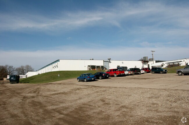
448 S Main St
Madison, WI
ASSESSORS PLAT PRT OUTLOT 46 LYG N OF N LN OF VIL ST RNG E&W ACR SD OL SD N LN D ESCR AS BEG 170.3 FT S OF NE COR OF SD OL TH N80DEGW 600.4 FT TH N9DEGE 80.6 FT TH S45DEG33W 94.15 FT TH S6DEG55W 4.5 FT TH N80DEGW 94.6 FT TO POE SD N LN & ALSO INCL AD
0608-222-6128-2
Dane
Industrialgeneral
Wisconsin
AE
28
55025C0556G
17.50 AC
2024
Outlying Dane West
2024
Milwaukee/Madison
011900
DEMOGRAPHICS near 448 S Main St
1 Mile
3 Mile
5 Mile
2024 Total Population
7,883
25,356
70,089
2029 Population
8,242
26,471
72,751
Pop Growth 2024-2029
+ 4.55%
+ 4.40%
+ 3.80%
Average Age
37
38
38
2024 Total Households
3,105
10,294
29,246
HH Growth 2024-2029
+ 4.73%
+ 4.55%
+ 3.92%
Median Household Inc
$90,509
$107,012
$95,760
Avg Household Size
2.50
2.40
2.30
2024 Avg HH Vehicles
2.00
2.00
2.00
Median Home Value
$362,540
$356,734
$352,412
Median Year Built
2000
2000
1995
Nearby Places
Map Layers
Map Styles
 Street
 Aerial
- Restaurants
- Banks
- Shops
- Fitness
- Groceries
PUBLIC TRANSPORTATION
AIRPORT
Dane County Regional/Truax Field
DRIVE
WALK
Distance
Dane County Regional/Truax Field
34 min
17.1 mi
Nearby Properties
Address
Land Use
TOTAL SIZE
Lot Size
Zoning
Address
Land Use
TOTAL SIZE
Lot Size
Zoning
13.06 AC
Address
Land Use
TOTAL SIZE
Lot Size
Zoning
77,296 SF
4.84 AC
TR-U1
Address
Land Use
TOTAL SIZE
Lot Size
Zoning
11.20 AC
SE
Address
Land Use
TOTAL SIZE
Lot Size
Zoning
18,242 SF
4.45 AC
TR-U1
Address
Land Use
TOTAL SIZE
Lot Size
Zoning
Address
Land Use
TOTAL SIZE
Lot Size
Zoning
244,074 SF
7.96 AC
SR-V2
Address
Land Use
TOTAL SIZE
Lot Size
Zoning
Address
Land Use
TOTAL SIZE
Lot Size
Zoning
3.35 AC
Address
Land Use
TOTAL SIZE
Lot Size
Zoning
2.76 AC
Address
Land Use
TOTAL SIZE
Lot Size
Zoning
236,626 SF
5.63 AC
PD
Address
Land Use
TOTAL SIZE
Lot Size
Zoning
5.58 AC
Address
Land Use
TOTAL SIZE
Lot Size
Zoning
3.56 AC
Address
Land Use
TOTAL SIZE
Lot Size
Zoning
3.96 AC
Address
Land Use
TOTAL SIZE
Lot Size
Zoning
17.81 AC
Address
Land Use
TOTAL SIZE
Lot Size
Zoning
3.71 AC
Address
Land Use
TOTAL SIZE
Lot Size
Zoning
6.66 AC
Address
Land Use
TOTAL SIZE
Lot Size
Zoning
152,075 SF
3.54 AC
PD
Address
Land Use
TOTAL SIZE
Lot Size
Zoning
5.23 AC
Address
Land Use
TOTAL SIZE
Lot Size
Zoning
142,001 SF
4.18 AC
SR-V2
Address
Land Use
TOTAL SIZE
Lot Size
Zoning
20,787 SF
4.56 AC
TR-U1
Address
Land Use
TOTAL SIZE
Lot Size
Zoning
3.62 AC
Address
Land Use
TOTAL SIZE
Lot Size
Zoning
7.77 AC
Address
Land Use
TOTAL SIZE
Lot Size
Zoning
6.32 AC
Address
Land Use
TOTAL SIZE
Lot Size
Zoning
3.12 AC
Address
Land Use
TOTAL SIZE
Lot Size
Zoning
147,249 SF
4.91 AC
PD
Address
Land Use
TOTAL SIZE
Lot Size
Zoning
13.43 AC
Address
Land Use
TOTAL SIZE
Lot Size
Zoning
54,658 SF
5.35 AC
PD
Address
Land Use
TOTAL SIZE
Lot Size
Zoning
5.77 AC
Address
Land Use
TOTAL SIZE
Lot Size
Zoning
5.17 AC
Address
Land Use
TOTAL SIZE
Lot Size
Zoning
The World's #1 Commercial Real Estate Marketplace
Connect with us
© 2025 CoStar Group
The information above has been obtained from sources believed reliable. While we do not doubt its accuracy we have not verified it and make no guarantee, warranty or representation about it. It is your responsibility to independently confirm its accuracy and completeness. Any projections, opinions, assumptions, or estimates used are for example only and do not represent the current or future performance of the property. The value of this transaction to you depends on tax and other factors which should be evaluated by your tax, financial, and legal advisors. You and your advisors should conduct a careful, independent investigation of the property to determine to your satisfaction the suitability of the property for your needs.