Property Record
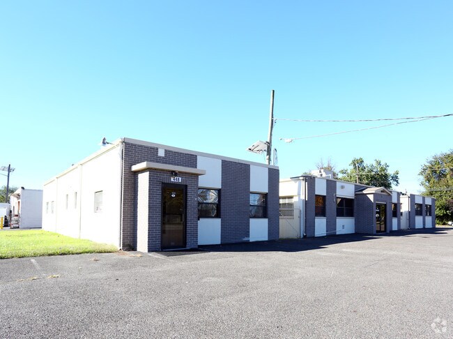
448 Whitehead Rd, Trenton, NJ 08619


Property Detail
448 Whitehead Rd
03-01580-0000-00006
03050-X
Officebuilding
Mercer
I
New Jersey
B and X Area of moderate flood hazard, usually the area between the limits of the 100-year and 500-year floods.
6
2024
0.31 AC
2025
Trenton
002902
Northern New Jersey
6,849 SF
Trenton-Princeton, NJ
NEARBY LISTINGS FOR SALE OR LEASE
DEMOGRAPHICS near 448 Whitehead Rd
1 mile
3 mile
5 mile
2025 Total Population
9,160
134,719
265,335
2030 Population
9,310
138,735
273,184
Pop Growth 2025-2030
+ 1.64%
+ 2.98%
+ 2.96%
Average Age
40
39
40
2025 Total Households
3,297
49,295
99,029
HH Growth 2025-2030
+ 1.88%
+ 3.24%
+ 3.26%
Median Household Inc
$74,842
$66,541
$80,568
Avg Household Size
2.60
2.60
2.50
2025 Avg HH Vehicles
2.00
2.00
2.00
Median Home Value
$306,179
$281,082
$320,292
Median Year Built
1957
1954
1958
Nearby Places
Map Layers
Map Styles
 Street
 Aerial
Layers
 Traffic
 Biking
Places
Listings with unknown addresses are not visible on the map
- Restaurants
- Banks
- Shops
- Fitness
- Groceries
PUBLIC TRANSPORTATION
COMMUTER RAIL
Hamilton (Northeast Corridor Line - NJ Transit Commuter Rail (NJ Transit))
Drive
Walk
Distance
Hamilton (Northeast Corridor Line - NJ Transit Commuter Rail (NJ Transit))
5 min
1.9 mi
Trenton Transit Center (NJT) (Northeast Corridor Line - NJ Transit Commuter Rail (NJ Transit), River LINE - River LINE (River LINE))
Drive
Walk
Distance
Trenton Transit Center (NJT) (Northeast Corridor Line - NJ Transit Commuter Rail (NJ Transit), River LINE - River LINE (River LINE))
7 min
2.5 mi
AIRPORT
Trenton Mercer
Drive
Walk
Distance
Trenton Mercer
16 min
7.5 mi
Freight Ports
Port of Philadelphia
Drive
Walk
Distance
Port of Philadelphia
48 min
32.5 mi
SALE & LEASE HISTORY
LISTING DATE
SALE/LEASE

Oct 14, 2016
For Lease
Jan 23, 2017
For Sale
Nearby Properties
Address
Land Use
TOTAL SIZE
Lot Size
Zoning
Address
Land Use
TOTAL SIZE
Lot Size
Zoning
8.23 AC
BA
Address
Land Use
TOTAL SIZE
Lot Size
Zoning
26 AC
HIST
Address
Land Use
TOTAL SIZE
Lot Size
Zoning
141.90 AC
EGI
Address
Land Use
TOTAL SIZE
Lot Size
Zoning
6.69 AC
BA
Address
Land Use
TOTAL SIZE
Lot Size
Zoning
Address
Land Use
TOTAL SIZE
Lot Size
Zoning
879,376 SF
2.54 AC
BA
Address
Land Use
TOTAL SIZE
Lot Size
Zoning
104,448 SF
8.49 AC
IA
Address
Land Use
TOTAL SIZE
Lot Size
Zoning
5.38 AC
MU
Address
Land Use
TOTAL SIZE
Lot Size
Zoning
Address
Land Use
TOTAL SIZE
Lot Size
Zoning
288,000 SF
1.23 AC
BA
Address
Land Use
TOTAL SIZE
Lot Size
Zoning
6.11 AC
R-1
Address
Land Use
TOTAL SIZE
Lot Size
Zoning
35.83 AC
RB
Address
Land Use
TOTAL SIZE
Lot Size
Zoning
56.45 AC
EGI
Address
Land Use
TOTAL SIZE
Lot Size
Zoning
0.24 AC
BA
Address
Land Use
TOTAL SIZE
Lot Size
Zoning
186,960 SF
2.37 AC
BA
Address
Land Use
TOTAL SIZE
Lot Size
Zoning
24.44 AC
AT
Address
Land Use
TOTAL SIZE
Lot Size
Zoning
212,074 SF
0.82 AC
BA
Address
Land Use
TOTAL SIZE
Lot Size
Zoning
58,620 SF
1.95 AC
PM
Address
Land Use
TOTAL SIZE
Lot Size
Zoning
161,080 SF
2.21 AC
BA
Address
Land Use
TOTAL SIZE
Lot Size
Zoning
27,776 SF
21.19 AC
B-H
Address
Land Use
TOTAL SIZE
Lot Size
Zoning
44.83 AC
I
Address
Land Use
TOTAL SIZE
Lot Size
Zoning
10.29 AC
RB
Address
Land Use
TOTAL SIZE
Lot Size
Zoning
69.56 AC
EGI
Address
Land Use
TOTAL SIZE
Lot Size
Zoning
21.17 AC
I
Address
Land Use
TOTAL SIZE
Lot Size
Zoning
7,724 SF
2.06 AC
BA
Address
Land Use
TOTAL SIZE
Lot Size
Zoning
11,885 SF
20.25 AC
R-2
Address
Land Use
TOTAL SIZE
Lot Size
Zoning
4.07 AC
MU
Address
Land Use
TOTAL SIZE
Lot Size
Zoning
357 SF
0.96 AC
HIST
Address
Land Use
TOTAL SIZE
Lot Size
Zoning
260,160 SF
0.84 AC
BA
Address
Land Use
TOTAL SIZE
Lot Size
Zoning
57,500 SF
0.77 AC
BA
The World's #1 Commercial Real Estate Marketplace
Connect with us
© 2026 CoStar Group
The information above has been obtained from sources believed reliable. While we do not doubt its accuracy we have not verified it and make no guarantee, warranty or representation about it. It is your responsibility to independently confirm its accuracy and completeness. Any projections, opinions, assumptions, or estimates used are for example only and do not represent the current or future performance of the property. The value of this transaction to you depends on tax and other factors which should be evaluated by your tax, financial, and legal advisors. You and your advisors should conduct a careful, independent investigation of the property to determine to your satisfaction the suitability of the property for your needs.