Property Record
4480 Poole Rd, Raleigh, NC 27610


NEARBY LISTINGS FOR SALE OR LEASE
Property Detail
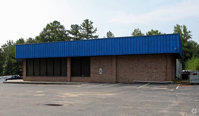
4480 Poole Rd
Raleigh-Cary, NC
Eastpark
1733.13-03-3962-000
LO44 EASTPARK BM1999-03
Warehouse
Wake
X
North Carolina
3720173300K
44
2025
1.93 AC
2025
Southeast Wake County
054106
Raleigh/Durham
9,815 SF
DEMOGRAPHICS near 4480 Poole Rd
1 Mile
3 Mile
5 Mile
2024 Total Population
5,616
61,176
158,617
2029 Population
6,110
66,443
172,459
Pop Growth 2024-2029
+ 8.80%
+ 8.61%
+ 8.73%
Average Age
35
36
37
2024 Total Households
1,990
21,434
60,478
HH Growth 2024-2029
+ 8.89%
+ 8.69%
+ 9.00%
Median Household Inc
$64,023
$65,045
$67,786
Avg Household Size
2.70
2.80
2.50
2024 Avg HH Vehicles
2.00
2.00
2.00
Median Home Value
$172,995
$218,978
$246,521
Median Year Built
2002
1997
1995
Nearby Places
Map Layers
Map Styles
 Street
 Aerial
- Restaurants
- Banks
- Shops
- Fitness
- Groceries
PUBLIC TRANSPORTATION
COMMUTER RAIL
Raleigh Union Station (Piedmont - North Carolina by Train (NC Train))
DRIVE
WALK
Distance
Raleigh Union Station (Piedmont - North Carolina by Train (NC Train))
13 min
7.9 mi
AIRPORT
Raleigh-Durham International
DRIVE
WALK
Distance
Raleigh-Durham International
31 min
22.0 mi
Nearby Properties
Address
Land Use
TOTAL SIZE
Lot Size
Zoning
Address
Land Use
TOTAL SIZE
Lot Size
Zoning
2,660,245 SF
38.98 AC
CMP
Address
Land Use
TOTAL SIZE
Lot Size
Zoning
701,923 SF
64.64 AC
RX-5
Address
Land Use
TOTAL SIZE
Lot Size
Zoning
347,818 SF
32.02 AC
CX-3
Address
Land Use
TOTAL SIZE
Lot Size
Zoning
517,912 SF
27.44 AC
R-10
Address
Land Use
TOTAL SIZE
Lot Size
Zoning
438,469 SF
50 AC
R-4
Address
Land Use
TOTAL SIZE
Lot Size
Zoning
507,000 SF
46.54 AC
MI PU
Address
Land Use
TOTAL SIZE
Lot Size
Zoning
433,221 SF
7.78 AC
CMP
Address
Land Use
TOTAL SIZE
Lot Size
Zoning
313,755 SF
22.44 AC
PD
Address
Land Use
TOTAL SIZE
Lot Size
Zoning
276,494 SF
58.90 AC
R-6
Address
Land Use
TOTAL SIZE
Lot Size
Zoning
234,353 SF
102.82 AC
IX-3
Address
Land Use
TOTAL SIZE
Lot Size
Zoning
2,916 SF
81 AC
R-6
Address
Land Use
TOTAL SIZE
Lot Size
Zoning
403,802 SF
25.39 AC
RMX
Address
Land Use
TOTAL SIZE
Lot Size
Zoning
280,020 SF
15.44 AC
MI
Address
Land Use
TOTAL SIZE
Lot Size
Zoning
209,454 SF
12.41 AC
RX-4
Address
Land Use
TOTAL SIZE
Lot Size
Zoning
194,832 SF
11.06 AC
RX-3
Address
Land Use
TOTAL SIZE
Lot Size
Zoning
240,000 SF
16.77 AC
MI
Address
Land Use
TOTAL SIZE
Lot Size
Zoning
175,250 SF
1.74 AC
OX-5
Address
Land Use
TOTAL SIZE
Lot Size
Zoning
202,980 SF
16.96 AC
RX-3
Address
Land Use
TOTAL SIZE
Lot Size
Zoning
38,341 SF
259.59 AC
IH
Address
Land Use
TOTAL SIZE
Lot Size
Zoning
204,000 SF
19.83 AC
MI CD
Address
Land Use
TOTAL SIZE
Lot Size
Zoning
196,732 SF
12.02 AC
RX-3
Address
Land Use
TOTAL SIZE
Lot Size
Zoning
94,876 SF
42.83 AC
OX-3
Address
Land Use
TOTAL SIZE
Lot Size
Zoning
84,446 SF
22.87 AC
IX-3
Address
Land Use
TOTAL SIZE
Lot Size
Zoning
105,512 SF
19.47 AC
R-6
Address
Land Use
TOTAL SIZE
Lot Size
Zoning
159,522 SF
9.66 AC
MI
Address
Land Use
TOTAL SIZE
Lot Size
Zoning
203,777 SF
12.37 AC
RX-3
Address
Land Use
TOTAL SIZE
Lot Size
Zoning
150,000 SF
7.09 AC
MI
Address
Land Use
TOTAL SIZE
Lot Size
Zoning
116,880 SF
RX-4
Address
Land Use
TOTAL SIZE
Lot Size
Zoning
162,716 SF
20.21 AC
IH
Address
Land Use
TOTAL SIZE
Lot Size
Zoning
66,638 SF
18.63 AC
CMP
The World's #1 Commercial Real Estate Marketplace
Connect with us
© 2026 CoStar Group
The information above has been obtained from sources believed reliable. While we do not doubt its accuracy we have not verified it and make no guarantee, warranty or representation about it. It is your responsibility to independently confirm its accuracy and completeness. Any projections, opinions, assumptions, or estimates used are for example only and do not represent the current or future performance of the property. The value of this transaction to you depends on tax and other factors which should be evaluated by your tax, financial, and legal advisors. You and your advisors should conduct a careful, independent investigation of the property to determine to your satisfaction the suitability of the property for your needs.