Property Record
Old Rocky Mount Rd Sw, Roanoke, VA 24014
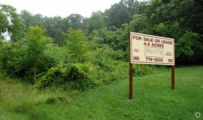

This Property Is For Sale
NEARBY LISTINGS FOR SALE OR LEASE
Property Detail
Old Rocky Mount Rd Sw
Roanoke, VA
LOT 7 SEC 10 U L PERDUE GRIFFIN LD
5380118
Roanoke City
Vacantlandnec
Virginia
X
7
51067C0055C
0.73 AC
2025
Southwest Roanoke
2025
Roanoke
002800
DEMOGRAPHICS near Old Rocky Mount Rd Sw
1 Mile
3 Mile
5 Mile
2024 Total Population
3,278
38,070
96,500
2029 Population
3,306
37,632
95,172
Pop Growth 2024-2029
+ 0.85%
(1.15%)
(1.38%)
Average Age
50
43
41
2024 Total Households
1,517
17,669
42,992
HH Growth 2024-2029
+ 0.92%
(1.23%)
(1.41%)
Median Household Inc
$92,624
$68,059
$57,988
Avg Household Size
2.00
2.10
2.20
2024 Avg HH Vehicles
2.00
2.00
2.00
Median Home Value
$362,796
$251,898
$235,812
Median Year Built
1989
1972
1965
Nearby Places
- Restaurants
- Banks
- Shops
- Fitness
- Groceries
PUBLIC TRANSPORTATION
COMMUTER RAIL
Roanoke (Northeast Regional - Amtrak)
DRIVE
WALK
Distance
Roanoke (Northeast Regional - Amtrak)
9 min
5.0 mi
AIRPORT
Roanoke/Blacksburg Regional (Woodrum Field)
DRIVE
WALK
Distance
Roanoke/Blacksburg Regional (Woodrum Field)
18 min
10.5 mi
Freight Ports
Virginia Port Authority - Richmond
DRIVE
WALK
Distance
Virginia Port Authority - Richmond
225 min
166.5 mi
Nearby Properties
Address
Land Use
TOTAL SIZE
Lot Size
Zoning
Address
Land Use
TOTAL SIZE
Lot Size
Zoning
998,139 SF
20.12 AC
INPUD
Address
Land Use
TOTAL SIZE
Lot Size
Zoning
41,443 SF
96.33 AC
INPUD
Address
Land Use
TOTAL SIZE
Lot Size
Zoning
217,815 SF
3.02 AC
INPUD
Address
Land Use
TOTAL SIZE
Lot Size
Zoning
211,622 SF
2.18 AC
INPUD
Address
Land Use
TOTAL SIZE
Lot Size
Zoning
47,181 SF
33.94 AC
INPUD
Address
Land Use
TOTAL SIZE
Lot Size
Zoning
19,734 SF
34.83 AC
INPUD
Address
Land Use
TOTAL SIZE
Lot Size
Zoning
1.51 AC
INPUD
Address
Land Use
TOTAL SIZE
Lot Size
Zoning
138,261 SF
22.24 AC
CLS
Address
Land Use
TOTAL SIZE
Lot Size
Zoning
59,641 SF
5.63 AC
INPUD
Address
Land Use
TOTAL SIZE
Lot Size
Zoning
149,370 SF
40 AC
R1
Address
Land Use
TOTAL SIZE
Lot Size
Zoning
65,502 SF
2.89 AC
INPUD
Address
Land Use
TOTAL SIZE
Lot Size
Zoning
100,606 SF
2.10 AC
INPUD
Address
Land Use
TOTAL SIZE
Lot Size
Zoning
7,279 SF
24.35 AC
R3C
Address
Land Use
TOTAL SIZE
Lot Size
Zoning
10,030 SF
32.18 AC
RMF
Address
Land Use
TOTAL SIZE
Lot Size
Zoning
122,814 SF
0.98 AC
INPUD
Address
Land Use
TOTAL SIZE
Lot Size
Zoning
209,930 SF
1.49 AC
D
Address
Land Use
TOTAL SIZE
Lot Size
Zoning
32,814 SF
18.14 AC
C1
Address
Land Use
TOTAL SIZE
Lot Size
Zoning
6.29 AC
MXPUD
Address
Land Use
TOTAL SIZE
Lot Size
Zoning
10,143 SF
25.30 AC
R3
Address
Land Use
TOTAL SIZE
Lot Size
Zoning
2.75 AC
Address
Land Use
TOTAL SIZE
Lot Size
Zoning
6,298 SF
43.38 AC
C2
Address
Land Use
TOTAL SIZE
Lot Size
Zoning
42,128 SF
32.68 AC
INPUD
Address
Land Use
TOTAL SIZE
Lot Size
Zoning
1.77 AC
D
Address
Land Use
TOTAL SIZE
Lot Size
Zoning
146,345 SF
5.97 AC
MX
Address
Land Use
TOTAL SIZE
Lot Size
Zoning
110,546 SF
2.65 AC
INPUD
Address
Land Use
TOTAL SIZE
Lot Size
Zoning
56,496 SF
19.14 AC
I2C
Address
Land Use
TOTAL SIZE
Lot Size
Zoning
187,130 SF
29.96 AC
C2
Address
Land Use
TOTAL SIZE
Lot Size
Zoning
190,512 SF
2.05 AC
INPUD
Address
Land Use
TOTAL SIZE
Lot Size
Zoning
11,529 SF
9.78 AC
R4
Address
Land Use
TOTAL SIZE
Lot Size
Zoning
583 SF
7.16 AC
INPUD
The World's #1 Commercial Real Estate Marketplace
Connect with us
© 2025 CoStar Group
The information above has been obtained from sources believed reliable. While we do not doubt its accuracy we have not verified it and make no guarantee, warranty or representation about it. It is your responsibility to independently confirm its accuracy and completeness. Any projections, opinions, assumptions, or estimates used are for example only and do not represent the current or future performance of the property. The value of this transaction to you depends on tax and other factors which should be evaluated by your tax, financial, and legal advisors. You and your advisors should conduct a careful, independent investigation of the property to determine to your satisfaction the suitability of the property for your needs.