Property Record
449 Cimarron Dr, Box Elder, SD 57719
Save to a Folder
{{folder.Name}}
{{folder.ListingIds.length}} Properties
{{folder.ListingIds.length}} Property
Create a New Folder
Property Detail
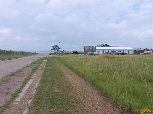
449 Cimarron Dr
Rapid City, SD
CIMARRON SUBD, BLOCK 1, LOT 8
0040896
PENNINGTON
Loftbuilding
South Dakota
B and X Area of moderate flood hazard, usually the area between the limits of the 100-year and 500-year floods.
8
2025
2.50 AC
2025
Rapid City
011602
Other Market Areas
6,720 SF
NEARBY LISTINGS FOR SALE OR LEASE
DEMOGRAPHICS near 449 Cimarron Dr
1 mile
3 mile
5 mile
2025 Total Population
1,868
13,272
18,210
2030 Population
2,008
13,928
19,117
Pop Growth 2025-2030
+ 7.49%
+ 4.94%
+ 4.98%
Average Age
35
33
34
2025 Total Households
706
4,558
6,450
HH Growth 2025-2030
+ 7.79%
+ 5.44%
+ 5.33%
Median Household Inc
$66,505
$72,499
$74,794
Avg Household Size
2.60
2.70
2.70
2025 Avg HH Vehicles
2.00
2.00
2.00
Median Home Value
$250,961
$285,142
$289,586
Median Year Built
1996
1998
2000
Nearby Places
Map Layers
Map Styles
 Street
 Aerial
Layers
 Traffic
 Biking
Places
Listings with unknown addresses are not visible on the map
- Restaurants
- Banks
- Shops
- Fitness
- Groceries
PUBLIC TRANSPORTATION
AIRPORT
Rapid City Regional
Drive
Walk
Distance
Rapid City Regional
19 min
10.2 mi
Freight Ports
Tulsa Port Of Catoosa
Drive
Walk
Distance
Tulsa Port Of Catoosa
959 min
881.6 mi
SALE & LEASE HISTORY
LISTING DATE
SALE/LEASE

Sep 24, 2016
For Sale
Nearby Properties
Address
Land Use
TOTAL SIZE
Lot Size
Zoning
Address
Land Use
TOTAL SIZE
Lot Size
Zoning
33,719 SF
8.15 AC
Address
Land Use
TOTAL SIZE
Lot Size
Zoning
936 SF
3.49 AC
Address
Land Use
TOTAL SIZE
Lot Size
Zoning
8,239 SF
20 AC
Address
Land Use
TOTAL SIZE
Lot Size
Zoning
11,900 SF
10.85 AC
Address
Land Use
TOTAL SIZE
Lot Size
Zoning
3,000 SF
10 AC
Address
Land Use
TOTAL SIZE
Lot Size
Zoning
40,200 SF
5.73 AC
Address
Land Use
TOTAL SIZE
Lot Size
Zoning
1.27 AC
Address
Land Use
TOTAL SIZE
Lot Size
Zoning
1.28 AC
Address
Land Use
TOTAL SIZE
Lot Size
Zoning
1.27 AC
Address
Land Use
TOTAL SIZE
Lot Size
Zoning
15,600 SF
7.40 AC
Address
Land Use
TOTAL SIZE
Lot Size
Zoning
18,600 SF
3.02 AC
Address
Land Use
TOTAL SIZE
Lot Size
Zoning
5,326 SF
2 AC
Address
Land Use
TOTAL SIZE
Lot Size
Zoning
2,496 SF
0.94 AC
Address
Land Use
TOTAL SIZE
Lot Size
Zoning
3,128 SF
2.20 AC
Address
Land Use
TOTAL SIZE
Lot Size
Zoning
5,000 SF
2 AC
Address
Land Use
TOTAL SIZE
Lot Size
Zoning
4,800 SF
0.51 AC
Address
Land Use
TOTAL SIZE
Lot Size
Zoning
4,800 SF
0.52 AC
Address
Land Use
TOTAL SIZE
Lot Size
Zoning
4,800 SF
0.51 AC
Address
Land Use
TOTAL SIZE
Lot Size
Zoning
4,800 SF
0.52 AC
Address
Land Use
TOTAL SIZE
Lot Size
Zoning
15,553 SF
2.01 AC
Address
Land Use
TOTAL SIZE
Lot Size
Zoning
3,326 SF
2 AC
Address
Land Use
TOTAL SIZE
Lot Size
Zoning
13,056 SF
1.23 AC
Address
Land Use
TOTAL SIZE
Lot Size
Zoning
53,775 SF
2.08 AC
Address
Land Use
TOTAL SIZE
Lot Size
Zoning
2,442 SF
18.76 AC
Address
Land Use
TOTAL SIZE
Lot Size
Zoning
8,025 SF
0.63 AC
Address
Land Use
TOTAL SIZE
Lot Size
Zoning
Address
Land Use
TOTAL SIZE
Lot Size
Zoning
8,171 SF
1.25 AC
Address
Land Use
TOTAL SIZE
Lot Size
Zoning
8,500 SF
1.36 AC
Address
Land Use
TOTAL SIZE
Lot Size
Zoning
9,294 SF
2.07 AC
The World's #1 Commercial Real Estate Marketplace
Connect with us
© 2026 CoStar Group
The information above has been obtained from sources believed reliable. While we do not doubt its accuracy we have not verified it and make no guarantee, warranty or representation about it. It is your responsibility to independently confirm its accuracy and completeness. Any projections, opinions, assumptions, or estimates used are for example only and do not represent the current or future performance of the property. The value of this transaction to you depends on tax and other factors which should be evaluated by your tax, financial, and legal advisors. You and your advisors should conduct a careful, independent investigation of the property to determine to your satisfaction the suitability of the property for your needs.