Property Record
449 E Renfro St, Burleson, TX 76028


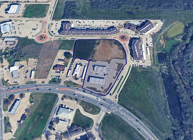

This Property Is For Sale
Property Detail
449 E Renfro St
Dallas-Fort Worth-Arlington, TX
ABST 4 TR 28B DAVID ANDERSON
126-0004-01962
JOHNSON
Commercialacreage
Texas
AE The base floodplain where base flood elevations are provided. AE Zones are now used on new format FIRMs instead of A1-A30 Zones.
1.61 AC
2024
Johnson County
2025
Dallas/Ft Worth
130220
NEARBY LISTINGS FOR SALE OR LEASE
DEMOGRAPHICS near 449 E Renfro St
1 mile
3 mile
5 mile
2025 Total Population
3,344
57,709
114,987
2030 Population
3,820
63,577
126,488
Pop Growth 2025-2030
+ 14.23%
+ 10.17%
+ 10.00%
Average Age
37
37
37
2025 Total Households
1,334
20,341
39,678
HH Growth 2025-2030
+ 14.09%
+ 10.09%
+ 10.01%
Median Household Inc
$50,427
$94,847
$97,881
Avg Household Size
2.50
2.80
2.90
2025 Avg HH Vehicles
1.00
2.00
2.00
Median Home Value
$256,981
$323,250
$327,643
Median Year Built
1992
2000
2002
Nearby Places
Map Layers
Map Styles
 Street
 Aerial
Transit
 Traffic
 Biking
Places
Listings with unknown addresses are not visible on the map
- Restaurants
- Banks
- Shops
- Fitness
- Groceries
PUBLIC TRANSPORTATION
AIRPORT
Dallas-Fort Worth International
Drive
Walk
Distance
Dallas-Fort Worth International
48 min
39.0 mi
Freight Ports
Port of Shreveport
Drive
Walk
Distance
Port of Shreveport
253 min
235.8 mi
Nearby Properties
Address
Land Use
TOTAL SIZE
Lot Size
Zoning
Address
Land Use
TOTAL SIZE
Lot Size
Zoning
647,641 SF
13.56 AC
Address
Land Use
TOTAL SIZE
Lot Size
Zoning
151.01 AC
Address
Land Use
TOTAL SIZE
Lot Size
Zoning
354,702 SF
80.43 AC
Address
Land Use
TOTAL SIZE
Lot Size
Zoning
316,872 SF
17.46 AC
Address
Land Use
TOTAL SIZE
Lot Size
Zoning
840 SF
41.70 AC
Address
Land Use
TOTAL SIZE
Lot Size
Zoning
242,003 SF
14 AC
Address
Land Use
TOTAL SIZE
Lot Size
Zoning
180,391 SF
19.14 AC
Address
Land Use
TOTAL SIZE
Lot Size
Zoning
12.93 AC
Address
Land Use
TOTAL SIZE
Lot Size
Zoning
117,990 SF
7.28 AC
Address
Land Use
TOTAL SIZE
Lot Size
Zoning
227,486 SF
10.06 AC
Address
Land Use
TOTAL SIZE
Lot Size
Zoning
35.61 AC
Address
Land Use
TOTAL SIZE
Lot Size
Zoning
11.95 AC
Address
Land Use
TOTAL SIZE
Lot Size
Zoning
442.50 AC
Address
Land Use
TOTAL SIZE
Lot Size
Zoning
178,582 SF
8.03 AC
Address
Land Use
TOTAL SIZE
Lot Size
Zoning
114,308 SF
9.73 AC
Address
Land Use
TOTAL SIZE
Lot Size
Zoning
19.33 AC
Address
Land Use
TOTAL SIZE
Lot Size
Zoning
58,506 SF
9.56 AC
Address
Land Use
TOTAL SIZE
Lot Size
Zoning
24.33 AC
Address
Land Use
TOTAL SIZE
Lot Size
Zoning
81,500 SF
7.92 AC
Address
Land Use
TOTAL SIZE
Lot Size
Zoning
151,300 SF
5 AC
Address
Land Use
TOTAL SIZE
Lot Size
Zoning
39,388 SF
7.38 AC
Address
Land Use
TOTAL SIZE
Lot Size
Zoning
66,665 SF
2.83 AC
Address
Land Use
TOTAL SIZE
Lot Size
Zoning
1.44 AC
Address
Land Use
TOTAL SIZE
Lot Size
Zoning
101,917 SF
14.79 AC
Address
Land Use
TOTAL SIZE
Lot Size
Zoning
96,000 SF
28.83 AC
Address
Land Use
TOTAL SIZE
Lot Size
Zoning
96,635 SF
17.55 AC
Address
Land Use
TOTAL SIZE
Lot Size
Zoning
18,100 SF
7.27 AC
Address
Land Use
TOTAL SIZE
Lot Size
Zoning
97,567 SF
17.59 AC
Address
Land Use
TOTAL SIZE
Lot Size
Zoning
Address
Land Use
TOTAL SIZE
Lot Size
Zoning
3.11 AC
The World's #1 Commercial Real Estate Marketplace
Connect with us
© 2026 CoStar Group
The information above has been obtained from sources believed reliable. While we do not doubt its accuracy we have not verified it and make no guarantee, warranty or representation about it. It is your responsibility to independently confirm its accuracy and completeness. Any projections, opinions, assumptions, or estimates used are for example only and do not represent the current or future performance of the property. The value of this transaction to you depends on tax and other factors which should be evaluated by your tax, financial, and legal advisors. You and your advisors should conduct a careful, independent investigation of the property to determine to your satisfaction the suitability of the property for your needs.