Property Record
449 Kellogg Way, Goleta, CA 93117


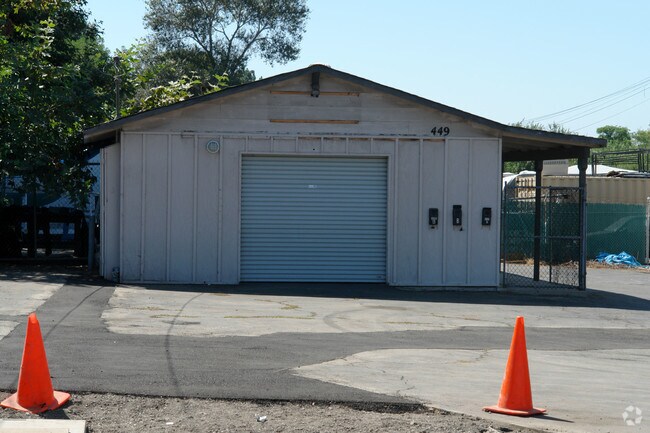
Property Detail
449 Kellogg Way
Santa Maria-Santa Barbara, CA
RO GOLETA MAP 13A LTS 55 & 57
071-130-039
Santa Barbara
Storebuilding
California
AE The base floodplain where base flood elevations are provided. AE Zones are now used on new format FIRMs instead of A1-A30 Zones.
55
2024
0.53 AC
2025
Santa Barbara Airport
003001
Santa Barbara/Sta Maria/Goleta
3,000 SF
NEARBY LISTINGS FOR SALE OR LEASE
DEMOGRAPHICS near 449 Kellogg Way
1 mile
3 mile
5 mile
2025 Total Population
12,333
58,073
95,347
2030 Population
12,645
58,044
95,274
Pop Growth 2025-2030
+ 2.53%
(0.05%)
(0.08%)
Average Age
43
37
39
2025 Total Households
4,799
19,540
33,889
HH Growth 2025-2030
+ 2.81%
+ 0.11%
0.00%
Median Household Inc
$86,346
$94,957
$103,313
Avg Household Size
2.40
2.60
2.60
2025 Avg HH Vehicles
2.00
2.00
2.00
Median Home Value
$979,676
$1,094,924
$1,079,837
Median Year Built
1976
1973
1973
Nearby Places
Map Layers
Map Styles
 Street
 Aerial
Transit
 Traffic
 Biking
Places
Listings with unknown addresses are not visible on the map
- Restaurants
- Banks
- Shops
- Fitness
- Groceries
PUBLIC TRANSPORTATION
COMMUTER RAIL
Drive
Walk
Distance
7 min
2.0 mi
Drive
Walk
Distance
14 min
8.8 mi
AIRPORT
Santa Barbara Municipal
Drive
Walk
Distance
Santa Barbara Municipal
7 min
2.6 mi
Freight Ports
The Port of Hueneme
Drive
Walk
Distance
The Port of Hueneme
64 min
48.1 mi
Nearby Properties
Address
Land Use
TOTAL SIZE
Lot Size
Zoning
Address
Land Use
TOTAL SIZE
Lot Size
Zoning
13,528 SF
9.35 AC
Address
Land Use
TOTAL SIZE
Lot Size
Zoning
20.78 AC
8R1
Address
Land Use
TOTAL SIZE
Lot Size
Zoning
2.50 AC
SRH20
Address
Land Use
TOTAL SIZE
Lot Size
Zoning
5.30 AC
Address
Land Use
TOTAL SIZE
Lot Size
Zoning
1.90 AC
Address
Land Use
TOTAL SIZE
Lot Size
Zoning
13.08 AC
Address
Land Use
TOTAL SIZE
Lot Size
Zoning
8.82 AC
Address
Land Use
TOTAL SIZE
Lot Size
Zoning
4.25 AC
Address
Land Use
TOTAL SIZE
Lot Size
Zoning
Address
Land Use
TOTAL SIZE
Lot Size
Zoning
2.42 AC
SRH20
Address
Land Use
TOTAL SIZE
Lot Size
Zoning
2.18 AC
Address
Land Use
TOTAL SIZE
Lot Size
Zoning
102,570 SF
14.03 AC
Address
Land Use
TOTAL SIZE
Lot Size
Zoning
3.05 AC
Address
Land Use
TOTAL SIZE
Lot Size
Zoning
37,584 SF
2 AC
SRH20
Address
Land Use
TOTAL SIZE
Lot Size
Zoning
3.81 AC
Address
Land Use
TOTAL SIZE
Lot Size
Zoning
85,052 SF
2.97 AC
SRH20
Address
Land Use
TOTAL SIZE
Lot Size
Zoning
7.18 AC
Address
Land Use
TOTAL SIZE
Lot Size
Zoning
7.99 AC
Address
Land Use
TOTAL SIZE
Lot Size
Zoning
0.87 AC
SRH20
Address
Land Use
TOTAL SIZE
Lot Size
Zoning
109,624 SF
9.11 AC
SC
Address
Land Use
TOTAL SIZE
Lot Size
Zoning
34,688 SF
2.17 AC
Address
Land Use
TOTAL SIZE
Lot Size
Zoning
6.90 AC
Address
Land Use
TOTAL SIZE
Lot Size
Zoning
0.38 AC
C2
Address
Land Use
TOTAL SIZE
Lot Size
Zoning
5.38 AC
Address
Land Use
TOTAL SIZE
Lot Size
Zoning
1.82 AC
Address
Land Use
TOTAL SIZE
Lot Size
Zoning
10.19 AC
Address
Land Use
TOTAL SIZE
Lot Size
Zoning
5.34 AC
Address
Land Use
TOTAL SIZE
Lot Size
Zoning
68,163 SF
4.04 AC
Address
Land Use
TOTAL SIZE
Lot Size
Zoning
18.65 AC
Address
Land Use
TOTAL SIZE
Lot Size
Zoning
8.33 AC
The World's #1 Commercial Real Estate Marketplace
Connect with us
© 2026 CoStar Group
The information above has been obtained from sources believed reliable. While we do not doubt its accuracy we have not verified it and make no guarantee, warranty or representation about it. It is your responsibility to independently confirm its accuracy and completeness. Any projections, opinions, assumptions, or estimates used are for example only and do not represent the current or future performance of the property. The value of this transaction to you depends on tax and other factors which should be evaluated by your tax, financial, and legal advisors. You and your advisors should conduct a careful, independent investigation of the property to determine to your satisfaction the suitability of the property for your needs.