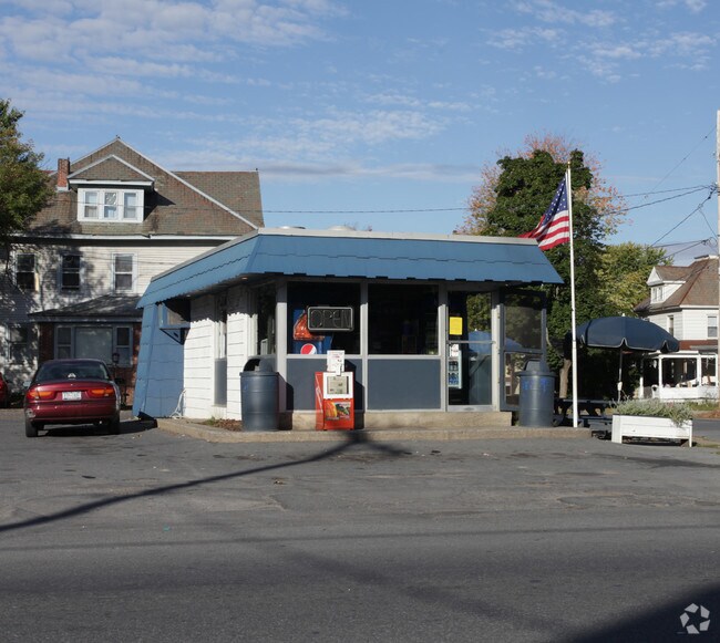
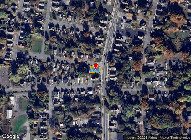
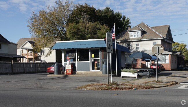
Property Record
449 Lower Main St, Hudson Falls, NY 12839
NEARBY LISTINGS FOR SALE OR LEASE
Property Detail
449 Lower Main St
Glens Falls, NY
COMM BLDG & LAND
533089-163-005-0002-018-000-0000
Washington
Restaurantdrivein
New York
2025
18.000
2024
0.12 AC
088001
Washington County
448 SF
Albany/Schenectady/Troy
DEMOGRAPHICS near 449 Lower Main St
1 mile
3 mile
5 mile
2024 Total Population
6,618
23,983
49,852
2029 Population
6,533
23,874
49,632
Pop Growth 2024-2029
(1.28%)
(0.45%)
(0.44%)
Average Age
41
41
42
2024 Total Households
2,711
10,346
21,725
HH Growth 2024-2029
(1.36%)
(0.47%)
(0.52%)
Median Household Inc
$56,846
$57,842
$65,109
Avg Household Size
2.30
2.20
2.20
2024 Avg HH Vehicles
1.00
2.00
2.00
Median Home Value
$151,152
$156,875
$177,197
Median Year Built
1947
1955
1959
Nearby Places
Map Layers
Map Styles
 Street
 Aerial
Transit
 Traffic
 Biking
Places
Listings with unknown addresses are not visible on the map
- Restaurants
- Banks
- Shops
- Fitness
- Groceries
PUBLIC TRANSPORTATION
COMMUTER RAIL
Drive
Walk
Distance
5 min
2.0 mi
Nearby Properties
Address
Land Use
TOTAL SIZE
Lot Size
Zoning
Address
Land Use
TOTAL SIZE
Lot Size
Zoning
16.34 AC
M1
Address
Land Use
TOTAL SIZE
Lot Size
Zoning
116,696 SF
23.70 AC
04 - FARM
Address
Land Use
TOTAL SIZE
Lot Size
Zoning
35.53 AC
HI
Address
Land Use
TOTAL SIZE
Lot Size
Zoning
19.74 AC
HI
Address
Land Use
TOTAL SIZE
Lot Size
Zoning
393,880 SF
23.90 AC
M1
Address
Land Use
TOTAL SIZE
Lot Size
Zoning
9,216 SF
32.20 AC
UR
Address
Land Use
TOTAL SIZE
Lot Size
Zoning
82,922 SF
8.03 AC
I
Address
Land Use
TOTAL SIZE
Lot Size
Zoning
5,680 SF
39.79 AC
UR
Address
Land Use
TOTAL SIZE
Lot Size
Zoning
Address
Land Use
TOTAL SIZE
Lot Size
Zoning
1.91 AC
HI
Address
Land Use
TOTAL SIZE
Lot Size
Zoning
183,950 SF
11.41 AC
C1
Address
Land Use
TOTAL SIZE
Lot Size
Zoning
113.40 AC
04 - FARM
Address
Land Use
TOTAL SIZE
Lot Size
Zoning
89,902 SF
9.61 AC
05 - COMME
Address
Land Use
TOTAL SIZE
Lot Size
Zoning
12,337 SF
26.95 AC
HI
Address
Land Use
TOTAL SIZE
Lot Size
Zoning
70,176 SF
3.50 AC
GC1
Address
Land Use
TOTAL SIZE
Lot Size
Zoning
7,823 SF
27.33 AC
LDR25
Address
Land Use
TOTAL SIZE
Lot Size
Zoning
6,549 SF
17.26 AC
M1
Address
Land Use
TOTAL SIZE
Lot Size
Zoning
156,550 SF
33.27 AC
CI
Address
Land Use
TOTAL SIZE
Lot Size
Zoning
8,683 SF
8.27 AC
HI
Address
Land Use
TOTAL SIZE
Lot Size
Zoning
125,082 SF
17.54 AC
R2
Address
Land Use
TOTAL SIZE
Lot Size
Zoning
7,788 SF
25.34 AC
LDR25
Address
Land Use
TOTAL SIZE
Lot Size
Zoning
20,250 SF
46.97 AC
HI
Address
Land Use
TOTAL SIZE
Lot Size
Zoning
18,133 SF
29.71 AC
LDR25
Address
Land Use
TOTAL SIZE
Lot Size
Zoning
53,216 SF
14.20 AC
CLI
Address
Land Use
TOTAL SIZE
Lot Size
Zoning
3,000 SF
14.95 AC
M1
Address
Land Use
TOTAL SIZE
Lot Size
Zoning
176,238 SF
28.98 AC
CLI
Address
Land Use
TOTAL SIZE
Lot Size
Zoning
134,998 SF
20.10 AC
05 - COMME
Address
Land Use
TOTAL SIZE
Lot Size
Zoning
150,882 SF
8 AC
LI
Address
Land Use
TOTAL SIZE
Lot Size
Zoning
119,455 SF
66.60 AC
LDR25
Address
Land Use
TOTAL SIZE
Lot Size
Zoning
42,156 SF
5.93 AC
05 - COMME
The World's #1 Commercial Real Estate Marketplace
Connect with us
© 2026 CoStar Group
The information above has been obtained from sources believed reliable. While we do not doubt its accuracy we have not verified it and make no guarantee, warranty or representation about it. It is your responsibility to independently confirm its accuracy and completeness. Any projections, opinions, assumptions, or estimates used are for example only and do not represent the current or future performance of the property. The value of this transaction to you depends on tax and other factors which should be evaluated by your tax, financial, and legal advisors. You and your advisors should conduct a careful, independent investigation of the property to determine to your satisfaction the suitability of the property for your needs.