Property Record
4490 Huron St, North Branch, MI 48461
NEARBY LISTINGS FOR SALE OR LEASE
-
-
View all North Branch listings for lease on LoopNet.com
Property Detail
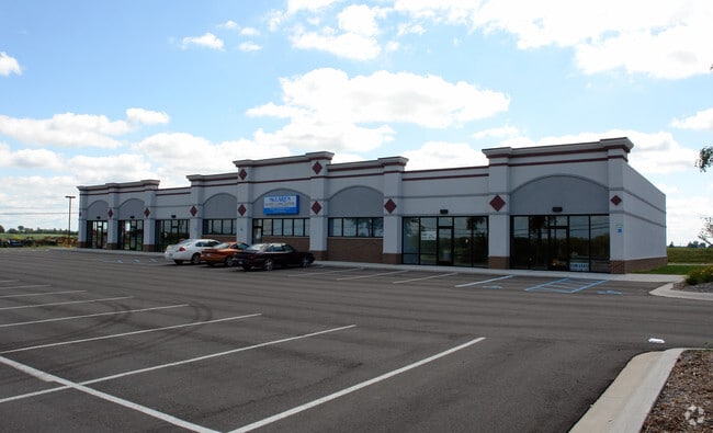
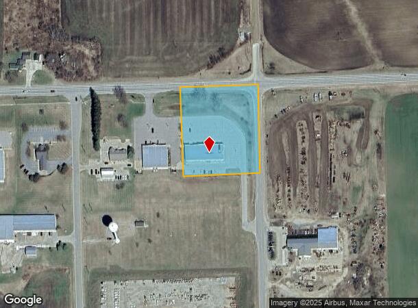
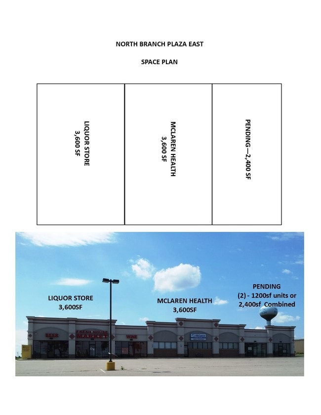
4490 Huron St
046-304-062-00
SEC 4 T9N R11E DDA PART OF E 1/2 OF SE 1/4 SEC 4 VILLAGE OF NORTH BRANCH BEG AT E 1/4 COR OF SEC 4 TH ALONG E SEC LINE S
Communitycenter
Lapeer
X
Michigan
26087C0175E
2.83 AC
2024
St Clair & Lapeer Counties
2025
Detroit
332500
Detroit-Warren-Dearborn, MI
9,600 SF
DEMOGRAPHICS near 4490 Huron St
1 Mile
3 Mile
5 Mile
2024 Total Population
1,044
2,682
5,798
2029 Population
1,058
2,698
5,775
Pop Growth 2024-2029
+ 1.34%
+ 0.60%
(0.40%)
Average Age
39
40
41
2024 Total Households
391
1,009
2,158
HH Growth 2024-2029
+ 1.28%
+ 0.59%
(0.46%)
Median Household Inc
$49,499
$60,252
$67,055
Avg Household Size
2.60
2.60
2.60
2024 Avg HH Vehicles
2.00
2.00
2.00
Median Home Value
$157,652
$170,895
$178,428
Median Year Built
1972
1974
1976
Nearby Places
Map Layers
Map Styles
 Street
 Aerial
- Restaurants
- Banks
- Shops
- Fitness
- Groceries
PUBLIC TRANSPORTATION
AIRPORT
Bishop International
DRIVE
WALK
Distance
Bishop International
73 min
47.8 mi
SALE & LEASE HISTORY
LISTING DATE
SALE/LEASE

Sep 25, 2016
For Lease
Nov 02, 2017
For Lease
Nearby Properties
Address
Land Use
TOTAL SIZE
Lot Size
Zoning
Address
Land Use
TOTAL SIZE
Lot Size
Zoning
3,348 SF
27.20 AC
RMH MO
Address
Land Use
TOTAL SIZE
Lot Size
Zoning
35,607 SF
5.09 AC
I-1 LI
Address
Land Use
TOTAL SIZE
Lot Size
Zoning
15,000 SF
A-R AG
Address
Land Use
TOTAL SIZE
Lot Size
Zoning
18,080 SF
2.44 AC
A-R AG
Address
Land Use
TOTAL SIZE
Lot Size
Zoning
2,046 SF
176 AC
A-R AG
Address
Land Use
TOTAL SIZE
Lot Size
Zoning
26,104 SF
2.40 AC
R SI
Address
Land Use
TOTAL SIZE
Lot Size
Zoning
28,216 SF
2.88 AC
RM MU
Address
Land Use
TOTAL SIZE
Lot Size
Zoning
2,162 SF
160 AC
A-R AG
Address
Land Use
TOTAL SIZE
Lot Size
Zoning
1,378 SF
20 AC
A-R AG
Address
Land Use
TOTAL SIZE
Lot Size
Zoning
209.90 AC
UNZONED
Address
Land Use
TOTAL SIZE
Lot Size
Zoning
45,856 SF
5.62 AC
I IN
Address
Land Use
TOTAL SIZE
Lot Size
Zoning
2,809 SF
40 AC
A-R AG
Address
Land Use
TOTAL SIZE
Lot Size
Zoning
75 AC
UNZONED
Address
Land Use
TOTAL SIZE
Lot Size
Zoning
93.40 AC
A-R AG
Address
Land Use
TOTAL SIZE
Lot Size
Zoning
2,097 SF
157.11 AC
UNZONED
Address
Land Use
TOTAL SIZE
Lot Size
Zoning
160 AC
UNZONED
Address
Land Use
TOTAL SIZE
Lot Size
Zoning
3,309 SF
80 AC
A-R AG
Address
Land Use
TOTAL SIZE
Lot Size
Zoning
2,569 SF
58 AC
A-R AG
Address
Land Use
TOTAL SIZE
Lot Size
Zoning
27,500 SF
I IN
Address
Land Use
TOTAL SIZE
Lot Size
Zoning
1,012 SF
120 AC
UNZONED
Address
Land Use
TOTAL SIZE
Lot Size
Zoning
1,930 SF
115 AC
A-R AG
Address
Land Use
TOTAL SIZE
Lot Size
Zoning
1,931 SF
96 AC
A-R AG
Address
Land Use
TOTAL SIZE
Lot Size
Zoning
9,100 SF
3.62 AC
C CO
Address
Land Use
TOTAL SIZE
Lot Size
Zoning
2,434 SF
80.32 AC
A-R AG
Address
Land Use
TOTAL SIZE
Lot Size
Zoning
2,054 SF
90 AC
A-R AG
Address
Land Use
TOTAL SIZE
Lot Size
Zoning
1,782 SF
46.48 AC
A-R AG
Address
Land Use
TOTAL SIZE
Lot Size
Zoning
1,400 SF
111.43 AC
A-R AG
Address
Land Use
TOTAL SIZE
Lot Size
Zoning
160 AC
UNZONED
Address
Land Use
TOTAL SIZE
Lot Size
Zoning
2,240 SF
73 AC
A-R AG
The World's #1 Commercial Real Estate Marketplace
Connect with us
© 2026 CoStar Group
The information above has been obtained from sources believed reliable. While we do not doubt its accuracy we have not verified it and make no guarantee, warranty or representation about it. It is your responsibility to independently confirm its accuracy and completeness. Any projections, opinions, assumptions, or estimates used are for example only and do not represent the current or future performance of the property. The value of this transaction to you depends on tax and other factors which should be evaluated by your tax, financial, and legal advisors. You and your advisors should conduct a careful, independent investigation of the property to determine to your satisfaction the suitability of the property for your needs.