Property Record
4492 Nourse Ave, Columbus, OH 43228


NEARBY LISTINGS FOR SALE OR LEASE
Property Detail
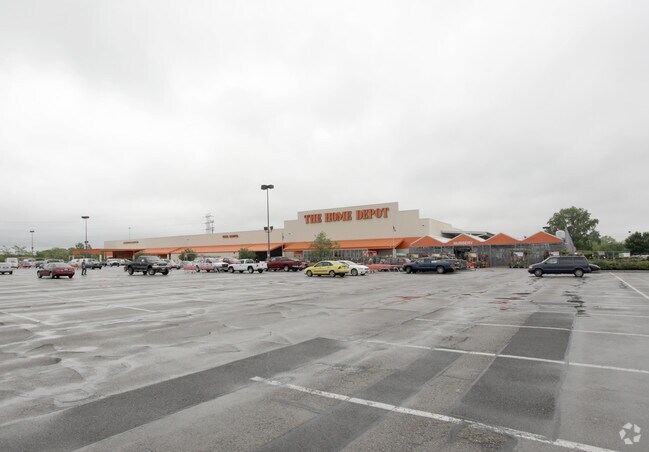
4492 Nourse Ave
Columbus, OH
West Columbus Park
240-000193
4491 W BROAD ST ENTRY 1482-1425 12.534 ACRES
Storebuilding
Franklin
X
Ohio
39049C0303K
288
2024
12.53 AC
2025
Southwest
008120
Columbus
118,176 SF
DEMOGRAPHICS near 4492 Nourse Ave
1 mile
3 mile
5 mile
2024 Total Population
15,596
112,327
224,294
2029 Population
15,656
112,335
224,988
Pop Growth 2024-2029
+ 0.38%
+ 0.01%
+ 0.31%
Average Age
34
36
36
2024 Total Households
5,672
43,470
87,817
HH Growth 2024-2029
+ 0.18%
(0.12%)
+ 0.23%
Median Household Inc
$50,262
$58,805
$65,372
Avg Household Size
2.60
2.50
2.50
2024 Avg HH Vehicles
2.00
2.00
2.00
Median Home Value
$151,596
$183,391
$209,276
Median Year Built
1969
1979
1979
Nearby Places
Map Layers
Map Styles
 Street
 Aerial
Transit
 Traffic
 Biking
Places
Listings with unknown addresses are not visible on the map
- Restaurants
- Banks
- Shops
- Fitness
- Groceries
PUBLIC TRANSPORTATION
AIRPORT
John Glenn Columbus International
Drive
Walk
Distance
John Glenn Columbus International
24 min
15.9 mi
Rickenbacker International
Drive
Walk
Distance
Rickenbacker International
25 min
17.3 mi
Freight Ports
Port of Toledo
Drive
Walk
Distance
Port of Toledo
184 min
136.2 mi
Nearby Properties
Address
Land Use
TOTAL SIZE
Lot Size
Zoning
Address
Land Use
TOTAL SIZE
Lot Size
Zoning
1,215,421 SF
108.07 AC
Address
Land Use
TOTAL SIZE
Lot Size
Zoning
269,165 SF
7 AC
Address
Land Use
TOTAL SIZE
Lot Size
Zoning
961,554 SF
75.09 AC
Address
Land Use
TOTAL SIZE
Lot Size
Zoning
257,723 SF
38.06 AC
Address
Land Use
TOTAL SIZE
Lot Size
Zoning
538,680 SF
32.49 AC
Address
Land Use
TOTAL SIZE
Lot Size
Zoning
472,671 SF
70.36 AC
Address
Land Use
TOTAL SIZE
Lot Size
Zoning
155,280 SF
0.23 AC
Address
Land Use
TOTAL SIZE
Lot Size
Zoning
1,011,597 SF
49.94 AC
Address
Land Use
TOTAL SIZE
Lot Size
Zoning
566,334 SF
58.62 AC
Address
Land Use
TOTAL SIZE
Lot Size
Zoning
25,368 SF
27.23 AC
Address
Land Use
TOTAL SIZE
Lot Size
Zoning
96,602 SF
0.21 AC
Address
Land Use
TOTAL SIZE
Lot Size
Zoning
24,736 SF
29.55 AC
Address
Land Use
TOTAL SIZE
Lot Size
Zoning
108,828 SF
23.51 AC
Address
Land Use
TOTAL SIZE
Lot Size
Zoning
247,354 SF
30.38 AC
Address
Land Use
TOTAL SIZE
Lot Size
Zoning
143.78 AC
Address
Land Use
TOTAL SIZE
Lot Size
Zoning
62,400 SF
9.02 AC
Address
Land Use
TOTAL SIZE
Lot Size
Zoning
332,176 SF
24.52 AC
Address
Land Use
TOTAL SIZE
Lot Size
Zoning
759,600 SF
23.75 AC
Address
Land Use
TOTAL SIZE
Lot Size
Zoning
131,116 SF
15.30 AC
Address
Land Use
TOTAL SIZE
Lot Size
Zoning
202,330 SF
18.89 AC
Address
Land Use
TOTAL SIZE
Lot Size
Zoning
117,389 SF
177.98 AC
Address
Land Use
TOTAL SIZE
Lot Size
Zoning
178,452 SF
34.84 AC
Address
Land Use
TOTAL SIZE
Lot Size
Zoning
18,823 SF
14.73 AC
Address
Land Use
TOTAL SIZE
Lot Size
Zoning
69,650 SF
15.15 AC
Address
Land Use
TOTAL SIZE
Lot Size
Zoning
72,320 SF
2.52 AC
Address
Land Use
TOTAL SIZE
Lot Size
Zoning
249,644 SF
7.15 AC
Address
Land Use
TOTAL SIZE
Lot Size
Zoning
52,283 SF
19.41 AC
Address
Land Use
TOTAL SIZE
Lot Size
Zoning
84,002 SF
4.08 AC
Address
Land Use
TOTAL SIZE
Lot Size
Zoning
55,758 SF
7.83 AC
Address
Land Use
TOTAL SIZE
Lot Size
Zoning
121,403 SF
50.93 AC
The World's #1 Commercial Real Estate Marketplace
Connect with us
© 2026 CoStar Group
The information above has been obtained from sources believed reliable. While we do not doubt its accuracy we have not verified it and make no guarantee, warranty or representation about it. It is your responsibility to independently confirm its accuracy and completeness. Any projections, opinions, assumptions, or estimates used are for example only and do not represent the current or future performance of the property. The value of this transaction to you depends on tax and other factors which should be evaluated by your tax, financial, and legal advisors. You and your advisors should conduct a careful, independent investigation of the property to determine to your satisfaction the suitability of the property for your needs.