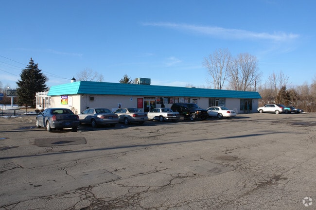
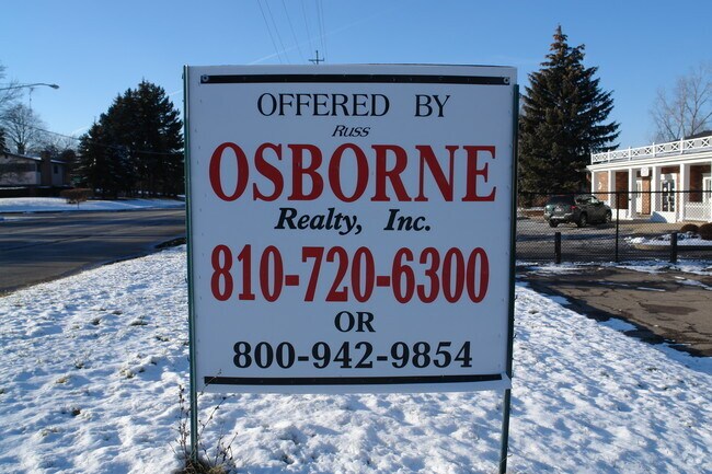
Property Record
4496 Beecher Rd, Flint, MI 48532

Property Detail
4496 Beecher Rd
Flint, MI
ELY 300 FT OF LOT 13 EXCEPT A PARCEL OF LAND BEG AT SE COR OF LOT 13 TH N 61 DEG 49 MIN W 167 FT TH N 18 DEG 15 MIN E 167 FT
07-09-528-010
Genesee
Commercialnec
Michigan
B and X Area of moderate flood hazard, usually the area between the limits of the 100-year and 500-year floods.
13
2024
1.41 AC
2025
Flint
010811
Detroit
4,331 SF
NEARBY LISTINGS FOR SALE OR LEASE
DEMOGRAPHICS near 4496 Beecher Rd
1 mile
3 mile
5 mile
2025 Total Population
4,043
53,208
113,506
2030 Population
3,947
53,492
114,659
Pop Growth 2025-2030
(2.37%)
+ 0.53%
+ 1.02%
Average Age
41
40
41
2025 Total Households
1,667
22,213
47,407
HH Growth 2025-2030
(2.52%)
+ 0.50%
+ 1.04%
Median Household Inc
$56,906
$47,666
$45,167
Avg Household Size
2.30
2.30
2.30
2025 Avg HH Vehicles
1.00
1.00
1.00
Median Home Value
$184,710
$92,150
$94,886
Median Year Built
1968
1961
1960
Nearby Places
Map Layers
Map Styles
 Street
 Aerial
Transit
 Traffic
 Biking
Places
Listings with unknown addresses are not visible on the map
- Restaurants
- Banks
- Shops
- Fitness
- Groceries
PUBLIC TRANSPORTATION
COMMUTER RAIL
Flint Amtrak Station (Blue Water - Amtrak)
Drive
Walk
Distance
Flint Amtrak Station (Blue Water - Amtrak)
15 min
7.0 mi
AIRPORT
Bishop International
Drive
Walk
Distance
Bishop International
21 min
7.5 mi
Freight Ports
Port of Toledo
Drive
Walk
Distance
Port of Toledo
137 min
114.7 mi
Nearby Properties
Address
Land Use
TOTAL SIZE
Lot Size
Zoning
Address
Land Use
TOTAL SIZE
Lot Size
Zoning
101,590 SF
5.54 AC
Address
Land Use
TOTAL SIZE
Lot Size
Zoning
54,651 SF
3.06 AC
Address
Land Use
TOTAL SIZE
Lot Size
Zoning
571,389 SF
584 AC
Address
Land Use
TOTAL SIZE
Lot Size
Zoning
112,232 SF
196 AC
Address
Land Use
TOTAL SIZE
Lot Size
Zoning
99,992 SF
8.39 AC
Address
Land Use
TOTAL SIZE
Lot Size
Zoning
59,232 SF
3.65 AC
Address
Land Use
TOTAL SIZE
Lot Size
Zoning
247,555 SF
198 AC
Address
Land Use
TOTAL SIZE
Lot Size
Zoning
85,936 SF
12.71 AC
Address
Land Use
TOTAL SIZE
Lot Size
Zoning
61,892 SF
10.61 AC
Address
Land Use
TOTAL SIZE
Lot Size
Zoning
48,557 SF
2.99 AC
Address
Land Use
TOTAL SIZE
Lot Size
Zoning
76,823 SF
114 AC
Address
Land Use
TOTAL SIZE
Lot Size
Zoning
23,500 SF
4.96 AC
Address
Land Use
TOTAL SIZE
Lot Size
Zoning
207,043 SF
24.20 AC
Address
Land Use
TOTAL SIZE
Lot Size
Zoning
214,422 SF
208 AC
Address
Land Use
TOTAL SIZE
Lot Size
Zoning
92,158 SF
8.40 AC
FM,MULT
Address
Land Use
TOTAL SIZE
Lot Size
Zoning
187,019 SF
180 AC
Address
Land Use
TOTAL SIZE
Lot Size
Zoning
290,502 SF
272.83 AC
Address
Land Use
TOTAL SIZE
Lot Size
Zoning
157,068 SF
160 AC
Address
Land Use
TOTAL SIZE
Lot Size
Zoning
11.97 AC
Address
Land Use
TOTAL SIZE
Lot Size
Zoning
6,051 SF
3.82 AC
Address
Land Use
TOTAL SIZE
Lot Size
Zoning
209,058 SF
9.02 AC
Address
Land Use
TOTAL SIZE
Lot Size
Zoning
95,300 SF
9.26 AC
Address
Land Use
TOTAL SIZE
Lot Size
Zoning
131,641 SF
136 AC
Address
Land Use
TOTAL SIZE
Lot Size
Zoning
403,803 SF
252 AC
Address
Land Use
TOTAL SIZE
Lot Size
Zoning
79,828 SF
6.48 AC
Address
Land Use
TOTAL SIZE
Lot Size
Zoning
10.30 AC
Address
Land Use
TOTAL SIZE
Lot Size
Zoning
41,298 SF
9.49 AC
Address
Land Use
TOTAL SIZE
Lot Size
Zoning
Address
Land Use
TOTAL SIZE
Lot Size
Zoning
44,864 SF
5.54 AC
Address
Land Use
TOTAL SIZE
Lot Size
Zoning
59,173 SF
11.43 AC
The World's #1 Commercial Real Estate Marketplace
Connect with us
© 2026 CoStar Group
The information above has been obtained from sources believed reliable. While we do not doubt its accuracy we have not verified it and make no guarantee, warranty or representation about it. It is your responsibility to independently confirm its accuracy and completeness. Any projections, opinions, assumptions, or estimates used are for example only and do not represent the current or future performance of the property. The value of this transaction to you depends on tax and other factors which should be evaluated by your tax, financial, and legal advisors. You and your advisors should conduct a careful, independent investigation of the property to determine to your satisfaction the suitability of the property for your needs.