Property Record
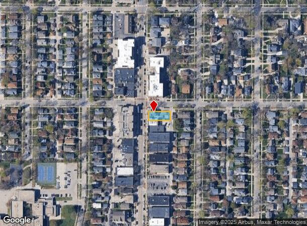
4496 N Oakland Ave, Milwaukee, WI 53211


NEARBY LISTINGS FOR SALE OR LEASE
Property Detail
4496 N Oakland Ave
Milwaukee-Waukesha-West Allis, WI
J H Myers & H B Walkers
237-0232-000
J H MYERS & H B WALKERS NW 1/4 3-7-22 EXC W 7FT TAKEN FOR N OAKLAND AVE LOT 28 BLK 3
Commercialnec
Milwaukee
X
Wisconsin
55079C0082E
28
2024
0.14 AC
2024
Milwaukee East
080200
Milwaukee/Madison
3,682 SF
DEMOGRAPHICS near 4496 N Oakland Ave
1 Mile
3 Mile
5 Mile
2024 Total Population
15,832
105,926
265,985
2029 Population
15,275
104,015
262,662
Pop Growth 2024-2029
(3.52%)
(1.80%)
(1.25%)
Average Age
39
36
36
2024 Total Households
7,075
45,835
114,639
HH Growth 2024-2029
(3.56%)
(1.95%)
(1.31%)
Median Household Inc
$98,004
$52,409
$45,333
Avg Household Size
2.20
2.20
2.20
2024 Avg HH Vehicles
1.00
1.00
1.00
Median Home Value
$391,152
$270,539
$210,346
Median Year Built
1946
1947
1949
Nearby Places
Map Layers
Map Styles
 Street
 Aerial
- Restaurants
- Banks
- Shops
- Fitness
- Groceries
PUBLIC TRANSPORTATION
COMMUTER RAIL
DRIVE
WALK
Distance
16 min
7.3 mi
AIRPORT
General Mitchell International
DRIVE
WALK
Distance
General Mitchell International
26 min
13.8 mi
Freight Ports
Port Milwaukee
DRIVE
WALK
Distance
Port Milwaukee
19 min
9.7 mi
SALE & LEASE HISTORY
LISTING DATE
SALE/LEASE

Nov 18, 2019
For Lease
Nov 18, 2019
For Sale
Nearby Properties
Address
Land Use
TOTAL SIZE
Lot Size
Zoning
Address
Land Use
TOTAL SIZE
Lot Size
Zoning
26.11 AC
TL
Address
Land Use
TOTAL SIZE
Lot Size
Zoning
417,704 SF
0.81 AC
PD
Address
Land Use
TOTAL SIZE
Lot Size
Zoning
42.90 AC
TL
Address
Land Use
TOTAL SIZE
Lot Size
Zoning
162,000 SF
0.83 AC
PD
Address
Land Use
TOTAL SIZE
Lot Size
Zoning
305,573 SF
3.20 AC
Address
Land Use
TOTAL SIZE
Lot Size
Zoning
66,245 SF
10.21 AC
Address
Land Use
TOTAL SIZE
Lot Size
Zoning
12.97 AC
TL
Address
Land Use
TOTAL SIZE
Lot Size
Zoning
85,000 SF
1.13 AC
Address
Land Use
TOTAL SIZE
Lot Size
Zoning
685,390 SF
26.20 AC
Address
Land Use
TOTAL SIZE
Lot Size
Zoning
1 SF
5.12 AC
PD
Address
Land Use
TOTAL SIZE
Lot Size
Zoning
152,640 SF
10.50 AC
Address
Land Use
TOTAL SIZE
Lot Size
Zoning
171,170 SF
25.88 AC
Address
Land Use
TOTAL SIZE
Lot Size
Zoning
12.74 AC
TL
Address
Land Use
TOTAL SIZE
Lot Size
Zoning
224,756 SF
12 AC
RESIDENTIA
Address
Land Use
TOTAL SIZE
Lot Size
Zoning
145,605 SF
2.64 AC
Address
Land Use
TOTAL SIZE
Lot Size
Zoning
241,520 SF
6.60 AC
Address
Land Use
TOTAL SIZE
Lot Size
Zoning
110,011 SF
0.59 AC
PD
Address
Land Use
TOTAL SIZE
Lot Size
Zoning
27.05 AC
PK
Address
Land Use
TOTAL SIZE
Lot Size
Zoning
165,296 SF
1.04 AC
Address
Land Use
TOTAL SIZE
Lot Size
Zoning
294,553 SF
6.19 AC
Address
Land Use
TOTAL SIZE
Lot Size
Zoning
113,542 SF
2.31 AC
Address
Land Use
TOTAL SIZE
Lot Size
Zoning
213,218 SF
11 AC
Address
Land Use
TOTAL SIZE
Lot Size
Zoning
154,494 SF
0.83 AC
PD
Address
Land Use
TOTAL SIZE
Lot Size
Zoning
90,714 SF
4.18 AC
Address
Land Use
TOTAL SIZE
Lot Size
Zoning
72,121 SF
10.93 AC
TL
Address
Land Use
TOTAL SIZE
Lot Size
Zoning
148,694 SF
0.68 AC
LB3
Address
Land Use
TOTAL SIZE
Lot Size
Zoning
195,507 SF
1.92 AC
Address
Land Use
TOTAL SIZE
Lot Size
Zoning
150.45 AC
PK
Address
Land Use
TOTAL SIZE
Lot Size
Zoning
0.80 AC
RT4
Address
Land Use
TOTAL SIZE
Lot Size
Zoning
2.15 AC
RT4
The World's #1 Commercial Real Estate Marketplace
Connect with us
© 2025 CoStar Group
The information above has been obtained from sources believed reliable. While we do not doubt its accuracy we have not verified it and make no guarantee, warranty or representation about it. It is your responsibility to independently confirm its accuracy and completeness. Any projections, opinions, assumptions, or estimates used are for example only and do not represent the current or future performance of the property. The value of this transaction to you depends on tax and other factors which should be evaluated by your tax, financial, and legal advisors. You and your advisors should conduct a careful, independent investigation of the property to determine to your satisfaction the suitability of the property for your needs.