Property Record
4496 Sugar Maple Dr, Duluth, MN 55811
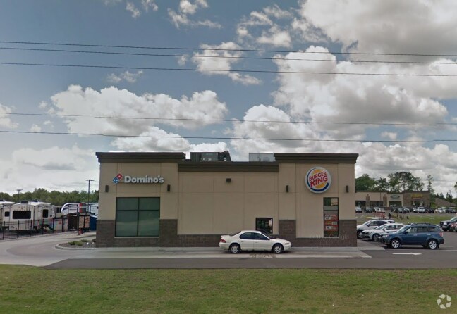

Property Detail
4496 Sugar Maple Dr
Duluth, MN-WI
OUTLOT D SERIAL #
395013400620
Saint Louis
Commercialnec
Minnesota
B and X Area of moderate flood hazard, usually the area between the limits of the 100-year and 500-year floods.
d
2026
0.98 AC
2024
South St Louis County
010301
Duluth
5,074 SF
NEARBY LISTINGS FOR SALE OR LEASE
DEMOGRAPHICS near 4496 Sugar Maple Dr
1 mile
3 mile
5 mile
2025 Total Population
1,550
8,652
26,437
2030 Population
1,562
8,672
26,230
Pop Growth 2025-2030
+ 0.77%
+ 0.23%
(0.78%)
Average Age
42
42
42
2025 Total Households
595
3,383
10,385
HH Growth 2025-2030
+ 0.67%
+ 0.06%
(1.26%)
Median Household Inc
$95,116
$82,965
$82,611
Avg Household Size
2.30
2.30
2.30
2025 Avg HH Vehicles
2.00
2.00
2.00
Median Home Value
$434,848
$364,947
$331,184
Median Year Built
1996
1993
1978
Nearby Places
Map Layers
Map Styles
 Street
 Aerial
Layers
 Traffic
 Biking
Places
Listings with unknown addresses are not visible on the map
- Restaurants
- Banks
- Shops
- Fitness
- Groceries
PUBLIC TRANSPORTATION
AIRPORT
Duluth International
Drive
Walk
Distance
Duluth International
10 min
2.1 mi
Nearby Properties
Address
Land Use
TOTAL SIZE
Lot Size
Zoning
Address
Land Use
TOTAL SIZE
Lot Size
Zoning
322,819 SF
139.41 AC
Address
Land Use
TOTAL SIZE
Lot Size
Zoning
524,275 SF
38.23 AC
Address
Land Use
TOTAL SIZE
Lot Size
Zoning
222,050 SF
5 AC
Address
Land Use
TOTAL SIZE
Lot Size
Zoning
20,388 SF
20 AC
Address
Land Use
TOTAL SIZE
Lot Size
Zoning
100,246 SF
12.24 AC
Address
Land Use
TOTAL SIZE
Lot Size
Zoning
7,300 SF
19.85 AC
Address
Land Use
TOTAL SIZE
Lot Size
Zoning
113,448 SF
10 AC
Address
Land Use
TOTAL SIZE
Lot Size
Zoning
109,021 SF
10.01 AC
Address
Land Use
TOTAL SIZE
Lot Size
Zoning
158,240 SF
0.13 AC
Address
Land Use
TOTAL SIZE
Lot Size
Zoning
183,097 SF
27.58 AC
Address
Land Use
TOTAL SIZE
Lot Size
Zoning
174,964 SF
41.97 AC
Address
Land Use
TOTAL SIZE
Lot Size
Zoning
81,316 SF
1.89 AC
Address
Land Use
TOTAL SIZE
Lot Size
Zoning
176,840 SF
27.50 AC
Address
Land Use
TOTAL SIZE
Lot Size
Zoning
161,568 SF
20.87 AC
Address
Land Use
TOTAL SIZE
Lot Size
Zoning
153,866 SF
13.83 AC
Address
Land Use
TOTAL SIZE
Lot Size
Zoning
57,230 SF
4.67 AC
Address
Land Use
TOTAL SIZE
Lot Size
Zoning
172,700 SF
33.34 AC
Address
Land Use
TOTAL SIZE
Lot Size
Zoning
164,720 SF
19.81 AC
Address
Land Use
TOTAL SIZE
Lot Size
Zoning
123,720 SF
2.65 AC
Address
Land Use
TOTAL SIZE
Lot Size
Zoning
21,204 SF
26.34 AC
Address
Land Use
TOTAL SIZE
Lot Size
Zoning
38,952 SF
20.99 AC
Address
Land Use
TOTAL SIZE
Lot Size
Zoning
112,838 SF
40 AC
Address
Land Use
TOTAL SIZE
Lot Size
Zoning
59,349 SF
0.99 AC
Address
Land Use
TOTAL SIZE
Lot Size
Zoning
91,736 SF
4.21 AC
R3
Address
Land Use
TOTAL SIZE
Lot Size
Zoning
114,112 SF
8.59 AC
Address
Land Use
TOTAL SIZE
Lot Size
Zoning
51,765 SF
3.03 AC
Address
Land Use
TOTAL SIZE
Lot Size
Zoning
20,388 SF
7.78 AC
Address
Land Use
TOTAL SIZE
Lot Size
Zoning
35,448 SF
1.15 AC
Address
Land Use
TOTAL SIZE
Lot Size
Zoning
75,274 SF
10 AC
Address
Land Use
TOTAL SIZE
Lot Size
Zoning
57,012 SF
1.67 AC
The World's #1 Commercial Real Estate Marketplace
Connect with us
© 2026 CoStar Group
The information above has been obtained from sources believed reliable. While we do not doubt its accuracy we have not verified it and make no guarantee, warranty or representation about it. It is your responsibility to independently confirm its accuracy and completeness. Any projections, opinions, assumptions, or estimates used are for example only and do not represent the current or future performance of the property. The value of this transaction to you depends on tax and other factors which should be evaluated by your tax, financial, and legal advisors. You and your advisors should conduct a careful, independent investigation of the property to determine to your satisfaction the suitability of the property for your needs.