Property Record
45 Bethany Rd, Monson, MA 01057
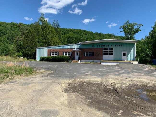
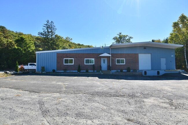
This Property Is For Sale
NEARBY LISTINGS FOR SALE OR LEASE
-
-
View all Monson listings for sale on LoopNet.com
Property Detail
45 Bethany Rd
Manufacturinglight
Hampden
X
Massachusetts
25013C0456E
1.14 AC
2025
Hampden County
2025
Hartford
813701
Springfield, MA
4,800 SF
MONS-000113-000000-000037
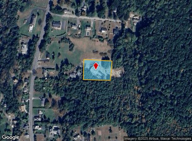
DEMOGRAPHICS near 45 Bethany Rd
1 mile
3 mile
5 mile
2024 Total Population
2,157
6,097
16,214
2029 Population
2,115
5,970
15,916
Pop Growth 2024-2029
(1.95%)
(2.08%)
(1.84%)
Average Age
45
45
44
2024 Total Households
940
2,557
6,810
HH Growth 2024-2029
(2.02%)
(2.11%)
(1.88%)
Median Household Inc
$65,567
$71,316
$71,344
Avg Household Size
2.30
2.40
2.30
2024 Avg HH Vehicles
2.00
2.00
2.00
Median Home Value
$274,522
$281,995
$281,356
Median Year Built
1963
1968
1967
Nearby Places
Map Layers
Map Styles
 Street
 Aerial
Transit
 Traffic
 Biking
Places
Listings with unknown addresses are not visible on the map
- Restaurants
- Banks
- Shops
- Fitness
- Groceries
PUBLIC TRANSPORTATION
AIRPORT
Bradley International
Drive
Walk
Distance
Bradley International
60 min
28.4 mi
Worcester Regional
Drive
Walk
Distance
Worcester Regional
59 min
35.0 mi
Freight Ports
Port of Davisville, RI
Drive
Walk
Distance
Port of Davisville, RI
117 min
86.2 mi
Nearby Properties
Address
Land Use
TOTAL SIZE
Lot Size
Zoning
Address
Land Use
TOTAL SIZE
Lot Size
Zoning
674.33 AC
RR
Address
Land Use
TOTAL SIZE
Lot Size
Zoning
112,556 SF
20 AC
RR
Address
Land Use
TOTAL SIZE
Lot Size
Zoning
91,544 SF
18.47 AC
RV
Address
Land Use
TOTAL SIZE
Lot Size
Zoning
85,228 SF
46.53 AC
RV
Address
Land Use
TOTAL SIZE
Lot Size
Zoning
50,656 SF
5.62 AC
I
Address
Land Use
TOTAL SIZE
Lot Size
Zoning
21,928 SF
2 AC
CC
Address
Land Use
TOTAL SIZE
Lot Size
Zoning
22.57 AC
I
Address
Land Use
TOTAL SIZE
Lot Size
Zoning
320 AC
Address
Land Use
TOTAL SIZE
Lot Size
Zoning
4 AC
RV
Address
Land Use
TOTAL SIZE
Lot Size
Zoning
714 AC
AR
Address
Land Use
TOTAL SIZE
Lot Size
Zoning
5.59 AC
CC
Address
Land Use
TOTAL SIZE
Lot Size
Zoning
53.88 AC
RR
Address
Land Use
TOTAL SIZE
Lot Size
Zoning
19.04 AC
RR
Address
Land Use
TOTAL SIZE
Lot Size
Zoning
2.75 AC
CC
Address
Land Use
TOTAL SIZE
Lot Size
Zoning
2.37 AC
RV
Address
Land Use
TOTAL SIZE
Lot Size
Zoning
12,516 SF
1.19 AC
CC
Address
Land Use
TOTAL SIZE
Lot Size
Zoning
4,685 SF
32.50 AC
RR
Address
Land Use
TOTAL SIZE
Lot Size
Zoning
8,880 SF
1.64 AC
CC
Address
Land Use
TOTAL SIZE
Lot Size
Zoning
48,750 SF
24.38 AC
I
Address
Land Use
TOTAL SIZE
Lot Size
Zoning
10,427 SF
0.33 AC
CC
Address
Land Use
TOTAL SIZE
Lot Size
Zoning
23.04 AC
IA
Address
Land Use
TOTAL SIZE
Lot Size
Zoning
6,450 SF
1.36 AC
CC
Address
Land Use
TOTAL SIZE
Lot Size
Zoning
1,924 SF
2.94 AC
HB
Address
Land Use
TOTAL SIZE
Lot Size
Zoning
191.29 AC
RL
Address
Land Use
TOTAL SIZE
Lot Size
Zoning
12,006 SF
1 AC
CC
Address
Land Use
TOTAL SIZE
Lot Size
Zoning
84.21 AC
RR
Address
Land Use
TOTAL SIZE
Lot Size
Zoning
2,798 SF
38.29 AC
Address
Land Use
TOTAL SIZE
Lot Size
Zoning
5,652 SF
3.55 AC
AR
Address
Land Use
TOTAL SIZE
Lot Size
Zoning
2,580 SF
0.44 AC
RR
Address
Land Use
TOTAL SIZE
Lot Size
Zoning
3,527 SF
1.36 AC
The World's #1 Commercial Real Estate Marketplace
Connect with us
© 2026 CoStar Group
The information above has been obtained from sources believed reliable. While we do not doubt its accuracy we have not verified it and make no guarantee, warranty or representation about it. It is your responsibility to independently confirm its accuracy and completeness. Any projections, opinions, assumptions, or estimates used are for example only and do not represent the current or future performance of the property. The value of this transaction to you depends on tax and other factors which should be evaluated by your tax, financial, and legal advisors. You and your advisors should conduct a careful, independent investigation of the property to determine to your satisfaction the suitability of the property for your needs.