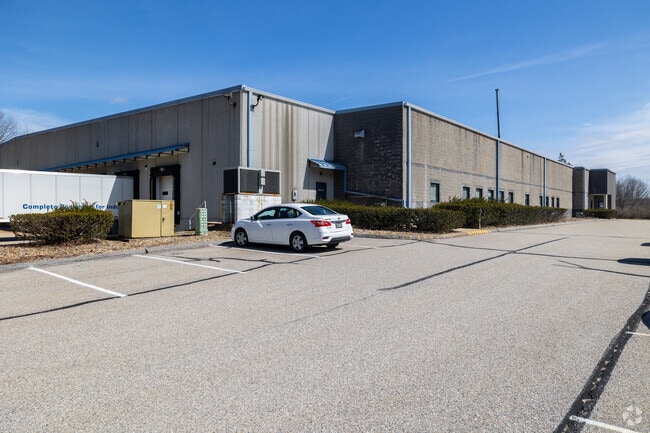
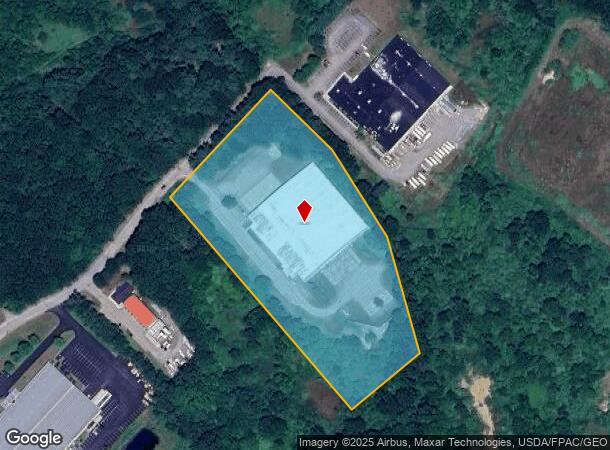
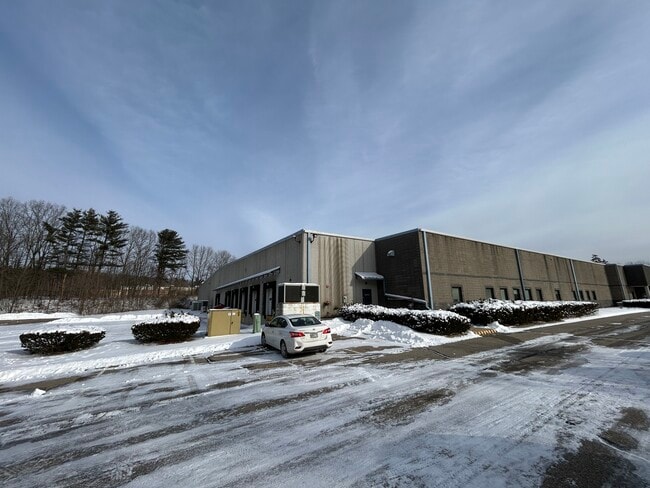
Property Record
45 Centre Rd, Somersworth, NH 03878
Current Lease Availabilities
NEARBY LISTINGS FOR SALE OR LEASE
Property Detail
45 Centre Rd
Warehouse
Strafford
X
New Hampshire
23031C0538G
7.30 AC
2024
Strafford County
2024
Boston
083001
Boston-Cambridge-Newton, MA-NH
61,963 SF
SMSW-000004-000007
DEMOGRAPHICS near 45 Centre Rd
1 mile
3 mile
5 mile
2024 Total Population
3,279
21,543
50,082
2029 Population
3,456
22,481
52,389
Pop Growth 2024-2029
+ 5.40%
+ 4.35%
+ 4.61%
Average Age
38
40
40
2024 Total Households
1,434
8,941
21,283
HH Growth 2024-2029
+ 5.44%
+ 4.36%
+ 4.75%
Median Household Inc
$62,091
$83,565
$89,057
Avg Household Size
2.30
2.40
2.30
2024 Avg HH Vehicles
2.00
2.00
2.00
Median Home Value
$223,859
$284,502
$319,073
Median Year Built
1948
1969
1972
Nearby Places
Map Layers
Map Styles
 Street
 Aerial
Transit
 Traffic
 Biking
Places
Listings with unknown addresses are not visible on the map
- Restaurants
- Banks
- Shops
- Fitness
- Groceries
PUBLIC TRANSPORTATION
COMMUTER RAIL
Drive
Walk
Distance
13 min
5.2 mi
AIRPORT
Portsmouth International at Pease
Drive
Walk
Distance
Portsmouth International at Pease
31 min
16.2 mi
Freight Ports
Portland, ME
Drive
Walk
Distance
Portland, ME
69 min
48.0 mi
Nearby Properties
Address
Land Use
TOTAL SIZE
Lot Size
Zoning
Address
Land Use
TOTAL SIZE
Lot Size
Zoning
50.50 AC
R2
Address
Land Use
TOTAL SIZE
Lot Size
Zoning
18.65 AC
B
Address
Land Use
TOTAL SIZE
Lot Size
Zoning
15.46 AC
C
Address
Land Use
TOTAL SIZE
Lot Size
Zoning
19.55 AC
B
Address
Land Use
TOTAL SIZE
Lot Size
Zoning
I1 IND
Address
Land Use
TOTAL SIZE
Lot Size
Zoning
I1 IND
Address
Land Use
TOTAL SIZE
Lot Size
Zoning
77,721 SF
22.63 AC
R1
Address
Land Use
TOTAL SIZE
Lot Size
Zoning
15,904 SF
54 AC
R1 RES
Address
Land Use
TOTAL SIZE
Lot Size
Zoning
428,428 SF
210.42 AC
CI
Address
Land Use
TOTAL SIZE
Lot Size
Zoning
Address
Land Use
TOTAL SIZE
Lot Size
Zoning
112,173 SF
21 AC
CI
Address
Land Use
TOTAL SIZE
Lot Size
Zoning
178.76 AC
AI
Address
Land Use
TOTAL SIZE
Lot Size
Zoning
197,921 SF
RC
Address
Land Use
TOTAL SIZE
Lot Size
Zoning
104,186 SF
21.50 AC
CI
Address
Land Use
TOTAL SIZE
Lot Size
Zoning
5.24 AC
C
Address
Land Use
TOTAL SIZE
Lot Size
Zoning
21.43 AC
I1 IND
Address
Land Use
TOTAL SIZE
Lot Size
Zoning
33.55 AC
COM-B
Address
Land Use
TOTAL SIZE
Lot Size
Zoning
14.50 AC
CI
Address
Land Use
TOTAL SIZE
Lot Size
Zoning
121,456 SF
25.46 AC
R1&R2
Address
Land Use
TOTAL SIZE
Lot Size
Zoning
46.98 AC
CI
Address
Land Use
TOTAL SIZE
Lot Size
Zoning
18.10 AC
B
Address
Land Use
TOTAL SIZE
Lot Size
Zoning
101,553 SF
35.40 AC
R2&R3
Address
Land Use
TOTAL SIZE
Lot Size
Zoning
2.02 AC
C
Address
Land Use
TOTAL SIZE
Lot Size
Zoning
12 AC
R2
Address
Land Use
TOTAL SIZE
Lot Size
Zoning
2.04 AC
C
Address
Land Use
TOTAL SIZE
Lot Size
Zoning
34,964 SF
1.47 AC
COM-B
Address
Land Use
TOTAL SIZE
Lot Size
Zoning
84.06 AC
MH
Address
Land Use
TOTAL SIZE
Lot Size
Zoning
6.10 AC
R2
Address
Land Use
TOTAL SIZE
Lot Size
Zoning
4.26 AC
C
Address
Land Use
TOTAL SIZE
Lot Size
Zoning
78,615 SF
4.90 AC
MY
The World's #1 Commercial Real Estate Marketplace
Connect with us
© 2026 CoStar Group
The information above has been obtained from sources believed reliable. While we do not doubt its accuracy we have not verified it and make no guarantee, warranty or representation about it. It is your responsibility to independently confirm its accuracy and completeness. Any projections, opinions, assumptions, or estimates used are for example only and do not represent the current or future performance of the property. The value of this transaction to you depends on tax and other factors which should be evaluated by your tax, financial, and legal advisors. You and your advisors should conduct a careful, independent investigation of the property to determine to your satisfaction the suitability of the property for your needs.