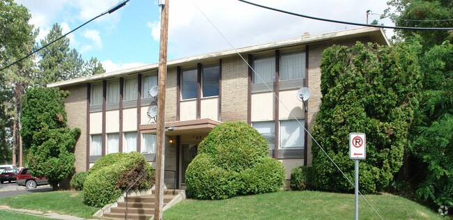
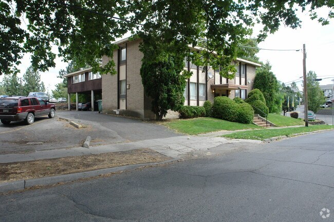
Property Record
45 E 8Th Ave, Spokane, WA 99202


Property Detail
45 E 8Th Ave
35203.0417
CAZENOVIA HTS ADD N37 OF E28.70 & S13 OF E34.70 OF LT 8 & E76.70 OF LTS 9&10 BLK 2
Apartment
Spokane
RHD
Washington
B and X Area of moderate flood hazard, usually the area between the limits of the 100-year and 500-year floods.
8
2025
0.26 AC
2025
Cliff Cannon
003200
Spokane
5,608 SF
Spokane-Spokane Valley, WA
NEARBY LISTINGS FOR SALE OR LEASE
DEMOGRAPHICS near 45 E 8Th Ave
1 mile
3 mile
5 mile
2025 Total Population
15,704
112,860
217,779
2030 Population
16,144
114,885
221,448
Pop Growth 2025-2030
+ 2.80%
+ 1.79%
+ 1.68%
Average Age
42
40
40
2025 Total Households
7,801
48,706
91,269
HH Growth 2025-2030
+ 3.47%
+ 2.11%
+ 1.85%
Median Household Inc
$52,173
$61,923
$65,945
Avg Household Size
1.80
2.10
2.30
2025 Avg HH Vehicles
1.00
2.00
2.00
Median Home Value
$441,971
$394,632
$377,219
Median Year Built
1956
1956
1962
Nearby Places
Map Layers
Map Styles
 Street
 Aerial
Transit
 Traffic
 Biking
Places
Listings with unknown addresses are not visible on the map
- Restaurants
- Banks
- Shops
- Fitness
- Groceries
PUBLIC TRANSPORTATION
COMMUTER RAIL
Drive
Walk
Distance
3 min
19 min
1.0 mi
AIRPORT
Spokane International
Drive
Walk
Distance
Spokane International
12 min
7.1 mi
Nearby Properties
Address
Land Use
TOTAL SIZE
Lot Size
Zoning
Address
Land Use
TOTAL SIZE
Lot Size
Zoning
763,627 SF
12.44 AC
OR
Address
Land Use
TOTAL SIZE
Lot Size
Zoning
481,348 SF
17.09 AC
DTU
Address
Land Use
TOTAL SIZE
Lot Size
Zoning
629,722 SF
26.28 AC
RHD
Address
Land Use
TOTAL SIZE
Lot Size
Zoning
917,113 SF
100.67 AC
LI
Address
Land Use
TOTAL SIZE
Lot Size
Zoning
157,882 SF
42.70 AC
DTG
Address
Land Use
TOTAL SIZE
Lot Size
Zoning
123,047 SF
3.95 AC
DTG
Address
Land Use
TOTAL SIZE
Lot Size
Zoning
241,106 SF
3.92 AC
CB
Address
Land Use
TOTAL SIZE
Lot Size
Zoning
536,438 SF
1.70 AC
DTC
Address
Land Use
TOTAL SIZE
Lot Size
Zoning
226,702 SF
49.25 AC
RSF
Address
Land Use
TOTAL SIZE
Lot Size
Zoning
365,804 SF
16.13 AC
RSF
Address
Land Use
TOTAL SIZE
Lot Size
Zoning
154,800 SF
20.06 AC
DTG
Address
Land Use
TOTAL SIZE
Lot Size
Zoning
251,542 SF
5.78 AC
DTG
Address
Land Use
TOTAL SIZE
Lot Size
Zoning
180,822 SF
16.11 AC
CC1
Address
Land Use
TOTAL SIZE
Lot Size
Zoning
107,800 SF
3.20 AC
CB
Address
Land Use
TOTAL SIZE
Lot Size
Zoning
379,678 SF
20.64 AC
LI
Address
Land Use
TOTAL SIZE
Lot Size
Zoning
91,882 SF
2.07 AC
OR
Address
Land Use
TOTAL SIZE
Lot Size
Zoning
124,234 SF
13.54 AC
RSF
Address
Land Use
TOTAL SIZE
Lot Size
Zoning
314,149 SF
1.07 AC
DTC
Address
Land Use
TOTAL SIZE
Lot Size
Zoning
151,667 SF
7.45 AC
DTG
Address
Land Use
TOTAL SIZE
Lot Size
Zoning
289,705 SF
3.36 AC
OR
Address
Land Use
TOTAL SIZE
Lot Size
Zoning
112,634 SF
3.87 AC
OR
Address
Land Use
TOTAL SIZE
Lot Size
Zoning
50,869 SF
0.61 AC
DTC
Address
Land Use
TOTAL SIZE
Lot Size
Zoning
137,503 SF
17.31 AC
GC
Address
Land Use
TOTAL SIZE
Lot Size
Zoning
228,981 SF
5.32 AC
RHD
Address
Land Use
TOTAL SIZE
Lot Size
Zoning
290,380 SF
2.11 AC
CA3
Address
Land Use
TOTAL SIZE
Lot Size
Zoning
182,088 SF
0.37 AC
DTC
Address
Land Use
TOTAL SIZE
Lot Size
Zoning
107,240 SF
1.54 AC
CC1
Address
Land Use
TOTAL SIZE
Lot Size
Zoning
53,748 SF
1.26 AC
DTC
Address
Land Use
TOTAL SIZE
Lot Size
Zoning
289,573 SF
7.73 AC
RMF
Address
Land Use
TOTAL SIZE
Lot Size
Zoning
124,249 SF
15.45 AC
RHD
The World's #1 Commercial Real Estate Marketplace
Connect with us
© 2026 CoStar Group
The information above has been obtained from sources believed reliable. While we do not doubt its accuracy we have not verified it and make no guarantee, warranty or representation about it. It is your responsibility to independently confirm its accuracy and completeness. Any projections, opinions, assumptions, or estimates used are for example only and do not represent the current or future performance of the property. The value of this transaction to you depends on tax and other factors which should be evaluated by your tax, financial, and legal advisors. You and your advisors should conduct a careful, independent investigation of the property to determine to your satisfaction the suitability of the property for your needs.