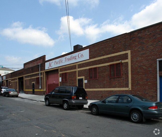
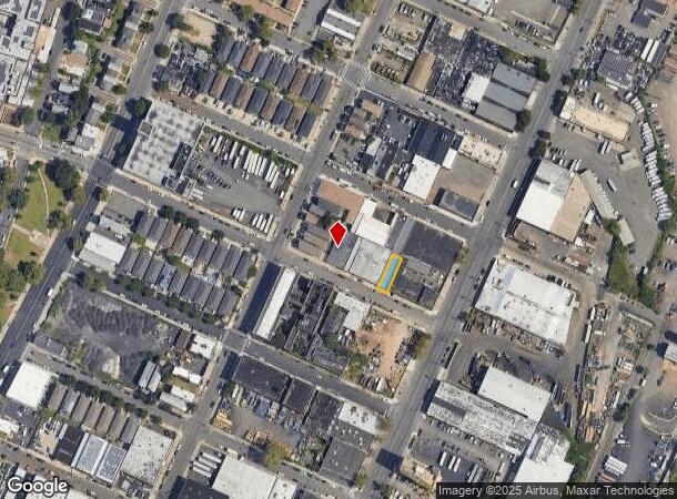
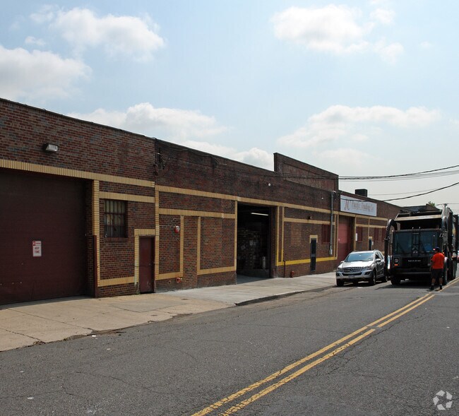
Property Record
45 E Bigelow St, Newark, NJ 07114

NEARBY LISTINGS FOR SALE OR LEASE
Property Detail
45 E Bigelow St
Newark, NJ-PA
125X100 11,12,13,14
14-02770-0000-00010
Essex
Apartment
New Jersey
X
10
34013C0154F
0.29 AC
2023
West Newark
2025
Northern New Jersey
005700
DEMOGRAPHICS near 45 E Bigelow St
1 Mile
3 Mile
5 Mile
2024 Total Population
34,432
323,343
793,766
2029 Population
33,473
312,978
768,537
Pop Growth 2024-2029
(2.79%)
(3.21%)
(3.18%)
Average Age
36
36
38
2024 Total Households
12,895
117,344
284,539
HH Growth 2024-2029
(2.78%)
(3.23%)
(3.26%)
Median Household Inc
$32,999
$46,378
$56,386
Avg Household Size
2.60
2.60
2.60
2024 Avg HH Vehicles
1.00
1.00
1.00
Median Home Value
$308,455
$293,421
$356,285
Median Year Built
1975
1964
1959
Nearby Places
Map Layers
Map Styles
 Street
 Aerial
- Restaurants
- Banks
- Shops
- Fitness
- Groceries
PUBLIC TRANSPORTATION
COMMUTER RAIL
Newark International Airport (AirTrain Newark - Port Authority of New York and New Jersey Airtrain (Airtrain))
DRIVE
WALK
Distance
Newark International Airport (AirTrain Newark - Port Authority of New York and New Jersey Airtrain (Airtrain))
5 min
1.9 mi
Newark Penn Station (Newark Penn Station-World Trade Center - Port Authority Trans-Hudson (PATH))
DRIVE
WALK
Distance
Newark Penn Station (Newark Penn Station-World Trade Center - Port Authority Trans-Hudson (PATH))
6 min
2.3 mi
AIRPORT
Newark Liberty International
DRIVE
WALK
Distance
Newark Liberty International
8 min
4.6 mi
LaGuardia
DRIVE
WALK
Distance
LaGuardia
43 min
22.0 mi
John F Kennedy International
DRIVE
WALK
Distance
John F Kennedy International
55 min
30.3 mi
Freight Ports
Maher Terminal
DRIVE
WALK
Distance
Maher Terminal
12 min
5.2 mi
Nearby Properties
Address
Land Use
TOTAL SIZE
Lot Size
Zoning
Address
Land Use
TOTAL SIZE
Lot Size
Zoning
961.13 AC
Address
Land Use
TOTAL SIZE
Lot Size
Zoning
789.45 AC
Address
Land Use
TOTAL SIZE
Lot Size
Zoning
0.57 AC
Address
Land Use
TOTAL SIZE
Lot Size
Zoning
0.45 AC
Address
Land Use
TOTAL SIZE
Lot Size
Zoning
Address
Land Use
TOTAL SIZE
Lot Size
Zoning
0.61 AC
Address
Land Use
TOTAL SIZE
Lot Size
Zoning
31.86 AC
Address
Land Use
TOTAL SIZE
Lot Size
Zoning
Address
Land Use
TOTAL SIZE
Lot Size
Zoning
98.48 AC
Address
Land Use
TOTAL SIZE
Lot Size
Zoning
877 SF
7.25 AC
Address
Land Use
TOTAL SIZE
Lot Size
Zoning
1,136 SF
6.51 AC
Address
Land Use
TOTAL SIZE
Lot Size
Zoning
683 SF
9.59 AC
Address
Land Use
TOTAL SIZE
Lot Size
Zoning
19.03 AC
Address
Land Use
TOTAL SIZE
Lot Size
Zoning
2.01 AC
Address
Land Use
TOTAL SIZE
Lot Size
Zoning
3.42 AC
Address
Land Use
TOTAL SIZE
Lot Size
Zoning
320 SF
1.25 AC
Address
Land Use
TOTAL SIZE
Lot Size
Zoning
9.77 AC
Address
Land Use
TOTAL SIZE
Lot Size
Zoning
877 SF
0.91 AC
Address
Land Use
TOTAL SIZE
Lot Size
Zoning
1.64 AC
Address
Land Use
TOTAL SIZE
Lot Size
Zoning
Address
Land Use
TOTAL SIZE
Lot Size
Zoning
1.63 AC
Address
Land Use
TOTAL SIZE
Lot Size
Zoning
Address
Land Use
TOTAL SIZE
Lot Size
Zoning
2.79 AC
Address
Land Use
TOTAL SIZE
Lot Size
Zoning
4.82 AC
Address
Land Use
TOTAL SIZE
Lot Size
Zoning
0.13 AC
Address
Land Use
TOTAL SIZE
Lot Size
Zoning
1,264 SF
3.20 AC
Address
Land Use
TOTAL SIZE
Lot Size
Zoning
Address
Land Use
TOTAL SIZE
Lot Size
Zoning
0.06 AC
Address
Land Use
TOTAL SIZE
Lot Size
Zoning
0.09 AC
Address
Land Use
TOTAL SIZE
Lot Size
Zoning
877 SF
1.95 AC
The World's #1 Commercial Real Estate Marketplace
Connect with us
© 2025 CoStar Group
The information above has been obtained from sources believed reliable. While we do not doubt its accuracy we have not verified it and make no guarantee, warranty or representation about it. It is your responsibility to independently confirm its accuracy and completeness. Any projections, opinions, assumptions, or estimates used are for example only and do not represent the current or future performance of the property. The value of this transaction to you depends on tax and other factors which should be evaluated by your tax, financial, and legal advisors. You and your advisors should conduct a careful, independent investigation of the property to determine to your satisfaction the suitability of the property for your needs.