Property Record
45 Mazzeo Dr, Randolph, MA 02368

NEARBY LISTINGS FOR SALE OR LEASE
Property Detail
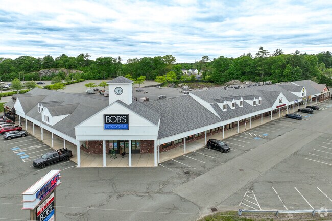
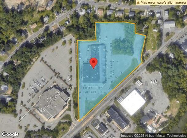
45 Mazzeo Dr
RAND-000057-B000000-000033
Norfolk
Regionalshoppingcenterormallwithanchorstore
Massachusetts
X
33
25021C0216F
9.37 AC
2025
Route 24
2025
Boston
420301
Boston-Cambridge-Newton, MA-NH
60,368 SF
DEMOGRAPHICS near 45 Mazzeo Dr
1 Mile
3 Mile
5 Mile
2024 Total Population
9,695
58,423
151,021
2029 Population
9,643
57,799
149,730
Pop Growth 2024-2029
(0.54%)
(1.07%)
(0.85%)
Average Age
43
42
42
2024 Total Households
3,589
21,275
56,196
HH Growth 2024-2029
(0.56%)
(1.14%)
(0.91%)
Median Household Inc
$79,922
$93,675
$97,413
Avg Household Size
2.60
2.70
2.60
2024 Avg HH Vehicles
2.00
2.00
2.00
Median Home Value
$464,579
$457,396
$471,153
Median Year Built
1972
1964
1965
Nearby Places
Map Layers
Map Styles
 Street
 Aerial
- Restaurants
- Banks
- Shops
- Fitness
- Groceries
PUBLIC TRANSPORTATION
COMMUTER RAIL
Holbrook/Randolph (Middleborough/Lakeville Line - Massachusetts Bay Transportation Authority Commuter Rail (Purple Line))
DRIVE
WALK
Distance
Holbrook/Randolph (Middleborough/Lakeville Line - Massachusetts Bay Transportation Authority Commuter Rail (Purple Line))
5 min
2.2 mi
Stoughton (Providence/Stoughton Line - Massachusetts Bay Transportation Authority Commuter Rail (Purple Line))
DRIVE
WALK
Distance
Stoughton (Providence/Stoughton Line - Massachusetts Bay Transportation Authority Commuter Rail (Purple Line))
7 min
3.8 mi
AIRPORT
General Edward Lawrence Logan International
DRIVE
WALK
Distance
General Edward Lawrence Logan International
30 min
19.8 mi
Freight Ports
Port of Boston
DRIVE
WALK
Distance
Port of Boston
28 min
17.6 mi
SALE & LEASE HISTORY
LISTING DATE
SALE/LEASE

Sep 25, 2016
For Lease
Oct 10, 2024
For Lease
Oct 04, 2023
For Lease
May 06, 2025
For Lease
May 01, 2018
For Lease
Mar 09, 2022
For Sale
Jul 16, 2020
For Lease
Jul 14, 2021
For Lease
Dec 02, 2024
For Lease
Nearby Properties
Address
Land Use
TOTAL SIZE
Lot Size
Zoning
Address
Land Use
TOTAL SIZE
Lot Size
Zoning
0.25 AC
RH
Address
Land Use
TOTAL SIZE
Lot Size
Zoning
235,150 SF
36.67 AC
R1
Address
Land Use
TOTAL SIZE
Lot Size
Zoning
13.08 AC
HB
Address
Land Use
TOTAL SIZE
Lot Size
Zoning
543,189 SF
22.90 AC
6
Address
Land Use
TOTAL SIZE
Lot Size
Zoning
403,163 SF
24.58 AC
I
Address
Land Use
TOTAL SIZE
Lot Size
Zoning
154,871 SF
34.30 AC
10
Address
Land Use
TOTAL SIZE
Lot Size
Zoning
0.25 AC
I
Address
Land Use
TOTAL SIZE
Lot Size
Zoning
132,143 SF
23.70 AC
RH
Address
Land Use
TOTAL SIZE
Lot Size
Zoning
167,076 SF
16 AC
A
Address
Land Use
TOTAL SIZE
Lot Size
Zoning
7.27 AC
GB
Address
Land Use
TOTAL SIZE
Lot Size
Zoning
10.10 AC
CSBD
Address
Land Use
TOTAL SIZE
Lot Size
Zoning
86,564 SF
8.45 AC
GBHD
Address
Land Use
TOTAL SIZE
Lot Size
Zoning
199,072 SF
10.07 AC
HB
Address
Land Use
TOTAL SIZE
Lot Size
Zoning
128,753 SF
17.50 AC
10
Address
Land Use
TOTAL SIZE
Lot Size
Zoning
138,400 SF
55.71 AC
RM
Address
Land Use
TOTAL SIZE
Lot Size
Zoning
76,223 SF
19.83 AC
B
Address
Land Use
TOTAL SIZE
Lot Size
Zoning
114,176 SF
11.69 AC
RH
Address
Land Use
TOTAL SIZE
Lot Size
Zoning
70,216 SF
6.86 AC
7
Address
Land Use
TOTAL SIZE
Lot Size
Zoning
298,820 SF
19.65 AC
6
Address
Land Use
TOTAL SIZE
Lot Size
Zoning
140,489 SF
36.47 AC
11
Address
Land Use
TOTAL SIZE
Lot Size
Zoning
34.45 AC
HB
Address
Land Use
TOTAL SIZE
Lot Size
Zoning
289,562 SF
13.59 AC
Address
Land Use
TOTAL SIZE
Lot Size
Zoning
37,252 SF
44.33 AC
10
Address
Land Use
TOTAL SIZE
Lot Size
Zoning
128,760 SF
19.51 AC
6
Address
Land Use
TOTAL SIZE
Lot Size
Zoning
94,356 SF
10 AC
6
Address
Land Use
TOTAL SIZE
Lot Size
Zoning
121,424 SF
11.11 AC
HB
Address
Land Use
TOTAL SIZE
Lot Size
Zoning
93,330 SF
13.90 AC
6
Address
Land Use
TOTAL SIZE
Lot Size
Zoning
102,480 SF
12.30 AC
6
Address
Land Use
TOTAL SIZE
Lot Size
Zoning
168,224 SF
11.83 AC
6
Address
Land Use
TOTAL SIZE
Lot Size
Zoning
190,000 SF
11.42 AC
The World's #1 Commercial Real Estate Marketplace
Connect with us
© 2026 CoStar Group
The information above has been obtained from sources believed reliable. While we do not doubt its accuracy we have not verified it and make no guarantee, warranty or representation about it. It is your responsibility to independently confirm its accuracy and completeness. Any projections, opinions, assumptions, or estimates used are for example only and do not represent the current or future performance of the property. The value of this transaction to you depends on tax and other factors which should be evaluated by your tax, financial, and legal advisors. You and your advisors should conduct a careful, independent investigation of the property to determine to your satisfaction the suitability of the property for your needs.