Property Record
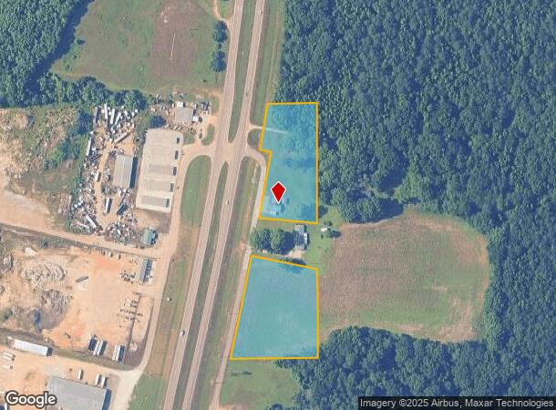
45 N Hwy Frontage Rd, Columbus, MS 39705
NEARBY LISTINGS FOR SALE OR LEASE
-
-
View all Columbus listings for sale on LoopNet.com
Property Detail
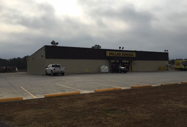
45 N Hwy Frontage Rd
33W00-00-01804
PT NE4 SE4 HWY 45 N FRONTAGE RD
Storebuilding
Lowndes
X
Mississippi
28087C0160K
4.10 AC
2024
Vicksburg/Central Area
2025
Other Market Areas
000302
Columbus, MS
1,601 SF
DEMOGRAPHICS near 45 N Hwy Frontage Rd
1 Mile
3 Mile
5 Mile
2024 Total Population
356
5,866
10,975
2029 Population
350
5,887
10,829
Pop Growth 2024-2029
(1.69%)
+ 0.36%
(1.33%)
Average Age
39
34
37
2024 Total Households
146
2,269
4,327
HH Growth 2024-2029
(1.37%)
+ 0.57%
(1.25%)
Median Household Inc
$41,071
$58,795
$64,314
Avg Household Size
2.40
2.40
2.40
2024 Avg HH Vehicles
2.00
2.00
2.00
Median Home Value
$160,869
$182,291
$193,807
Median Year Built
1988
1992
1986
Nearby Places
- Restaurants
- Banks
- Shops
- Fitness
- Groceries
PUBLIC TRANSPORTATION
AIRPORT
Golden Triangle Regional
DRIVE
WALK
Distance
Golden Triangle Regional
32 min
20.4 mi
Freight Ports
Port of Mobile
DRIVE
WALK
Distance
Port of Mobile
269 min
229.9 mi
Nearby Properties
Address
Land Use
TOTAL SIZE
Lot Size
Zoning
Address
Land Use
TOTAL SIZE
Lot Size
Zoning
Address
Land Use
TOTAL SIZE
Lot Size
Zoning
21,000 SF
22.70 AC
Address
Land Use
TOTAL SIZE
Lot Size
Zoning
8,000 SF
10 AC
Address
Land Use
TOTAL SIZE
Lot Size
Zoning
13,760 SF
6.10 AC
Address
Land Use
TOTAL SIZE
Lot Size
Zoning
5,100 SF
14.20 AC
Address
Land Use
TOTAL SIZE
Lot Size
Zoning
4,800 SF
15 AC
Address
Land Use
TOTAL SIZE
Lot Size
Zoning
4,140 SF
2.28 AC
Address
Land Use
TOTAL SIZE
Lot Size
Zoning
10,396 SF
1.20 AC
Address
Land Use
TOTAL SIZE
Lot Size
Zoning
1.01 AC
Address
Land Use
TOTAL SIZE
Lot Size
Zoning
5.40 AC
Address
Land Use
TOTAL SIZE
Lot Size
Zoning
3,160 SF
0.95 AC
Address
Land Use
TOTAL SIZE
Lot Size
Zoning
9,230 SF
1.70 AC
Address
Land Use
TOTAL SIZE
Lot Size
Zoning
5,103 SF
1.10 AC
Address
Land Use
TOTAL SIZE
Lot Size
Zoning
3,600 SF
1.85 AC
Address
Land Use
TOTAL SIZE
Lot Size
Zoning
13,864 SF
4.50 AC
Address
Land Use
TOTAL SIZE
Lot Size
Zoning
1,092 SF
1.20 AC
Address
Land Use
TOTAL SIZE
Lot Size
Zoning
8.30 AC
Address
Land Use
TOTAL SIZE
Lot Size
Zoning
2,805 SF
2.40 AC
Address
Land Use
TOTAL SIZE
Lot Size
Zoning
15,000 SF
2 AC
Address
Land Use
TOTAL SIZE
Lot Size
Zoning
4,200 SF
1.50 AC
Address
Land Use
TOTAL SIZE
Lot Size
Zoning
19,432 SF
0.60 AC
Address
Land Use
TOTAL SIZE
Lot Size
Zoning
2,584 SF
5.90 AC
Address
Land Use
TOTAL SIZE
Lot Size
Zoning
800 SF
13.30 AC
Address
Land Use
TOTAL SIZE
Lot Size
Zoning
800 SF
1.76 AC
Address
Land Use
TOTAL SIZE
Lot Size
Zoning
4,800 SF
1.80 AC
Address
Land Use
TOTAL SIZE
Lot Size
Zoning
0.24 AC
Address
Land Use
TOTAL SIZE
Lot Size
Zoning
4.20 AC
Address
Land Use
TOTAL SIZE
Lot Size
Zoning
2,700 SF
0.90 AC
Address
Land Use
TOTAL SIZE
Lot Size
Zoning
18.10 AC
Address
Land Use
TOTAL SIZE
Lot Size
Zoning
The World's #1 Commercial Real Estate Marketplace
Connect with us
© 2025 CoStar Group
The information above has been obtained from sources believed reliable. While we do not doubt its accuracy we have not verified it and make no guarantee, warranty or representation about it. It is your responsibility to independently confirm its accuracy and completeness. Any projections, opinions, assumptions, or estimates used are for example only and do not represent the current or future performance of the property. The value of this transaction to you depends on tax and other factors which should be evaluated by your tax, financial, and legal advisors. You and your advisors should conduct a careful, independent investigation of the property to determine to your satisfaction the suitability of the property for your needs.