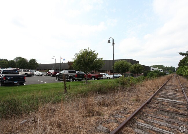
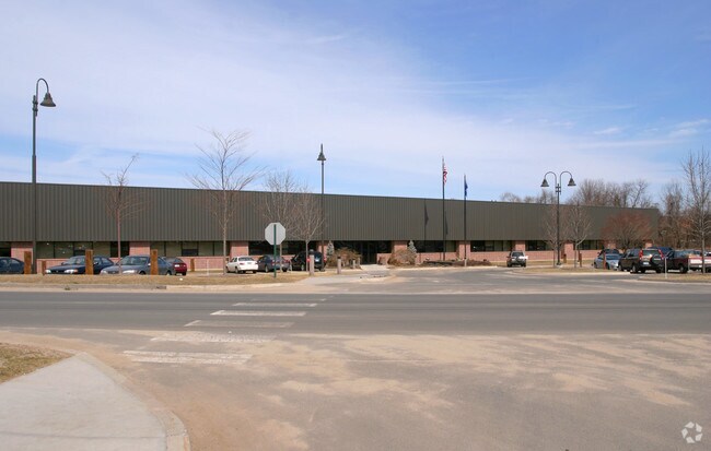
Property Record
45 Newell St, Southington, CT 06489

Property Detail
45 Newell St
SOUT-000193-000000-000007
Capitol
Commercialbuilding
Connecticut
I-2
7
AE The base floodplain where base flood elevations are provided. AE Zones are now used on new format FIRMs instead of A1-A30 Zones.
27.87 AC
2025
Southington
2025
Hartford
430604
Hartford-West Hartford-East Hartford, CT
502,440 SF
NEARBY LISTINGS FOR SALE OR LEASE
DEMOGRAPHICS near 45 Newell St
1 mile
3 mile
5 mile
2025 Total Population
3,852
43,374
137,501
2030 Population
3,966
44,459
140,439
Pop Growth 2025-2030
+ 2.96%
+ 2.50%
+ 2.14%
Average Age
46
43
42
2025 Total Households
1,703
18,915
57,134
HH Growth 2025-2030
+ 3.05%
+ 2.48%
+ 2.17%
Median Household Inc
$84,850
$88,659
$85,547
Avg Household Size
2.20
2.30
2.30
2025 Avg HH Vehicles
2.00
2.00
2.00
Median Home Value
$291,596
$302,554
$298,922
Median Year Built
1974
1973
1965
Nearby Places
Map Layers
Map Styles
 Street
 Aerial
Layers
 Traffic
 Biking
Places
Listings with unknown addresses are not visible on the map
- Restaurants
- Banks
- Shops
- Fitness
- Groceries
PUBLIC TRANSPORTATION
COMMUTER RAIL
Drive
Walk
Distance
18 min
9.1 mi
Drive
Walk
Distance
18 min
9.1 mi
AIRPORT
Tweed/New Haven
Drive
Walk
Distance
Tweed/New Haven
45 min
29.9 mi
Bradley International
Drive
Walk
Distance
Bradley International
55 min
30.1 mi
Freight Ports
Port of New Haven
Drive
Walk
Distance
Port of New Haven
41 min
27.6 mi
Nearby Properties
Address
Land Use
TOTAL SIZE
Lot Size
Zoning
Address
Land Use
TOTAL SIZE
Lot Size
Zoning
77,001 SF
54.59 AC
IP-1
Address
Land Use
TOTAL SIZE
Lot Size
Zoning
100,304 SF
28.80 AC
IP-1
Address
Land Use
TOTAL SIZE
Lot Size
Zoning
134,488 SF
63.26 AC
GC
Address
Land Use
TOTAL SIZE
Lot Size
Zoning
58,473 SF
18.20 AC
IP-1
Address
Land Use
TOTAL SIZE
Lot Size
Zoning
145,719 SF
17.90 AC
R-15
Address
Land Use
TOTAL SIZE
Lot Size
Zoning
395,492 SF
54.09 AC
R-20/2
Address
Land Use
TOTAL SIZE
Lot Size
Zoning
114,375 SF
12.72 AC
IP-1
Address
Land Use
TOTAL SIZE
Lot Size
Zoning
330,400 SF
36.90 AC
IP-1
Address
Land Use
TOTAL SIZE
Lot Size
Zoning
28.47 AC
R-10
Address
Land Use
TOTAL SIZE
Lot Size
Zoning
128,599 SF
14.75 AC
R-20/2
Address
Land Use
TOTAL SIZE
Lot Size
Zoning
17.62 AC
B
Address
Land Use
TOTAL SIZE
Lot Size
Zoning
29.05 AC
R-20
Address
Land Use
TOTAL SIZE
Lot Size
Zoning
149,912 SF
13.66 AC
B
Address
Land Use
TOTAL SIZE
Lot Size
Zoning
3,084 SF
14.90 AC
BG
Address
Land Use
TOTAL SIZE
Lot Size
Zoning
133,720 SF
7.34 AC
IP-1
Address
Land Use
TOTAL SIZE
Lot Size
Zoning
19 AC
GI
Address
Land Use
TOTAL SIZE
Lot Size
Zoning
130,252 SF
14.82 AC
B
Address
Land Use
TOTAL SIZE
Lot Size
Zoning
137,510 SF
12.95 AC
B
Address
Land Use
TOTAL SIZE
Lot Size
Zoning
16.04 AC
B
Address
Land Use
TOTAL SIZE
Lot Size
Zoning
1,250 SF
14.90 AC
I
Address
Land Use
TOTAL SIZE
Lot Size
Zoning
150,972 SF
9.99 AC
I-1
Address
Land Use
TOTAL SIZE
Lot Size
Zoning
98,463 SF
5.01 AC
I-1
Address
Land Use
TOTAL SIZE
Lot Size
Zoning
109,212 SF
20.15 AC
B
Address
Land Use
TOTAL SIZE
Lot Size
Zoning
121,648 SF
6.96 AC
I-1
Address
Land Use
TOTAL SIZE
Lot Size
Zoning
95,940 SF
12 AC
B
Address
Land Use
TOTAL SIZE
Lot Size
Zoning
12.28 AC
R-20/2
Address
Land Use
TOTAL SIZE
Lot Size
Zoning
9.07 AC
B
Address
Land Use
TOTAL SIZE
Lot Size
Zoning
40 AC
I-2
Address
Land Use
TOTAL SIZE
Lot Size
Zoning
101,495 SF
9.74 AC
B
The World's #1 Commercial Real Estate Marketplace
Connect with us
© 2026 CoStar Group
The information above has been obtained from sources believed reliable. While we do not doubt its accuracy we have not verified it and make no guarantee, warranty or representation about it. It is your responsibility to independently confirm its accuracy and completeness. Any projections, opinions, assumptions, or estimates used are for example only and do not represent the current or future performance of the property. The value of this transaction to you depends on tax and other factors which should be evaluated by your tax, financial, and legal advisors. You and your advisors should conduct a careful, independent investigation of the property to determine to your satisfaction the suitability of the property for your needs.