Property Record
45 Red Lion Ct, Winslow, NJ 08095
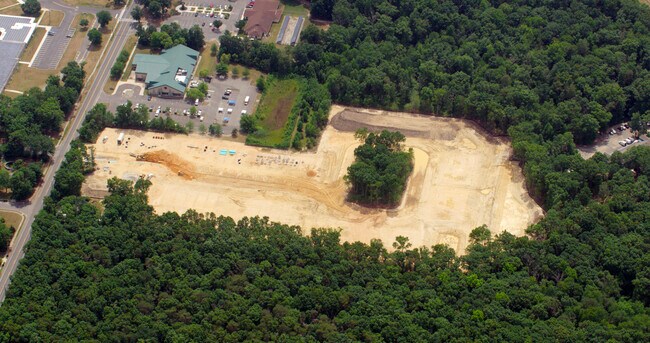
Property Detail
45 Red Lion Ct
Philadelphia-Camden-Wilmington, PA-NJ-DE-MD
ADDITIONAL LOTS: CHURCHILL ENGINEERS/FACILITY NAME: OFFICE
36-02504-0000-00013
CAMDEN
Vacantlandnec
New Jersey
PC2
4.2
B and X Area of moderate flood hazard, usually the area between the limits of the 100-year and 500-year floods.
0.60 AC
2025
South Camden County
2025
Philadelphia
609103
NEARBY LISTINGS FOR SALE OR LEASE
DEMOGRAPHICS near 45 Red Lion Ct
1 mile
3 mile
5 mile
2025 Total Population
4,270
22,365
76,306
2030 Population
4,435
23,066
78,309
Pop Growth 2025-2030
+ 3.86%
+ 3.13%
+ 2.62%
Average Age
43
43
41
2025 Total Households
1,724
8,526
27,845
HH Growth 2025-2030
+ 4.06%
+ 3.32%
+ 2.76%
Median Household Inc
$100,140
$101,142
$99,345
Avg Household Size
2.40
2.50
2.70
2025 Avg HH Vehicles
2.00
2.00
2.00
Median Home Value
$287,577
$293,780
$309,232
Median Year Built
1989
1979
1981
Nearby Places
Map Layers
Map Styles
 Street
 Aerial
Layers
 Traffic
 Biking
Places
Listings with unknown addresses are not visible on the map
- Restaurants
- Banks
- Shops
- Fitness
- Groceries
PUBLIC TRANSPORTATION
COMMUTER RAIL
Atco (Atlantic City Line - NJ Transit Commuter Rail (NJ Transit))
Drive
Walk
Distance
Atco (Atlantic City Line - NJ Transit Commuter Rail (NJ Transit))
5 min
3.3 mi
Lindenwold (Njt) (Atlantic City Line - NJ Transit Commuter Rail (NJ Transit))
Drive
Walk
Distance
Lindenwold (Njt) (Atlantic City Line - NJ Transit Commuter Rail (NJ Transit))
13 min
9.6 mi
AIRPORT
Philadelphia International
Drive
Walk
Distance
Philadelphia International
43 min
28.3 mi
Atlantic City International
Drive
Walk
Distance
Atlantic City International
61 min
33.9 mi
Freight Ports
Broadway Terminal - Pier 5
Drive
Walk
Distance
Broadway Terminal - Pier 5
27 min
19.8 mi
Nearby Properties
Address
Land Use
TOTAL SIZE
Lot Size
Zoning
Address
Land Use
TOTAL SIZE
Lot Size
Zoning
6,208 SF
30.73 AC
PARC
Address
Land Use
TOTAL SIZE
Lot Size
Zoning
137.33 AC
PR3
Address
Land Use
TOTAL SIZE
Lot Size
Zoning
4,480 SF
88.36 AC
PR4
Address
Land Use
TOTAL SIZE
Lot Size
Zoning
73.95 AC
PI3
Address
Land Use
TOTAL SIZE
Lot Size
Zoning
27.18 AC
PR4
Address
Land Use
TOTAL SIZE
Lot Size
Zoning
155 AC
PI
Address
Land Use
TOTAL SIZE
Lot Size
Zoning
89,672 SF
30.01 AC
PR2
Address
Land Use
TOTAL SIZE
Lot Size
Zoning
69,324 SF
20.26 AC
Address
Land Use
TOTAL SIZE
Lot Size
Zoning
59,361 SF
19.21 AC
INST
Address
Land Use
TOTAL SIZE
Lot Size
Zoning
22.93 AC
PC-2
Address
Land Use
TOTAL SIZE
Lot Size
Zoning
14.10 AC
RD-1
Address
Land Use
TOTAL SIZE
Lot Size
Zoning
8.56 AC
PARC
Address
Land Use
TOTAL SIZE
Lot Size
Zoning
0.42 AC
E-1
Address
Land Use
TOTAL SIZE
Lot Size
Zoning
30 AC
PR2
Address
Land Use
TOTAL SIZE
Lot Size
Zoning
5.06 AC
PF
Address
Land Use
TOTAL SIZE
Lot Size
Zoning
15.84 AC
RPF
Address
Land Use
TOTAL SIZE
Lot Size
Zoning
1,718 SF
68.48 AC
PR2
Address
Land Use
TOTAL SIZE
Lot Size
Zoning
7.07 AC
PF
Address
Land Use
TOTAL SIZE
Lot Size
Zoning
116.11 AC
E-1
Address
Land Use
TOTAL SIZE
Lot Size
Zoning
20.99 AC
C-2
Address
Land Use
TOTAL SIZE
Lot Size
Zoning
6.20 AC
Address
Land Use
TOTAL SIZE
Lot Size
Zoning
73.95 AC
PI3
Address
Land Use
TOTAL SIZE
Lot Size
Zoning
1,341 SF
1.98 AC
PHB
Address
Land Use
TOTAL SIZE
Lot Size
Zoning
Address
Land Use
TOTAL SIZE
Lot Size
Zoning
38.85 AC
PHB
Address
Land Use
TOTAL SIZE
Lot Size
Zoning
10.72 AC
PI1
Address
Land Use
TOTAL SIZE
Lot Size
Zoning
18,934 SF
5.99 AC
C2RG
Address
Land Use
TOTAL SIZE
Lot Size
Zoning
21,116 SF
4.67 AC
PC2
Address
Land Use
TOTAL SIZE
Lot Size
Zoning
85.89 AC
PI
Address
Land Use
TOTAL SIZE
Lot Size
Zoning
2.23 AC
The World's #1 Commercial Real Estate Marketplace
Connect with us
© 2026 CoStar Group
The information above has been obtained from sources believed reliable. While we do not doubt its accuracy we have not verified it and make no guarantee, warranty or representation about it. It is your responsibility to independently confirm its accuracy and completeness. Any projections, opinions, assumptions, or estimates used are for example only and do not represent the current or future performance of the property. The value of this transaction to you depends on tax and other factors which should be evaluated by your tax, financial, and legal advisors. You and your advisors should conduct a careful, independent investigation of the property to determine to your satisfaction the suitability of the property for your needs.