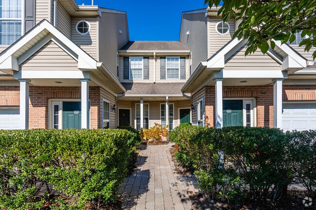
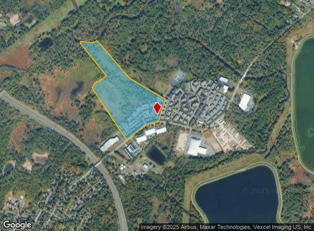
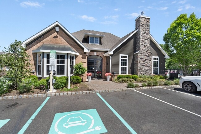
Property Record
45 S Passaic Ave, Florham Park, NJ 07932
NEARBY LISTINGS FOR SALE OR LEASE
Property Detail
45 S Passaic Ave
Northern New Jersey
Borough/Florham Park
Newark, NJ-PA
ADDITIONAL LOTS: 27
11-04201-0000-00026
Morris
Apartment
New Jersey
2024
26
2025
40.90 AC
042500
Southeast Morris County
DEMOGRAPHICS near 45 S Passaic Ave
1 Mile
3 Mile
5 Mile
2024 Total Population
4,215
71,521
185,053
2029 Population
4,250
71,353
184,246
Pop Growth 2024-2029
+ 0.83%
(0.23%)
(0.44%)
Average Age
39
40
41
2024 Total Households
1,633
24,708
64,423
HH Growth 2024-2029
+ 0.80%
(0.44%)
(0.63%)
Median Household Inc
$128,711
$183,297
$168,265
Avg Household Size
2.60
2.80
2.80
2024 Avg HH Vehicles
2.00
2.00
2.00
Median Home Value
$747,568
$882,063
$781,430
Median Year Built
1981
1959
1960
Nearby Places
Map Layers
Map Styles
 Street
 Aerial
- Restaurants
- Banks
- Shops
- Fitness
- Groceries
PUBLIC TRANSPORTATION
COMMUTER RAIL
Chatham (Morris & Essex Morristown Line - NJ Transit Commuter Rail (NJ Transit))
DRIVE
WALK
Distance
Chatham (Morris & Essex Morristown Line - NJ Transit Commuter Rail (NJ Transit))
4 min
1.4 mi
Madison (Morris & Essex Morristown Line - NJ Transit Commuter Rail (NJ Transit))
DRIVE
WALK
Distance
Madison (Morris & Essex Morristown Line - NJ Transit Commuter Rail (NJ Transit))
9 min
3.5 mi
AIRPORT
Newark Liberty International
DRIVE
WALK
Distance
Newark Liberty International
22 min
15.8 mi
LaGuardia
DRIVE
WALK
Distance
LaGuardia
57 min
35.0 mi
Freight Ports
Maher Terminal
DRIVE
WALK
Distance
Maher Terminal
25 min
16.2 mi
Nearby Properties
Address
Land Use
TOTAL SIZE
Lot Size
Zoning
Address
Land Use
TOTAL SIZE
Lot Size
Zoning
46.18 AC
Address
Land Use
TOTAL SIZE
Lot Size
Zoning
1,968 SF
88.85 AC
PROD
Address
Land Use
TOTAL SIZE
Lot Size
Zoning
64.30 AC
MF-4
Address
Land Use
TOTAL SIZE
Lot Size
Zoning
4,595 SF
4.57 AC
M-3
Address
Land Use
TOTAL SIZE
Lot Size
Zoning
7.19 AC
PI
Address
Land Use
TOTAL SIZE
Lot Size
Zoning
42.64 AC
D-S
Address
Land Use
TOTAL SIZE
Lot Size
Zoning
9.80 AC
Address
Land Use
TOTAL SIZE
Lot Size
Zoning
4.30 AC
OR-3
Address
Land Use
TOTAL SIZE
Lot Size
Zoning
31.03 AC
R-L
Address
Land Use
TOTAL SIZE
Lot Size
Zoning
19.05 AC
R-2
Address
Land Use
TOTAL SIZE
Lot Size
Zoning
Address
Land Use
TOTAL SIZE
Lot Size
Zoning
41.19 AC
MF-C
Address
Land Use
TOTAL SIZE
Lot Size
Zoning
59,369 SF
86.79 AC
R-44
Address
Land Use
TOTAL SIZE
Lot Size
Zoning
18.98 AC
R-5B
Address
Land Use
TOTAL SIZE
Lot Size
Zoning
296,578 SF
15 AC
Address
Land Use
TOTAL SIZE
Lot Size
Zoning
Address
Land Use
TOTAL SIZE
Lot Size
Zoning
Address
Land Use
TOTAL SIZE
Lot Size
Zoning
17.26 AC
R-L
Address
Land Use
TOTAL SIZE
Lot Size
Zoning
7.52 AC
OR-3
Address
Land Use
TOTAL SIZE
Lot Size
Zoning
60 AC
R-L
Address
Land Use
TOTAL SIZE
Lot Size
Zoning
55.22 AC
R-2
Address
Land Use
TOTAL SIZE
Lot Size
Zoning
15.50 AC
R-1
Address
Land Use
TOTAL SIZE
Lot Size
Zoning
252,828 SF
44.53 AC
C-1
Address
Land Use
TOTAL SIZE
Lot Size
Zoning
5.35 AC
MF-6
Address
Land Use
TOTAL SIZE
Lot Size
Zoning
9.44 AC
Address
Land Use
TOTAL SIZE
Lot Size
Zoning
19.14 AC
Address
Land Use
TOTAL SIZE
Lot Size
Zoning
24.60 AC
R-L
Address
Land Use
TOTAL SIZE
Lot Size
Zoning
1,889 SF
3.26 AC
R-1
Address
Land Use
TOTAL SIZE
Lot Size
Zoning
137,681 SF
30.15 AC
R-3
The World's #1 Commercial Real Estate Marketplace
Connect with us
© 2026 CoStar Group
The information above has been obtained from sources believed reliable. While we do not doubt its accuracy we have not verified it and make no guarantee, warranty or representation about it. It is your responsibility to independently confirm its accuracy and completeness. Any projections, opinions, assumptions, or estimates used are for example only and do not represent the current or future performance of the property. The value of this transaction to you depends on tax and other factors which should be evaluated by your tax, financial, and legal advisors. You and your advisors should conduct a careful, independent investigation of the property to determine to your satisfaction the suitability of the property for your needs.