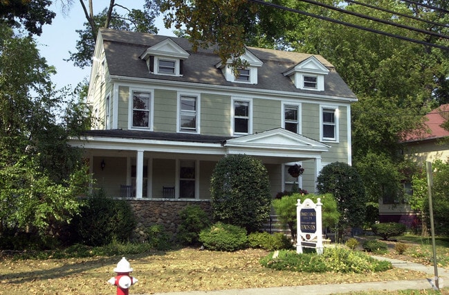
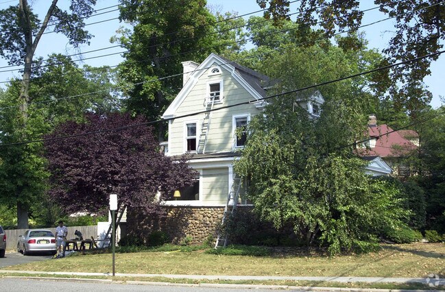
Property Record
45 Smull Ave, Caldwell, NJ 07006


Property Detail
45 Smull Ave
03-00024-0000-00014
95X97 IRR
Commercialofficeresidentialmixeduse
Essex
RA
New Jersey
B and X Area of moderate flood hazard, usually the area between the limits of the 100-year and 500-year floods.
14
2024
0.21 AC
2025
Suburban Essex/Rt 280
021701
Northern New Jersey
3,051 SF
Newark, NJ
NEARBY LISTINGS FOR SALE OR LEASE
DEMOGRAPHICS near 45 Smull Ave
1 mile
3 mile
5 mile
2025 Total Population
18,022
83,797
262,259
2030 Population
18,919
88,719
275,273
Pop Growth 2025-2030
+ 4.98%
+ 5.87%
+ 4.96%
Average Age
41
43
42
2025 Total Households
6,757
31,461
96,541
HH Growth 2025-2030
+ 5.18%
+ 6.04%
+ 5.10%
Median Household Inc
$139,928
$161,539
$145,372
Avg Household Size
2.50
2.60
2.60
2025 Avg HH Vehicles
2.00
2.00
2.00
Median Home Value
$695,058
$682,997
$676,693
Median Year Built
1956
1960
1958
Nearby Places
Map Layers
Map Styles
 Street
 Aerial
Layers
 Traffic
 Biking
Places
Listings with unknown addresses are not visible on the map
- Restaurants
- Banks
- Shops
- Fitness
- Groceries
PUBLIC TRANSPORTATION
COMMUTER RAIL
Little Falls (Montclair-Boonton Line - NJ Transit Commuter Rail (NJ Transit))
Drive
Walk
Distance
Little Falls (Montclair-Boonton Line - NJ Transit Commuter Rail (NJ Transit))
10 min
3.8 mi
Walnut Street (Montclair-Boonton Line - NJ Transit Commuter Rail (NJ Transit))
Drive
Walk
Distance
Walnut Street (Montclair-Boonton Line - NJ Transit Commuter Rail (NJ Transit))
13 min
4.4 mi
AIRPORT
Newark Liberty International
Drive
Walk
Distance
Newark Liberty International
27 min
15.6 mi
LaGuardia
Drive
Walk
Distance
LaGuardia
49 min
32.7 mi
John F Kennedy International
Drive
Walk
Distance
John F Kennedy International
60 min
43.8 mi
Freight Ports
Maher Terminal
Drive
Walk
Distance
Maher Terminal
31 min
15.9 mi
Nearby Properties
Address
Land Use
TOTAL SIZE
Lot Size
Zoning
Address
Land Use
TOTAL SIZE
Lot Size
Zoning
74.58 AC
S
Address
Land Use
TOTAL SIZE
Lot Size
Zoning
48.85 AC
R-3B
Address
Land Use
TOTAL SIZE
Lot Size
Zoning
298,272 SF
31.36 AC
P-6
Address
Land Use
TOTAL SIZE
Lot Size
Zoning
101.44 AC
OB-1
Address
Land Use
TOTAL SIZE
Lot Size
Zoning
32.34 AC
RA
Address
Land Use
TOTAL SIZE
Lot Size
Zoning
55.77 AC
OB-1
Address
Land Use
TOTAL SIZE
Lot Size
Zoning
4.60 AC
Address
Land Use
TOTAL SIZE
Lot Size
Zoning
51.24 AC
OB-2
Address
Land Use
TOTAL SIZE
Lot Size
Zoning
8,600 SF
27.27 AC
L3
Address
Land Use
TOTAL SIZE
Lot Size
Zoning
84.70 AC
Address
Land Use
TOTAL SIZE
Lot Size
Zoning
17.90 AC
B-2
Address
Land Use
TOTAL SIZE
Lot Size
Zoning
25.88 AC
Address
Land Use
TOTAL SIZE
Lot Size
Zoning
41.84 AC
OB-1
Address
Land Use
TOTAL SIZE
Lot Size
Zoning
67.49 AC
Address
Land Use
TOTAL SIZE
Lot Size
Zoning
61.69 AC
Address
Land Use
TOTAL SIZE
Lot Size
Zoning
73,436 SF
189.03 AC
R-2
Address
Land Use
TOTAL SIZE
Lot Size
Zoning
27.50 AC
M-2
Address
Land Use
TOTAL SIZE
Lot Size
Zoning
278,784 SF
6.01 AC
OB-2
Address
Land Use
TOTAL SIZE
Lot Size
Zoning
5.74 AC
B-2
Address
Land Use
TOTAL SIZE
Lot Size
Zoning
31.56 AC
R-3
Address
Land Use
TOTAL SIZE
Lot Size
Zoning
38.40 AC
Address
Land Use
TOTAL SIZE
Lot Size
Zoning
28.06 AC
OB-3
Address
Land Use
TOTAL SIZE
Lot Size
Zoning
116,505 SF
10.77 AC
Address
Land Use
TOTAL SIZE
Lot Size
Zoning
7,507 SF
18.82 AC
L-1
Address
Land Use
TOTAL SIZE
Lot Size
Zoning
4.08 AC
Address
Land Use
TOTAL SIZE
Lot Size
Zoning
32.99 AC
R-4
Address
Land Use
TOTAL SIZE
Lot Size
Zoning
10.69 AC
M-2
Address
Land Use
TOTAL SIZE
Lot Size
Zoning
1,063 SF
14.08 AC
C-1
Address
Land Use
TOTAL SIZE
Lot Size
Zoning
10.72 AC
Address
Land Use
TOTAL SIZE
Lot Size
Zoning
5.06 AC
The World's #1 Commercial Real Estate Marketplace
Connect with us
© 2026 CoStar Group
The information above has been obtained from sources believed reliable. While we do not doubt its accuracy we have not verified it and make no guarantee, warranty or representation about it. It is your responsibility to independently confirm its accuracy and completeness. Any projections, opinions, assumptions, or estimates used are for example only and do not represent the current or future performance of the property. The value of this transaction to you depends on tax and other factors which should be evaluated by your tax, financial, and legal advisors. You and your advisors should conduct a careful, independent investigation of the property to determine to your satisfaction the suitability of the property for your needs.