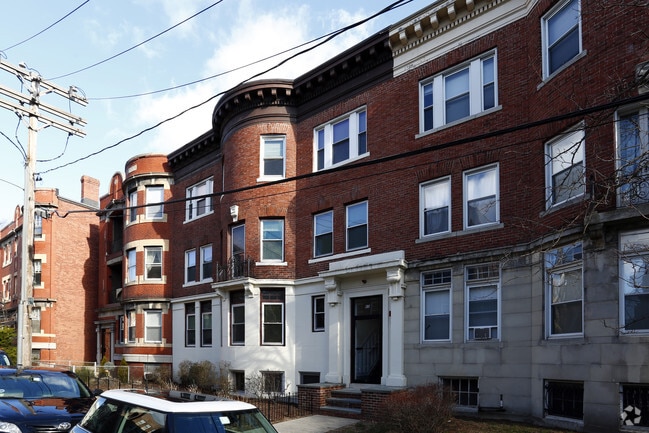
Property Record
45 Strathmore Rd, Brighton, MA 02135


NEARBY LISTINGS FOR SALE OR LEASE
Property Detail
45 Strathmore Rd
Transientlodging
Suffolk
X
Massachusetts
25021C0034F
0.08 AC
2025
Commonwealth
2025
Boston
000506
Boston-Cambridge-Newton, MA-NH
9,412 SF
BRIG-000000-000021-002423
DEMOGRAPHICS near 45 Strathmore Rd
1 mile
3 mile
5 mile
2024 Total Population
47,559
309,099
876,718
2029 Population
45,962
300,078
849,629
Pop Growth 2024-2029
(3.36%)
(2.92%)
(3.09%)
Average Age
37
36
38
2024 Total Households
21,966
124,889
361,240
HH Growth 2024-2029
(3.81%)
(3.22%)
(3.31%)
Median Household Inc
$89,339
$96,876
$100,018
Avg Household Size
2.10
2.10
2.20
2024 Avg HH Vehicles
1.00
1.00
1.00
Median Home Value
$949,168
$931,827
$860,355
Median Year Built
1952
1949
1949
Nearby Places
Map Layers
Map Styles
 Street
 Aerial
Transit
 Traffic
 Biking
Places
Listings with unknown addresses are not visible on the map
- Restaurants
- Banks
- Shops
- Fitness
- Groceries
PUBLIC TRANSPORTATION
COMMUTER RAIL
Ruggles Station (Orange Line - Massachusetts Bay Transportation Authority Subway (The T))
Drive
Walk
Distance
Ruggles Station (Orange Line - Massachusetts Bay Transportation Authority Subway (The T))
8 min
3.7 mi
Yawkey (Framingham/Worcester Line - Massachusetts Bay Transportation Authority Commuter Rail (Purple Line))
Drive
Walk
Distance
Yawkey (Framingham/Worcester Line - Massachusetts Bay Transportation Authority Commuter Rail (Purple Line))
9 min
4.4 mi
AIRPORT
General Edward Lawrence Logan International
Drive
Walk
Distance
General Edward Lawrence Logan International
18 min
10.2 mi
Freight Ports
Port of Boston
Drive
Walk
Distance
Port of Boston
17 min
7.9 mi
Nearby Properties
Address
Land Use
TOTAL SIZE
Lot Size
Zoning
Address
Land Use
TOTAL SIZE
Lot Size
Zoning
909,764 SF
25.13 AC
E
Address
Land Use
TOTAL SIZE
Lot Size
Zoning
439,500 SF
9.21 AC
E
Address
Land Use
TOTAL SIZE
Lot Size
Zoning
150,192 SF
10.27 AC
E
Address
Land Use
TOTAL SIZE
Lot Size
Zoning
596,972 SF
7.32 AC
E
Address
Land Use
TOTAL SIZE
Lot Size
Zoning
530,200 SF
62.08 AC
E
Address
Land Use
TOTAL SIZE
Lot Size
Zoning
142,458 SF
1.67 AC
C-3
Address
Land Use
TOTAL SIZE
Lot Size
Zoning
304,349 SF
1.72 AC
Address
Land Use
TOTAL SIZE
Lot Size
Zoning
3.52 AC
C-3
Address
Land Use
TOTAL SIZE
Lot Size
Zoning
377,634 SF
4.86 AC
E
Address
Land Use
TOTAL SIZE
Lot Size
Zoning
419,722 SF
2.03 AC
RC
Address
Land Use
TOTAL SIZE
Lot Size
Zoning
2.81 AC
O-2
Address
Land Use
TOTAL SIZE
Lot Size
Zoning
254,208 SF
3.83 AC
E
Address
Land Use
TOTAL SIZE
Lot Size
Zoning
4,355 SF
13.12 AC
E
Address
Land Use
TOTAL SIZE
Lot Size
Zoning
262,120 SF
0.62 AC
C
Address
Land Use
TOTAL SIZE
Lot Size
Zoning
336,518 SF
6.15 AC
I-3
Address
Land Use
TOTAL SIZE
Lot Size
Zoning
220,671 SF
2.52 AC
I-2
Address
Land Use
TOTAL SIZE
Lot Size
Zoning
506,534 SF
2.75 AC
C
Address
Land Use
TOTAL SIZE
Lot Size
Zoning
136,025 SF
6.91 AC
C3
Address
Land Use
TOTAL SIZE
Lot Size
Zoning
2.25 AC
SD-12
Address
Land Use
TOTAL SIZE
Lot Size
Zoning
468,308 SF
0.78 AC
E
Address
Land Use
TOTAL SIZE
Lot Size
Zoning
176,625 SF
5.76 AC
I-3
Address
Land Use
TOTAL SIZE
Lot Size
Zoning
443,356 SF
2.40 AC
C
Address
Land Use
TOTAL SIZE
Lot Size
Zoning
249,135 SF
1.99 AC
RC
Address
Land Use
TOTAL SIZE
Lot Size
Zoning
110,299 SF
0.82 AC
C-3
Address
Land Use
TOTAL SIZE
Lot Size
Zoning
191,648 SF
0.65 AC
RC
Address
Land Use
TOTAL SIZE
Lot Size
Zoning
91,500 SF
1.03 AC
SD-5
Address
Land Use
TOTAL SIZE
Lot Size
Zoning
241,130 SF
0.84 AC
CRDD
Address
Land Use
TOTAL SIZE
Lot Size
Zoning
208,468 SF
1.44 AC
RC
Address
Land Use
TOTAL SIZE
Lot Size
Zoning
268,675 SF
1.72 AC
I
Address
Land Use
TOTAL SIZE
Lot Size
Zoning
1.28 AC
C-3
The World's #1 Commercial Real Estate Marketplace
Connect with us
© 2026 CoStar Group
The information above has been obtained from sources believed reliable. While we do not doubt its accuracy we have not verified it and make no guarantee, warranty or representation about it. It is your responsibility to independently confirm its accuracy and completeness. Any projections, opinions, assumptions, or estimates used are for example only and do not represent the current or future performance of the property. The value of this transaction to you depends on tax and other factors which should be evaluated by your tax, financial, and legal advisors. You and your advisors should conduct a careful, independent investigation of the property to determine to your satisfaction the suitability of the property for your needs.