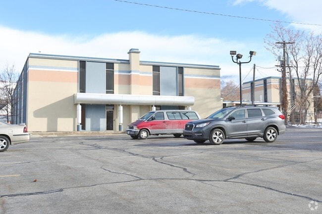
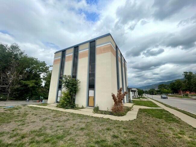
Property Record
460 E 500 S, Bountiful, UT 84010
Property Detail
460 E 500 S
03-034-0070
SECOND BUYER DENTAL WING: BEG 25.8 FT W & 69.9 FT N FR SE COR OF DESC COMMON PARCEL, LOT 1,2,3,4, BLK 1, PLAT A, BOUNTIFUL TS SURVEY; TH N 72.5 FT TO CENTER OF PARTITION WALL; TH W 42 FT ALG CENTER LI
Dentalbldg
DAVIS
H
Utah
B and X Area of moderate flood hazard, usually the area between the limits of the 100-year and 500-year floods.
1-4
2025
0.07 AC
2025
Davis/Weber Counties
126700
Salt Lake City
2,736 SF
Ogden, UT
NEARBY LISTINGS FOR SALE OR LEASE
DEMOGRAPHICS near 460 E 500 S
1 mile
3 mile
5 mile
2025 Total Population
14,945
71,978
103,288
2030 Population
15,173
73,260
105,664
Pop Growth 2025-2030
+ 1.53%
+ 1.78%
+ 2.30%
Average Age
38
38
37
2025 Total Households
5,301
24,091
33,973
HH Growth 2025-2030
+ 1.64%
+ 1.93%
+ 2.45%
Median Household Inc
$100,646
$108,387
$112,210
Avg Household Size
2.80
3.00
3.00
2025 Avg HH Vehicles
2.00
2.00
2.00
Median Home Value
$528,324
$582,395
$593,238
Median Year Built
1966
1977
1983
Nearby Places
Map Layers
Map Styles
 Street
 Aerial
Transit
 Traffic
 Biking
Places
Listings with unknown addresses are not visible on the map
- Restaurants
- Banks
- Shops
- Fitness
- Groceries
PUBLIC TRANSPORTATION
COMMUTER RAIL
Woods Cross (FrontRunner North - Utah Transit Authority (UTA))
Drive
Walk
Distance
Woods Cross (FrontRunner North - Utah Transit Authority (UTA))
5 min
1.8 mi
Farmington (FrontRunner North - Utah Transit Authority (UTA))
Drive
Walk
Distance
Farmington (FrontRunner North - Utah Transit Authority (UTA))
13 min
9.2 mi
AIRPORT
Salt Lake City International
Drive
Walk
Distance
Salt Lake City International
17 min
14.2 mi
Freight Ports
Port of Oakland
Drive
Walk
Distance
Port of Oakland
1 min
595.3 mi
SALE & LEASE HISTORY
LISTING DATE
SALE/LEASE

Sep 25, 2016
For Lease
Oct 29, 2019
For Sale
Oct 29, 2019
For Sale
Oct 19, 2023
For Sale
Jun 28, 2023
For Lease
Jul 26, 2021
For Sale
Dec 12, 2018
For Sale
Aug 18, 2023
For Lease
Nearby Properties
Address
Land Use
TOTAL SIZE
Lot Size
Zoning
Address
Land Use
TOTAL SIZE
Lot Size
Zoning
123,416 SF
14.85 AC
R4
Address
Land Use
TOTAL SIZE
Lot Size
Zoning
181,804 SF
24.72 AC
Address
Land Use
TOTAL SIZE
Lot Size
Zoning
83,092 SF
9.07 AC
R3
Address
Land Use
TOTAL SIZE
Lot Size
Zoning
240,104 SF
37.03 AC
C2
Address
Land Use
TOTAL SIZE
Lot Size
Zoning
168,369 SF
10.14 AC
H
Address
Land Use
TOTAL SIZE
Lot Size
Zoning
113,419 SF
16.45 AC
R4
Address
Land Use
TOTAL SIZE
Lot Size
Zoning
92,796 SF
2.22 AC
DN
Address
Land Use
TOTAL SIZE
Lot Size
Zoning
67,712 SF
4.98 AC
CVH
Address
Land Use
TOTAL SIZE
Lot Size
Zoning
219,598 SF
19.99 AC
CVH
Address
Land Use
TOTAL SIZE
Lot Size
Zoning
113,265 SF
0.55 AC
CG
Address
Land Use
TOTAL SIZE
Lot Size
Zoning
45,956 SF
8.44 AC
Address
Land Use
TOTAL SIZE
Lot Size
Zoning
156,694 SF
7.67 AC
Address
Land Use
TOTAL SIZE
Lot Size
Zoning
167,410 SF
12.89 AC
CG
Address
Land Use
TOTAL SIZE
Lot Size
Zoning
155,896 SF
8.96 AC
Address
Land Use
TOTAL SIZE
Lot Size
Zoning
58,273 SF
3.80 AC
I1
Address
Land Use
TOTAL SIZE
Lot Size
Zoning
280,221 SF
30.36 AC
R4
Address
Land Use
TOTAL SIZE
Lot Size
Zoning
167,405 SF
13.81 AC
CVH
Address
Land Use
TOTAL SIZE
Lot Size
Zoning
19,299 SF
3.06 AC
Address
Land Use
TOTAL SIZE
Lot Size
Zoning
3,986 SF
13 AC
CG
Address
Land Use
TOTAL SIZE
Lot Size
Zoning
119,710 SF
13.15 AC
R4
Address
Land Use
TOTAL SIZE
Lot Size
Zoning
6,050 SF
59.94 AC
Address
Land Use
TOTAL SIZE
Lot Size
Zoning
90,104 SF
9.62 AC
CVH
Address
Land Use
TOTAL SIZE
Lot Size
Zoning
66,855 SF
5.84 AC
CVH
Address
Land Use
TOTAL SIZE
Lot Size
Zoning
81,147 SF
4.10 AC
CVH
Address
Land Use
TOTAL SIZE
Lot Size
Zoning
146,381 SF
18.50 AC
PFL
Address
Land Use
TOTAL SIZE
Lot Size
Zoning
72,560 SF
2.32 AC
Address
Land Use
TOTAL SIZE
Lot Size
Zoning
101,110 SF
8.12 AC
Address
Land Use
TOTAL SIZE
Lot Size
Zoning
9,747 SF
7.73 AC
R4
Address
Land Use
TOTAL SIZE
Lot Size
Zoning
37,334 SF
9.72 AC
RM19
Address
Land Use
TOTAL SIZE
Lot Size
Zoning
166.84 AC
R-F
The World's #1 Commercial Real Estate Marketplace
Connect with us
© 2026 CoStar Group
The information above has been obtained from sources believed reliable. While we do not doubt its accuracy we have not verified it and make no guarantee, warranty or representation about it. It is your responsibility to independently confirm its accuracy and completeness. Any projections, opinions, assumptions, or estimates used are for example only and do not represent the current or future performance of the property. The value of this transaction to you depends on tax and other factors which should be evaluated by your tax, financial, and legal advisors. You and your advisors should conduct a careful, independent investigation of the property to determine to your satisfaction the suitability of the property for your needs.