Property Record
450 Broad St, Windsor, CT 06095
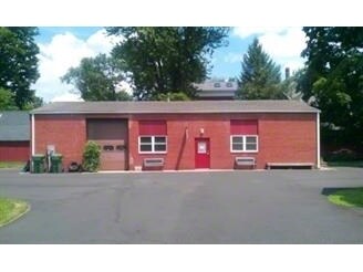

Property Detail
450 Broad St
Hartford-West Hartford-East Hartford, CT
HARTFORD
WIND-000066-000079-000011
Connecticut
Commercialnec
11
B and X Area of moderate flood hazard, usually the area between the limits of the 100-year and 500-year floods.
0.15 AC
2024
Windsor
2025
Hartford
473400
NEARBY LISTINGS FOR SALE OR LEASE
DEMOGRAPHICS near 450 Broad St
1 mile
3 mile
5 mile
2025 Total Population
4,623
26,789
108,122
2030 Population
4,679
27,185
110,121
Pop Growth 2025-2030
+ 1.21%
+ 1.48%
+ 1.85%
Average Age
42
43
41
2025 Total Households
1,959
10,414
41,117
HH Growth 2025-2030
+ 1.02%
+ 1.43%
+ 1.84%
Median Household Inc
$105,695
$107,082
$80,914
Avg Household Size
2.30
2.50
2.50
2025 Avg HH Vehicles
2.00
2.00
2.00
Median Home Value
$275,690
$279,650
$276,810
Median Year Built
1951
1960
1965
Nearby Places
Map Layers
Map Styles
 Street
 Aerial
Transit
 Traffic
 Biking
Places
Listings with unknown addresses are not visible on the map
- Restaurants
- Banks
- Shops
- Fitness
- Groceries
PUBLIC TRANSPORTATION
COMMUTER RAIL
Windsor (Hartford Line - CONN DOT)
Drive
Walk
Distance
Windsor (Hartford Line - CONN DOT)
2 min
12 min
0.6 mi
Windsor Locks (Hartford Line - CT Rail (CTRail))
Drive
Walk
Distance
Windsor Locks (Hartford Line - CT Rail (CTRail))
9 min
5.2 mi
AIRPORT
Bradley International
Drive
Walk
Distance
Bradley International
27 min
13.0 mi
Freight Ports
Port of New Haven
Drive
Walk
Distance
Port of New Haven
61 min
45.4 mi
Nearby Properties
Address
Land Use
TOTAL SIZE
Lot Size
Zoning
Address
Land Use
TOTAL SIZE
Lot Size
Zoning
13,680 SF
240.83 AC
Address
Land Use
TOTAL SIZE
Lot Size
Zoning
6.50 AC
Address
Land Use
TOTAL SIZE
Lot Size
Zoning
35.05 AC
FP
Address
Land Use
TOTAL SIZE
Lot Size
Zoning
203,071 SF
17.46 AC
Address
Land Use
TOTAL SIZE
Lot Size
Zoning
177,630 SF
32.64 AC
Address
Land Use
TOTAL SIZE
Lot Size
Zoning
247,428 SF
35.46 AC
Address
Land Use
TOTAL SIZE
Lot Size
Zoning
302,370 SF
16.43 AC
I
Address
Land Use
TOTAL SIZE
Lot Size
Zoning
488,812 SF
77.31 AC
Address
Land Use
TOTAL SIZE
Lot Size
Zoning
183,263 SF
21.69 AC
Address
Land Use
TOTAL SIZE
Lot Size
Zoning
14.90 AC
R-15
Address
Land Use
TOTAL SIZE
Lot Size
Zoning
416,640 SF
30 AC
I
Address
Land Use
TOTAL SIZE
Lot Size
Zoning
768 SF
15.72 AC
Address
Land Use
TOTAL SIZE
Lot Size
Zoning
107,272 SF
31.67 AC
Address
Land Use
TOTAL SIZE
Lot Size
Zoning
65,592 SF
6.66 AC
Address
Land Use
TOTAL SIZE
Lot Size
Zoning
153,247 SF
19.85 AC
I
Address
Land Use
TOTAL SIZE
Lot Size
Zoning
239,516 SF
31.50 AC
I-2
Address
Land Use
TOTAL SIZE
Lot Size
Zoning
12,416 SF
10.79 AC
R-15
Address
Land Use
TOTAL SIZE
Lot Size
Zoning
82,784 SF
7.07 AC
Address
Land Use
TOTAL SIZE
Lot Size
Zoning
166,420 SF
15.83 AC
Address
Land Use
TOTAL SIZE
Lot Size
Zoning
198,750 SF
14.98 AC
Address
Land Use
TOTAL SIZE
Lot Size
Zoning
87,963 SF
9.53 AC
Address
Land Use
TOTAL SIZE
Lot Size
Zoning
11,212 SF
15.54 AC
Address
Land Use
TOTAL SIZE
Lot Size
Zoning
325,600 SF
51.25 AC
Address
Land Use
TOTAL SIZE
Lot Size
Zoning
53,586 SF
40.49 AC
PO
Address
Land Use
TOTAL SIZE
Lot Size
Zoning
168,000 SF
13.86 AC
I
Address
Land Use
TOTAL SIZE
Lot Size
Zoning
76,125 SF
30.11 AC
Address
Land Use
TOTAL SIZE
Lot Size
Zoning
112,378 SF
5.83 AC
Address
Land Use
TOTAL SIZE
Lot Size
Zoning
53,799 SF
25.22 AC
R-15
Address
Land Use
TOTAL SIZE
Lot Size
Zoning
24.10 AC
Address
Land Use
TOTAL SIZE
Lot Size
Zoning
61,530 SF
12.90 AC
The World's #1 Commercial Real Estate Marketplace
Connect with us
© 2026 CoStar Group
The information above has been obtained from sources believed reliable. While we do not doubt its accuracy we have not verified it and make no guarantee, warranty or representation about it. It is your responsibility to independently confirm its accuracy and completeness. Any projections, opinions, assumptions, or estimates used are for example only and do not represent the current or future performance of the property. The value of this transaction to you depends on tax and other factors which should be evaluated by your tax, financial, and legal advisors. You and your advisors should conduct a careful, independent investigation of the property to determine to your satisfaction the suitability of the property for your needs.