Property Record
450 Butteville Rd Ne, Woodburn, OR 97071

Property Detail
450 Butteville Rd Ne
355089
PP 2023-045 LOT 2 ACRES 82.43
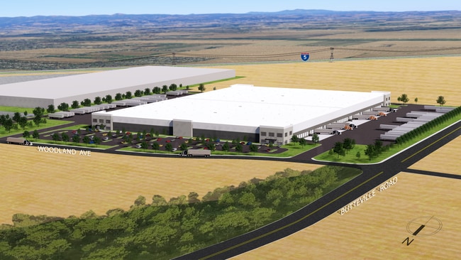
Officebuilding
MARION
IL
Oregon
B and X Area of moderate flood hazard, usually the area between the limits of the 100-year and 500-year floods.
2
2024
82.43 AC
2025
Marion County
010303
Portland
3,486,458 SF
Salem, OR
NEARBY LISTINGS FOR SALE OR LEASE
DEMOGRAPHICS near 450 Butteville Rd Ne
1 mile
3 mile
5 mile
2025 Total Population
4,821
32,622
38,025
2030 Population
5,038
33,418
38,942
Pop Growth 2025-2030
+ 4.50%
+ 2.44%
+ 2.41%
Average Age
37
38
38
2025 Total Households
1,585
10,089
11,663
HH Growth 2025-2030
+ 4.48%
+ 2.56%
+ 2.53%
Median Household Inc
$76,755
$69,159
$71,439
Avg Household Size
3.00
3.10
3.20
2025 Avg HH Vehicles
2.00
2.00
2.00
Median Home Value
$351,012
$365,813
$378,960
Median Year Built
1996
1978
1978
Nearby Places
Map Layers
Map Styles
 Street
 Aerial
Layers
 Traffic
 Biking
Places
Listings with unknown addresses are not visible on the map
- Restaurants
- Banks
- Shops
- Fitness
- Groceries
SALE & LEASE HISTORY
LISTING DATE
SALE/LEASE

Sep 27, 2021
For Lease
Sep 25, 2016
For Lease
Aug 24, 2018
For Sale
Nearby Properties
Address
Land Use
TOTAL SIZE
Lot Size
Zoning
Address
Land Use
TOTAL SIZE
Lot Size
Zoning
60,057 SF
37.80 AC
CG
Address
Land Use
TOTAL SIZE
Lot Size
Zoning
80.18 AC
IL
Address
Land Use
TOTAL SIZE
Lot Size
Zoning
26,283 SF
56.26 AC
P/SP
Address
Land Use
TOTAL SIZE
Lot Size
Zoning
Address
Land Use
TOTAL SIZE
Lot Size
Zoning
41.57 AC
IL
Address
Land Use
TOTAL SIZE
Lot Size
Zoning
10 SF
23.27 AC
RM; RS
Address
Land Use
TOTAL SIZE
Lot Size
Zoning
42,561 SF
9.01 AC
P/SP
Address
Land Use
TOTAL SIZE
Lot Size
Zoning
6,853 SF
75.96 AC
IH-LU; MUV
Address
Land Use
TOTAL SIZE
Lot Size
Zoning
391,539 SF
28.02 AC
IL
Address
Land Use
TOTAL SIZE
Lot Size
Zoning
82,150 SF
7.05 AC
CG
Address
Land Use
TOTAL SIZE
Lot Size
Zoning
246,258 SF
10.44 AC
RMN
Address
Land Use
TOTAL SIZE
Lot Size
Zoning
170,895 SF
7.34 AC
RM
Address
Land Use
TOTAL SIZE
Lot Size
Zoning
219,424 SF
11.91 AC
CG
Address
Land Use
TOTAL SIZE
Lot Size
Zoning
129,578 SF
6.12 AC
RMN
Address
Land Use
TOTAL SIZE
Lot Size
Zoning
107,208 SF
5.81 AC
RMN
Address
Land Use
TOTAL SIZE
Lot Size
Zoning
100,645 SF
3.24 AC
CG
Address
Land Use
TOTAL SIZE
Lot Size
Zoning
20.51 AC
IL; EFU; I
Address
Land Use
TOTAL SIZE
Lot Size
Zoning
161,280 SF
11.39 AC
RM
Address
Land Use
TOTAL SIZE
Lot Size
Zoning
90,582 SF
3.39 AC
CG
Address
Land Use
TOTAL SIZE
Lot Size
Zoning
123,691 SF
3.94 AC
RM
Address
Land Use
TOTAL SIZE
Lot Size
Zoning
Address
Land Use
TOTAL SIZE
Lot Size
Zoning
27,204 SF
9.16 AC
P/SP
Address
Land Use
TOTAL SIZE
Lot Size
Zoning
206,926 SF
12.74 AC
UT-20
Address
Land Use
TOTAL SIZE
Lot Size
Zoning
57,356 SF
3.52 AC
RM
Address
Land Use
TOTAL SIZE
Lot Size
Zoning
77,506 SF
8.91 AC
RM
Address
Land Use
TOTAL SIZE
Lot Size
Zoning
10 SF
7.11 AC
CG
Address
Land Use
TOTAL SIZE
Lot Size
Zoning
The World's #1 Commercial Real Estate Marketplace
Connect with us
© 2026 CoStar Group
The information above has been obtained from sources believed reliable. While we do not doubt its accuracy we have not verified it and make no guarantee, warranty or representation about it. It is your responsibility to independently confirm its accuracy and completeness. Any projections, opinions, assumptions, or estimates used are for example only and do not represent the current or future performance of the property. The value of this transaction to you depends on tax and other factors which should be evaluated by your tax, financial, and legal advisors. You and your advisors should conduct a careful, independent investigation of the property to determine to your satisfaction the suitability of the property for your needs.