Property Record
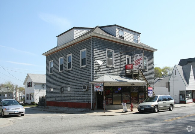
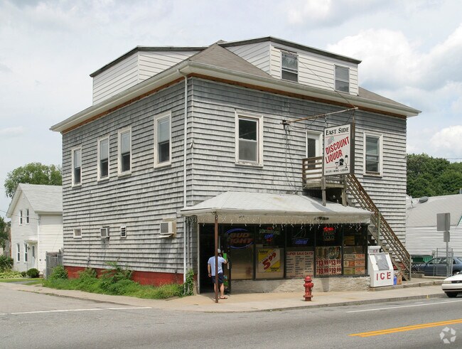
450 E Main St, Norwich, CT 06360

Property Detail
450 E Main St
NORW-000103-000003-000082
Southeastern Ct
Commercialbuilding
Connecticut
NC
82
B and X Area of moderate flood hazard, usually the area between the limits of the 100-year and 500-year floods.
0.07 AC
2025
NE New London/Norwich
2025
Hartford
697000
Norwich-New London-Willimantic, CT
3,250 SF
NEARBY LISTINGS FOR SALE OR LEASE
DEMOGRAPHICS near 450 E Main St
1 mile
3 mile
5 mile
2025 Total Population
11,250
33,422
53,102
2030 Population
11,245
33,627
53,584
Pop Growth 2025-2030
(0.04%)
+ 0.61%
+ 0.91%
Average Age
38
40
41
2025 Total Households
4,550
13,712
21,872
HH Growth 2025-2030
(0.07%)
+ 0.61%
+ 0.88%
Median Household Inc
$54,315
$63,771
$71,879
Avg Household Size
2.30
2.30
2.30
2025 Avg HH Vehicles
2.00
2.00
2.00
Median Home Value
$236,671
$246,737
$264,903
Median Year Built
1948
1953
1960
Nearby Places
Map Layers
Map Styles
 Street
 Aerial
Transit
 Traffic
 Biking
Places
Listings with unknown addresses are not visible on the map
- Restaurants
- Banks
- Shops
- Fitness
- Groceries
Nearby Properties
Address
Land Use
TOTAL SIZE
Lot Size
Zoning
Address
Land Use
TOTAL SIZE
Lot Size
Zoning
45.74 AC
PDD
Address
Land Use
TOTAL SIZE
Lot Size
Zoning
242 AC
R20
Address
Land Use
TOTAL SIZE
Lot Size
Zoning
200,847 SF
14.30 AC
R40
Address
Land Use
TOTAL SIZE
Lot Size
Zoning
16 AC
ROS
Address
Land Use
TOTAL SIZE
Lot Size
Zoning
Address
Land Use
TOTAL SIZE
Lot Size
Zoning
13.78 AC
R40
Address
Land Use
TOTAL SIZE
Lot Size
Zoning
179,652 SF
16.82 AC
PC
Address
Land Use
TOTAL SIZE
Lot Size
Zoning
2,102 SF
110.90 AC
PDD
Address
Land Use
TOTAL SIZE
Lot Size
Zoning
16,551 SF
18.11 AC
MF
Address
Land Use
TOTAL SIZE
Lot Size
Zoning
54.97 AC
GC
Address
Land Use
TOTAL SIZE
Lot Size
Zoning
128,565 SF
18.90 AC
R40
Address
Land Use
TOTAL SIZE
Lot Size
Zoning
129,948 SF
9.70 AC
PC
Address
Land Use
TOTAL SIZE
Lot Size
Zoning
18.66 AC
PC
Address
Land Use
TOTAL SIZE
Lot Size
Zoning
4.18 AC
R20
Address
Land Use
TOTAL SIZE
Lot Size
Zoning
8.78 AC
MF
Address
Land Use
TOTAL SIZE
Lot Size
Zoning
18,401 SF
12.88 AC
MF
Address
Land Use
TOTAL SIZE
Lot Size
Zoning
87,162 SF
30.20 AC
R20/MF
Address
Land Use
TOTAL SIZE
Lot Size
Zoning
79,192 SF
11.90 AC
MF
Address
Land Use
TOTAL SIZE
Lot Size
Zoning
6.39 AC
MF
Address
Land Use
TOTAL SIZE
Lot Size
Zoning
3.76 AC
MF
Address
Land Use
TOTAL SIZE
Lot Size
Zoning
26 AC
PC
Address
Land Use
TOTAL SIZE
Lot Size
Zoning
351.80 AC
ROS
Address
Land Use
TOTAL SIZE
Lot Size
Zoning
15,208 SF
205.14 AC
TRDD
Address
Land Use
TOTAL SIZE
Lot Size
Zoning
11.23 AC
MF
Address
Land Use
TOTAL SIZE
Lot Size
Zoning
134.40 AC
PC
Address
Land Use
TOTAL SIZE
Lot Size
Zoning
51,154 SF
0.38 AC
CC
Address
Land Use
TOTAL SIZE
Lot Size
Zoning
42,127 SF
0.63 AC
CC
Address
Land Use
TOTAL SIZE
Lot Size
Zoning
10.62 AC
PC
Address
Land Use
TOTAL SIZE
Lot Size
Zoning
23.24 AC
RSRVT
Address
Land Use
TOTAL SIZE
Lot Size
Zoning
10.95 AC
PC
The World's #1 Commercial Real Estate Marketplace
Connect with us
© 2026 CoStar Group
The information above has been obtained from sources believed reliable. While we do not doubt its accuracy we have not verified it and make no guarantee, warranty or representation about it. It is your responsibility to independently confirm its accuracy and completeness. Any projections, opinions, assumptions, or estimates used are for example only and do not represent the current or future performance of the property. The value of this transaction to you depends on tax and other factors which should be evaluated by your tax, financial, and legal advisors. You and your advisors should conduct a careful, independent investigation of the property to determine to your satisfaction the suitability of the property for your needs.