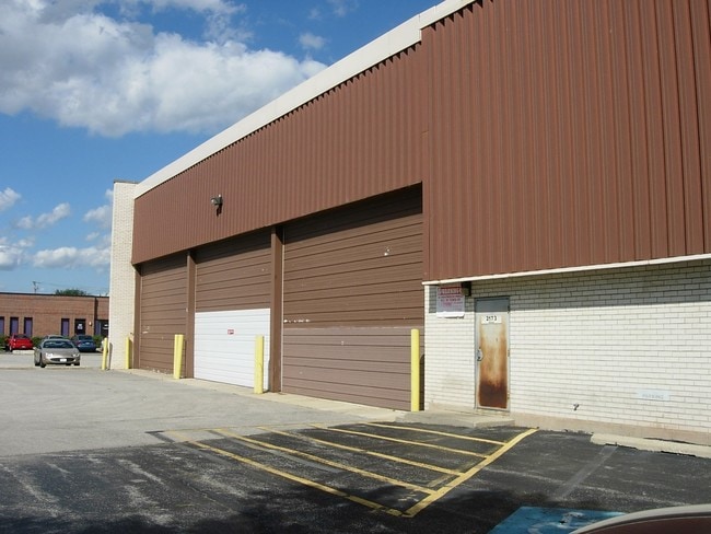
Property Record
450 Jarvis Ave, Des Plaines, IL 60018


NEARBY LISTINGS FOR SALE OR LEASE
Property Detail
450 Jarvis Ave
09-30-400-038-0000
J Emil Andersons Wolf Toll Road Subdivis
Industrialgeneral
WEST 375 00 FT E 850 00 FT PART OF W2 SE4 OF SEC30 T41N R12E 3P
X
Cook
17031C0218J
Illinois
2023
4.47 AC
2024
O'Hare
770602
Chicago
109,263 SF
Chicago-Naperville-Elgin, IL-IN-WI
DEMOGRAPHICS near 450 Jarvis Ave
1 Mile
3 Mile
5 Mile
2024 Total Population
4,876
81,180
278,471
2029 Population
4,804
78,728
270,473
Pop Growth 2024-2029
(1.48%)
(3.02%)
(2.87%)
Average Age
43
42
42
2024 Total Households
1,667
31,574
106,294
HH Growth 2024-2029
(1.68%)
(3.27%)
(3.17%)
Median Household Inc
$77,000
$73,806
$80,173
Avg Household Size
2.80
2.50
2.50
2024 Avg HH Vehicles
2.00
2.00
2.00
Median Home Value
$285,514
$288,988
$323,880
Median Year Built
1970
1969
1967
Nearby Places
Map Layers
Map Styles
 Street
 Aerial
- Restaurants
- Banks
- Shops
- Fitness
- Groceries
PUBLIC TRANSPORTATION
COMMUTER RAIL
O'hare Transfer Station (North Central Service - Northeast Illinois Regional Commuter Railroad (Metra))
DRIVE
WALK
Distance
O'hare Transfer Station (North Central Service - Northeast Illinois Regional Commuter Railroad (Metra))
6 min
2.8 mi
Des Plaines Station (Union Pacific Northwest Line - Northeast Illinois Regional Commuter Railroad (Metra))
DRIVE
WALK
Distance
Des Plaines Station (Union Pacific Northwest Line - Northeast Illinois Regional Commuter Railroad (Metra))
7 min
3.2 mi
AIRPORT
Chicago O'Hare International
DRIVE
WALK
Distance
Chicago O'Hare International
10 min
5.2 mi
Chicago Midway International
DRIVE
WALK
Distance
Chicago Midway International
40 min
24.0 mi
Freight Ports
Port Milwaukee
DRIVE
WALK
Distance
Port Milwaukee
92 min
75.3 mi
Nearby Properties
Address
Land Use
TOTAL SIZE
Lot Size
Zoning
Address
Land Use
TOTAL SIZE
Lot Size
Zoning
108,216 SF
7.87 AC
Address
Land Use
TOTAL SIZE
Lot Size
Zoning
1,127,595 SF
Address
Land Use
TOTAL SIZE
Lot Size
Zoning
Address
Land Use
TOTAL SIZE
Lot Size
Zoning
310,751 SF
15.04 AC
Address
Land Use
TOTAL SIZE
Lot Size
Zoning
179,780 SF
8.12 AC
I
Address
Land Use
TOTAL SIZE
Lot Size
Zoning
58,373 SF
11.22 AC
Address
Land Use
TOTAL SIZE
Lot Size
Zoning
380,895 SF
5.36 AC
Address
Land Use
TOTAL SIZE
Lot Size
Zoning
Address
Land Use
TOTAL SIZE
Lot Size
Zoning
Address
Land Use
TOTAL SIZE
Lot Size
Zoning
410,822 SF
14.26 AC
Address
Land Use
TOTAL SIZE
Lot Size
Zoning
208,000 SF
10.35 AC
Address
Land Use
TOTAL SIZE
Lot Size
Zoning
132,699 SF
6.74 AC
Address
Land Use
TOTAL SIZE
Lot Size
Zoning
413,338 SF
23.92 AC
Address
Land Use
TOTAL SIZE
Lot Size
Zoning
688,900 SF
20.91 AC
Address
Land Use
TOTAL SIZE
Lot Size
Zoning
Address
Land Use
TOTAL SIZE
Lot Size
Zoning
533,629 SF
24.19 AC
Address
Land Use
TOTAL SIZE
Lot Size
Zoning
508,246 SF
32.81 AC
Address
Land Use
TOTAL SIZE
Lot Size
Zoning
1.23 AC
Address
Land Use
TOTAL SIZE
Lot Size
Zoning
270,512 SF
2.26 AC
Address
Land Use
TOTAL SIZE
Lot Size
Zoning
160,000 SF
2.14 AC
Address
Land Use
TOTAL SIZE
Lot Size
Zoning
378,525 SF
0.11 AC
Address
Land Use
TOTAL SIZE
Lot Size
Zoning
206,400 SF
9.73 AC
I
Address
Land Use
TOTAL SIZE
Lot Size
Zoning
667,821 SF
20.55 AC
Address
Land Use
TOTAL SIZE
Lot Size
Zoning
53,760 SF
5.36 AC
Address
Land Use
TOTAL SIZE
Lot Size
Zoning
214,652 SF
7.62 AC
I
Address
Land Use
TOTAL SIZE
Lot Size
Zoning
279,103 SF
7.09 AC
Address
Land Use
TOTAL SIZE
Lot Size
Zoning
207,560 SF
4.42 AC
Address
Land Use
TOTAL SIZE
Lot Size
Zoning
6.28 AC
Address
Land Use
TOTAL SIZE
Lot Size
Zoning
134,590 SF
9.92 AC
I
Address
Land Use
TOTAL SIZE
Lot Size
Zoning
282,366 SF
2.48 AC
The World's #1 Commercial Real Estate Marketplace
Connect with us
© 2025 CoStar Group
The information above has been obtained from sources believed reliable. While we do not doubt its accuracy we have not verified it and make no guarantee, warranty or representation about it. It is your responsibility to independently confirm its accuracy and completeness. Any projections, opinions, assumptions, or estimates used are for example only and do not represent the current or future performance of the property. The value of this transaction to you depends on tax and other factors which should be evaluated by your tax, financial, and legal advisors. You and your advisors should conduct a careful, independent investigation of the property to determine to your satisfaction the suitability of the property for your needs.