Property Record
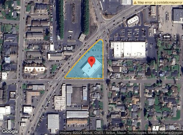
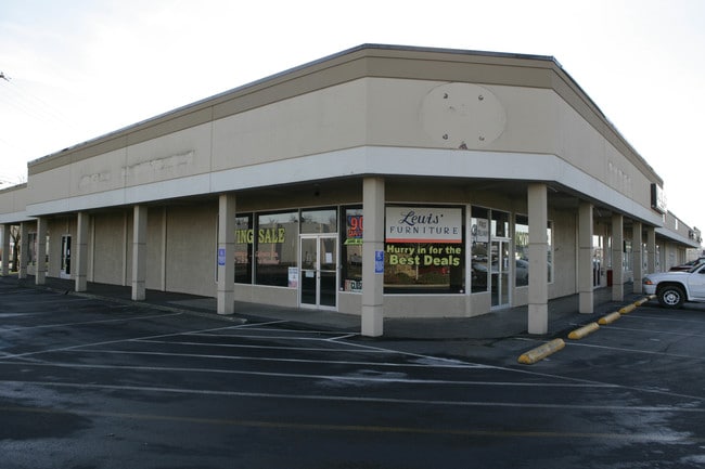
450 Ne Highway 99W, Mcminnville, OR 97128

NEARBY LISTINGS FOR SALE OR LEASE
Property Detail
450 Ne Highway 99W
Portland-Vancouver-Hillsboro, OR-WA
Joplings Subdivision
133572
TOWNSHIP 4S RANGE 4W SECTION 16 QTR C QQTR B TAXLOT 04200 LOT 13 SUBDIVISIONNAME JOPLINGS SUBDIVISION
Commercialbuilding
Yamhill
X
Oregon
41071C0402D
13
2025
1.68 AC
2025
Yamhill County
030802
Portland
DEMOGRAPHICS near 450 Ne Highway 99W
1 Mile
3 Mile
5 Mile
2024 Total Population
11,652
34,831
42,874
2029 Population
11,871
35,426
43,580
Pop Growth 2024-2029
+ 1.88%
+ 1.71%
+ 1.65%
Average Age
41
41
41
2024 Total Households
4,429
12,679
15,386
HH Growth 2024-2029
+ 2.03%
+ 1.79%
+ 1.72%
Median Household Inc
$59,605
$64,956
$67,672
Avg Household Size
2.50
2.50
2.60
2024 Avg HH Vehicles
2.00
2.00
2.00
Median Home Value
$385,611
$398,197
$392,283
Median Year Built
1979
1990
1990
Nearby Places
Map Layers
Map Styles
 Street
 Aerial
- Restaurants
- Banks
- Shops
- Fitness
- Groceries
PUBLIC TRANSPORTATION
AIRPORT
Portland International
DRIVE
WALK
Distance
Portland International
80 min
49.3 mi
Nearby Properties
Address
Land Use
TOTAL SIZE
Lot Size
Zoning
Address
Land Use
TOTAL SIZE
Lot Size
Zoning
Address
Land Use
TOTAL SIZE
Lot Size
Zoning
24.20 AC
M2
Address
Land Use
TOTAL SIZE
Lot Size
Zoning
29.70 AC
C-3
Address
Land Use
TOTAL SIZE
Lot Size
Zoning
37 AC
EF-80
Address
Land Use
TOTAL SIZE
Lot Size
Zoning
82.02 AC
M-2
Address
Land Use
TOTAL SIZE
Lot Size
Zoning
2,342 SF
16.75 AC
C-3
Address
Land Use
TOTAL SIZE
Lot Size
Zoning
Address
Land Use
TOTAL SIZE
Lot Size
Zoning
4,747 SF
48.45 AC
R-4
Address
Land Use
TOTAL SIZE
Lot Size
Zoning
20.83 AC
C-3
Address
Land Use
TOTAL SIZE
Lot Size
Zoning
Address
Land Use
TOTAL SIZE
Lot Size
Zoning
11.91 AC
C-3
Address
Land Use
TOTAL SIZE
Lot Size
Zoning
5.40 AC
M-2
Address
Land Use
TOTAL SIZE
Lot Size
Zoning
5 AC
M-1
Address
Land Use
TOTAL SIZE
Lot Size
Zoning
11.86 AC
R-4
Address
Land Use
TOTAL SIZE
Lot Size
Zoning
Address
Land Use
TOTAL SIZE
Lot Size
Zoning
4.59 AC
M-2
Address
Land Use
TOTAL SIZE
Lot Size
Zoning
9.44 AC
C-3
Address
Land Use
TOTAL SIZE
Lot Size
Zoning
16.38 AC
M-2
Address
Land Use
TOTAL SIZE
Lot Size
Zoning
12.75 AC
M-2
Address
Land Use
TOTAL SIZE
Lot Size
Zoning
12.30 AC
C-3
Address
Land Use
TOTAL SIZE
Lot Size
Zoning
1.45 AC
R-4
Address
Land Use
TOTAL SIZE
Lot Size
Zoning
21.58 AC
R-2
Address
Land Use
TOTAL SIZE
Lot Size
Zoning
Address
Land Use
TOTAL SIZE
Lot Size
Zoning
5 AC
R-4
Address
Land Use
TOTAL SIZE
Lot Size
Zoning
4.45 AC
R-4
Address
Land Use
TOTAL SIZE
Lot Size
Zoning
11.46 AC
R-2
Address
Land Use
TOTAL SIZE
Lot Size
Zoning
Address
Land Use
TOTAL SIZE
Lot Size
Zoning
0.51 AC
C-3
Address
Land Use
TOTAL SIZE
Lot Size
Zoning
The World's #1 Commercial Real Estate Marketplace
Connect with us
© 2026 CoStar Group
The information above has been obtained from sources believed reliable. While we do not doubt its accuracy we have not verified it and make no guarantee, warranty or representation about it. It is your responsibility to independently confirm its accuracy and completeness. Any projections, opinions, assumptions, or estimates used are for example only and do not represent the current or future performance of the property. The value of this transaction to you depends on tax and other factors which should be evaluated by your tax, financial, and legal advisors. You and your advisors should conduct a careful, independent investigation of the property to determine to your satisfaction the suitability of the property for your needs.