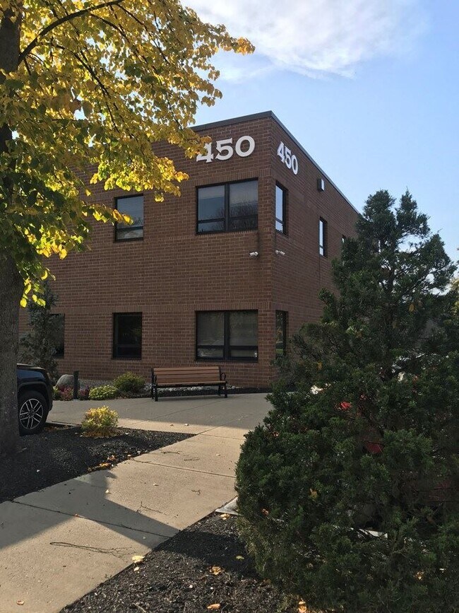
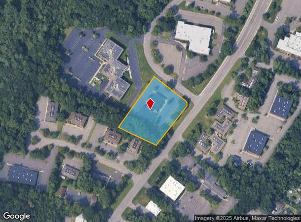
Property Record
450 New Karner Rd, Albany, NY 12205
NEARBY LISTINGS FOR SALE OR LEASE
Property Detail
450 New Karner Rd
Albany-Schenectady-Troy, NY
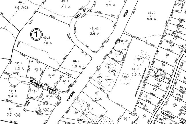
Ayco Plaza Subdivision
012689-029-002-0001-043-003-0000
N-WALL ST E-N/KARNER S-97-38.3
Officebuilding
Albany
X
New York
36001C0177D
43.003
2025
1.85 AC
2024
Central Avenue Corridor
013804
Albany/Schenectady/Troy
25,090 SF
DEMOGRAPHICS near 450 New Karner Rd
1 Mile
3 Mile
5 Mile
2024 Total Population
6,126
33,211
120,526
2029 Population
6,106
33,324
121,188
Pop Growth 2024-2029
(0.33%)
+ 0.34%
+ 0.55%
Average Age
43
44
42
2024 Total Households
2,350
13,601
47,541
HH Growth 2024-2029
(0.34%)
+ 0.28%
+ 0.62%
Median Household Inc
$88,043
$92,670
$89,811
Avg Household Size
2.40
2.30
2.30
2024 Avg HH Vehicles
2.00
2.00
2.00
Median Home Value
$277,829
$271,281
$268,436
Median Year Built
1966
1974
1971
Nearby Places
- Restaurants
- Banks
- Shops
- Fitness
- Groceries
PUBLIC TRANSPORTATION
COMMUTER RAIL
DRIVE
WALK
Distance
19 min
9.5 mi
AIRPORT
Albany International
DRIVE
WALK
Distance
Albany International
12 min
5.6 mi
Freight Ports
Albany, NY Port
DRIVE
WALK
Distance
Albany, NY Port
23 min
13.3 mi
SALE & LEASE HISTORY
LISTING DATE
SALE/LEASE

Sep 01, 2021
For Lease
May 26, 2017
For Lease
Jan 07, 2020
For Lease
Nearby Properties
Address
Land Use
TOTAL SIZE
Lot Size
Zoning
Address
Land Use
TOTAL SIZE
Lot Size
Zoning
821,670 SF
803.50 AC
17
Address
Land Use
TOTAL SIZE
Lot Size
Zoning
10,216 SF
48.37 AC
16
Address
Land Use
TOTAL SIZE
Lot Size
Zoning
373,296 SF
11.70 AC
46
Address
Land Use
TOTAL SIZE
Lot Size
Zoning
301,834 SF
9 AC
26
Address
Land Use
TOTAL SIZE
Lot Size
Zoning
80.10 AC
LC
Address
Land Use
TOTAL SIZE
Lot Size
Zoning
279,150 SF
21.10 AC
CO
Address
Land Use
TOTAL SIZE
Lot Size
Zoning
266,600 SF
22.60 AC
47
Address
Land Use
TOTAL SIZE
Lot Size
Zoning
25,786 SF
8 AC
17
Address
Land Use
TOTAL SIZE
Lot Size
Zoning
167,222 SF
15.65 AC
14
Address
Land Use
TOTAL SIZE
Lot Size
Zoning
66,419 SF
2 AC
CPB
Address
Land Use
TOTAL SIZE
Lot Size
Zoning
77.50 AC
M1
Address
Land Use
TOTAL SIZE
Lot Size
Zoning
162,500 SF
19.90 AC
17
Address
Land Use
TOTAL SIZE
Lot Size
Zoning
256,101 SF
9 AC
12
Address
Land Use
TOTAL SIZE
Lot Size
Zoning
141,570 SF
4.43 AC
12
Address
Land Use
TOTAL SIZE
Lot Size
Zoning
103.30 AC
LC
Address
Land Use
TOTAL SIZE
Lot Size
Zoning
238,709 SF
55.82 AC
04 - FARM
Address
Land Use
TOTAL SIZE
Lot Size
Zoning
78,326 SF
27.47 AC
R40
Address
Land Use
TOTAL SIZE
Lot Size
Zoning
83,120 SF
126.75 AC
25
Address
Land Use
TOTAL SIZE
Lot Size
Zoning
214,716 SF
28.40 AC
19
Address
Land Use
TOTAL SIZE
Lot Size
Zoning
272,520 SF
20.70 AC
16
Address
Land Use
TOTAL SIZE
Lot Size
Zoning
183,140 SF
9.85 AC
CM
Address
Land Use
TOTAL SIZE
Lot Size
Zoning
9,774 SF
49.20 AC
43
Address
Land Use
TOTAL SIZE
Lot Size
Zoning
53,852 SF
43.35 AC
25
Address
Land Use
TOTAL SIZE
Lot Size
Zoning
25,112 SF
13.16 AC
04 - FARM
Address
Land Use
TOTAL SIZE
Lot Size
Zoning
Address
Land Use
TOTAL SIZE
Lot Size
Zoning
69.90 AC
R1B
Address
Land Use
TOTAL SIZE
Lot Size
Zoning
269,318 SF
7.60 AC
17
Address
Land Use
TOTAL SIZE
Lot Size
Zoning
262,422 SF
18.45 AC
16
Address
Land Use
TOTAL SIZE
Lot Size
Zoning
32.10 AC
CPB
Address
Land Use
TOTAL SIZE
Lot Size
Zoning
117,723 SF
9.07 AC
12
The World's #1 Commercial Real Estate Marketplace
Connect with us
© 2025 CoStar Group
The information above has been obtained from sources believed reliable. While we do not doubt its accuracy we have not verified it and make no guarantee, warranty or representation about it. It is your responsibility to independently confirm its accuracy and completeness. Any projections, opinions, assumptions, or estimates used are for example only and do not represent the current or future performance of the property. The value of this transaction to you depends on tax and other factors which should be evaluated by your tax, financial, and legal advisors. You and your advisors should conduct a careful, independent investigation of the property to determine to your satisfaction the suitability of the property for your needs.