Property Record
450 S Main St, Williamstown, KY 41097


NEARBY LISTINGS FOR SALE OR LEASE
-
-
View all Williamstown listings for sale on LoopNet.com
Property Detail
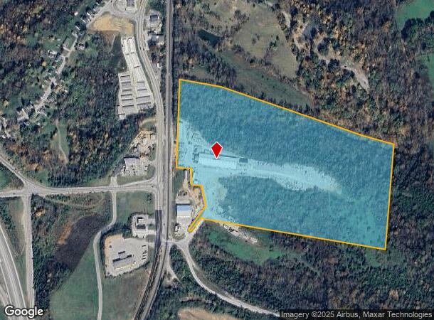
450 S Main St
059-00-00-026.00
BLDGS & 42.65
Industrialgeneral
Grant
X
Kentucky
21191C0125E
42.65 AC
2025
Grant County
2025
Cincinnati/Dayton
920302
Cincinnati, OH-KY-IN
28,420 SF
DEMOGRAPHICS near 450 S Main St
1 Mile
3 Mile
5 Mile
2024 Total Population
1,464
4,260
9,358
2029 Population
1,558
4,534
9,959
Pop Growth 2024-2029
+ 6.42%
+ 6.43%
+ 6.42%
Average Age
37
38
39
2024 Total Households
453
1,495
3,405
HH Growth 2024-2029
+ 6.62%
+ 6.35%
+ 6.46%
Median Household Inc
$42,352
$56,464
$56,908
Avg Household Size
2.80
2.60
2.60
2024 Avg HH Vehicles
2.00
2.00
2.00
Median Home Value
$128,671
$156,188
$172,337
Median Year Built
1978
1977
1980
Nearby Places
Map Layers
Map Styles
 Street
 Aerial
- Restaurants
- Banks
- Shops
- Fitness
- Groceries
PUBLIC TRANSPORTATION
AIRPORT
Cincinnati/Northern Kentucky International
DRIVE
WALK
Distance
Cincinnati/Northern Kentucky International
46 min
32.6 mi
Nearby Properties
Address
Land Use
TOTAL SIZE
Lot Size
Zoning
Address
Land Use
TOTAL SIZE
Lot Size
Zoning
3.03 AC
Address
Land Use
TOTAL SIZE
Lot Size
Zoning
29,364 SF
9.94 AC
Address
Land Use
TOTAL SIZE
Lot Size
Zoning
31.95 AC
Address
Land Use
TOTAL SIZE
Lot Size
Zoning
100.80 AC
Address
Land Use
TOTAL SIZE
Lot Size
Zoning
16,545 SF
3.34 AC
Address
Land Use
TOTAL SIZE
Lot Size
Zoning
276.50 AC
Address
Land Use
TOTAL SIZE
Lot Size
Zoning
17,022 SF
4.54 AC
Address
Land Use
TOTAL SIZE
Lot Size
Zoning
13,296 SF
4.31 AC
Address
Land Use
TOTAL SIZE
Lot Size
Zoning
1.40 AC
Address
Land Use
TOTAL SIZE
Lot Size
Zoning
1.85 AC
Address
Land Use
TOTAL SIZE
Lot Size
Zoning
40.47 AC
Address
Land Use
TOTAL SIZE
Lot Size
Zoning
28,896 SF
6.89 AC
Address
Land Use
TOTAL SIZE
Lot Size
Zoning
59,583 SF
10 AC
Address
Land Use
TOTAL SIZE
Lot Size
Zoning
148.11 AC
Address
Land Use
TOTAL SIZE
Lot Size
Zoning
11,080 SF
6.14 AC
Address
Land Use
TOTAL SIZE
Lot Size
Zoning
4,328 SF
2.62 AC
Address
Land Use
TOTAL SIZE
Lot Size
Zoning
4,608 SF
2.89 AC
Address
Land Use
TOTAL SIZE
Lot Size
Zoning
15,168 SF
3.75 AC
Address
Land Use
TOTAL SIZE
Lot Size
Zoning
13.76 AC
Address
Land Use
TOTAL SIZE
Lot Size
Zoning
42,660 SF
7.73 AC
Address
Land Use
TOTAL SIZE
Lot Size
Zoning
5.34 AC
Address
Land Use
TOTAL SIZE
Lot Size
Zoning
4,564 SF
1.50 AC
Address
Land Use
TOTAL SIZE
Lot Size
Zoning
7,496 SF
3.03 AC
Address
Land Use
TOTAL SIZE
Lot Size
Zoning
5,724 SF
1.82 AC
Address
Land Use
TOTAL SIZE
Lot Size
Zoning
13.63 AC
Address
Land Use
TOTAL SIZE
Lot Size
Zoning
6,750 SF
4 AC
Address
Land Use
TOTAL SIZE
Lot Size
Zoning
9,405 SF
11.54 AC
Address
Land Use
TOTAL SIZE
Lot Size
Zoning
0.90 AC
Address
Land Use
TOTAL SIZE
Lot Size
Zoning
100.30 AC
The World's #1 Commercial Real Estate Marketplace
Connect with us
© 2026 CoStar Group
The information above has been obtained from sources believed reliable. While we do not doubt its accuracy we have not verified it and make no guarantee, warranty or representation about it. It is your responsibility to independently confirm its accuracy and completeness. Any projections, opinions, assumptions, or estimates used are for example only and do not represent the current or future performance of the property. The value of this transaction to you depends on tax and other factors which should be evaluated by your tax, financial, and legal advisors. You and your advisors should conduct a careful, independent investigation of the property to determine to your satisfaction the suitability of the property for your needs.