Property Record
450 State Highway 78, Lavon, TX 75166
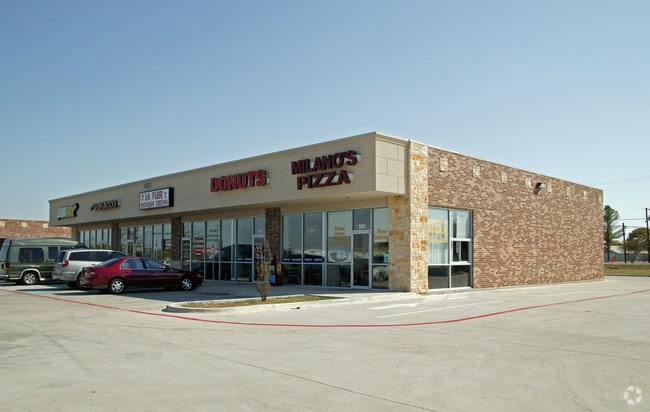


Property Detail
450 State Highway 78
Dallas-Fort Worth-Arlington, TX
LAVON BUSINESS PARK, BLK A, LOT 2
R-8362-00A-0020-1
COLLIN
Commercialnec
Texas
B and X Area of moderate flood hazard, usually the area between the limits of the 100-year and 500-year floods.
2
2025
1.31 AC
2025
East Plano
031201
Dallas/Ft Worth
6,000 SF
NEARBY LISTINGS FOR SALE OR LEASE
DEMOGRAPHICS near 450 State Highway 78
1 mile
3 mile
5 mile
2024 Total Population
6,504
13,839
46,744
2029 Population
7,738
16,572
55,323
Pop Growth 2024-2029
+ 18.97%
+ 19.75%
+ 18.35%
Average Age
37
38
38
2024 Total Households
2,075
4,457
15,065
HH Growth 2024-2029
+ 19.18%
+ 19.88%
+ 18.45%
Median Household Inc
$120,888
$125,104
$129,892
Avg Household Size
3.10
3.10
3.10
2024 Avg HH Vehicles
3.00
3.00
2.00
Median Home Value
$462,232
$458,488
$452,754
Median Year Built
2010
2010
2010
Nearby Places
Map Layers
Map Styles
 Street
 Aerial
Transit
 Traffic
 Biking
Places
Listings with unknown addresses are not visible on the map
- Restaurants
- Banks
- Shops
- Fitness
- Groceries
PUBLIC TRANSPORTATION
AIRPORT
Dallas Love Field
Drive
Walk
Distance
Dallas Love Field
53 min
35.5 mi
Freight Ports
Port of Shreveport
Drive
Walk
Distance
Port of Shreveport
218 min
192.7 mi
SALE & LEASE HISTORY
LISTING DATE
SALE/LEASE

Nov 29, 2022
For Lease
Jun 11, 2018
For Lease
Nearby Properties
Address
Land Use
TOTAL SIZE
Lot Size
Zoning
Address
Land Use
TOTAL SIZE
Lot Size
Zoning
603,573 SF
58.20 AC
Address
Land Use
TOTAL SIZE
Lot Size
Zoning
246,156 SF
59.12 AC
Address
Land Use
TOTAL SIZE
Lot Size
Zoning
457.27 AC
Address
Land Use
TOTAL SIZE
Lot Size
Zoning
96,728 SF
12 AC
Address
Land Use
TOTAL SIZE
Lot Size
Zoning
69.92 AC
Address
Land Use
TOTAL SIZE
Lot Size
Zoning
62.13 AC
Address
Land Use
TOTAL SIZE
Lot Size
Zoning
65,987 SF
4.99 AC
Address
Land Use
TOTAL SIZE
Lot Size
Zoning
14,921 SF
1.52 AC
PD
Address
Land Use
TOTAL SIZE
Lot Size
Zoning
44.63 AC
Address
Land Use
TOTAL SIZE
Lot Size
Zoning
24,739 SF
40.55 AC
Address
Land Use
TOTAL SIZE
Lot Size
Zoning
2,000,000 SF
5.68 AC
Address
Land Use
TOTAL SIZE
Lot Size
Zoning
92,265 SF
5.82 AC
Address
Land Use
TOTAL SIZE
Lot Size
Zoning
7,107 SF
1.24 AC
Address
Land Use
TOTAL SIZE
Lot Size
Zoning
41,721 SF
13.97 AC
Address
Land Use
TOTAL SIZE
Lot Size
Zoning
36,730 SF
6.46 AC
Address
Land Use
TOTAL SIZE
Lot Size
Zoning
37,928 SF
6.16 AC
Address
Land Use
TOTAL SIZE
Lot Size
Zoning
130.44 AC
RESI
Address
Land Use
TOTAL SIZE
Lot Size
Zoning
8.80 AC
COMM
Address
Land Use
TOTAL SIZE
Lot Size
Zoning
2,538 SF
150.45 AC
Address
Land Use
TOTAL SIZE
Lot Size
Zoning
5.70 AC
PD
Address
Land Use
TOTAL SIZE
Lot Size
Zoning
11,004 SF
1.56 AC
Address
Land Use
TOTAL SIZE
Lot Size
Zoning
40,762 SF
6.89 AC
IND
Address
Land Use
TOTAL SIZE
Lot Size
Zoning
5,445 SF
1.85 AC
Address
Land Use
TOTAL SIZE
Lot Size
Zoning
5.61 AC
PD
Address
Land Use
TOTAL SIZE
Lot Size
Zoning
4.40 AC
Address
Land Use
TOTAL SIZE
Lot Size
Zoning
9,200 SF
1.23 AC
Address
Land Use
TOTAL SIZE
Lot Size
Zoning
23.09 AC
PD
Address
Land Use
TOTAL SIZE
Lot Size
Zoning
Address
Land Use
TOTAL SIZE
Lot Size
Zoning
28,050 SF
2.81 AC
Address
Land Use
TOTAL SIZE
Lot Size
Zoning
27.04 AC
PD
The World's #1 Commercial Real Estate Marketplace
Connect with us
© 2026 CoStar Group
The information above has been obtained from sources believed reliable. While we do not doubt its accuracy we have not verified it and make no guarantee, warranty or representation about it. It is your responsibility to independently confirm its accuracy and completeness. Any projections, opinions, assumptions, or estimates used are for example only and do not represent the current or future performance of the property. The value of this transaction to you depends on tax and other factors which should be evaluated by your tax, financial, and legal advisors. You and your advisors should conduct a careful, independent investigation of the property to determine to your satisfaction the suitability of the property for your needs.