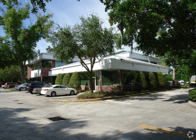
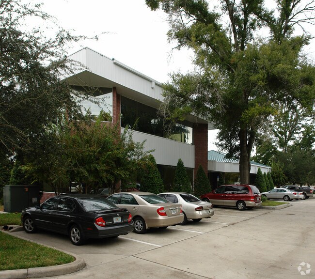
Property Record
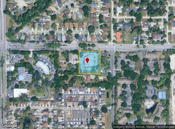
450 W Central Pky, Altamonte Springs, FL 32714
NEARBY LISTINGS FOR SALE OR LEASE
Property Detail
450 W Central Pky
Orlando-Kissimmee-Sanford, FL
450 Central Medical Building A Replat
10-21-29-533-0000-0010
LOT 1 450 CENTRAL MEDICAL BUILDING A REPLAT PB 57 PG 51
Officebuilding
Seminole
X
Florida
12095C0145F
1
2024
1.58 AC
2024
Altamonte/Douglas
021608
Orlando
15,927 SF
DEMOGRAPHICS near 450 W Central Pky
1 Mile
3 Mile
5 Mile
2024 Total Population
15,912
101,239
222,308
2029 Population
16,621
105,774
230,967
Pop Growth 2024-2029
+ 4.46%
+ 4.48%
+ 3.90%
Average Age
40
41
41
2024 Total Households
6,961
43,163
91,064
HH Growth 2024-2029
+ 4.83%
+ 4.67%
+ 4.07%
Median Household Inc
$57,327
$62,129
$64,345
Avg Household Size
2.20
2.30
2.40
2024 Avg HH Vehicles
2.00
2.00
2.00
Median Home Value
$243,875
$320,857
$312,373
Median Year Built
1981
1982
1982
Nearby Places
Map Layers
Map Styles
 Street
 Aerial
- Restaurants
- Banks
- Shops
- Fitness
- Groceries
PUBLIC TRANSPORTATION
COMMUTER RAIL
Altamonte Springs (SunRail - Florida Department of Transportation)
DRIVE
WALK
Distance
Altamonte Springs (SunRail - Florida Department of Transportation)
7 min
3.3 mi
Maitland (SunRail - Florida Department of Transportation)
DRIVE
WALK
Distance
Maitland (SunRail - Florida Department of Transportation)
11 min
5.3 mi
AIRPORT
Orlando Sanford International
DRIVE
WALK
Distance
Orlando Sanford International
26 min
15.6 mi
Orlando International
DRIVE
WALK
Distance
Orlando International
37 min
20.9 mi
Freight Ports
Port Canaveral
DRIVE
WALK
Distance
Port Canaveral
82 min
64.7 mi
Nearby Properties
Address
Land Use
TOTAL SIZE
Lot Size
Zoning
Address
Land Use
TOTAL SIZE
Lot Size
Zoning
1,009,074 SF
37.77 AC
PD
Address
Land Use
TOTAL SIZE
Lot Size
Zoning
630,861 SF
31.67 AC
PUDMO
Address
Land Use
TOTAL SIZE
Lot Size
Zoning
88,256 SF
39.64 AC
MOC3
Address
Land Use
TOTAL SIZE
Lot Size
Zoning
423,270 SF
3.45 AC
MOC3
Address
Land Use
TOTAL SIZE
Lot Size
Zoning
745,187 SF
18 AC
PUD
Address
Land Use
TOTAL SIZE
Lot Size
Zoning
34,430 SF
19.99 AC
Address
Land Use
TOTAL SIZE
Lot Size
Zoning
467,832 SF
20.10 AC
PD
Address
Land Use
TOTAL SIZE
Lot Size
Zoning
1,674 SF
10.53 AC
R3
Address
Land Use
TOTAL SIZE
Lot Size
Zoning
129,745 SF
71.01 AC
PUD
Address
Land Use
TOTAL SIZE
Lot Size
Zoning
357 SF
17.05 AC
Address
Land Use
TOTAL SIZE
Lot Size
Zoning
Address
Land Use
TOTAL SIZE
Lot Size
Zoning
1,416 SF
23.80 AC
Address
Land Use
TOTAL SIZE
Lot Size
Zoning
391,714 SF
42.59 AC
A1
Address
Land Use
TOTAL SIZE
Lot Size
Zoning
381,557 SF
10.09 AC
PD
Address
Land Use
TOTAL SIZE
Lot Size
Zoning
400 SF
13.82 AC
R1AA
Address
Land Use
TOTAL SIZE
Lot Size
Zoning
5,256 SF
1.10 AC
PUDRES
Address
Land Use
TOTAL SIZE
Lot Size
Zoning
231,070 SF
35.59 AC
MOR2
Address
Land Use
TOTAL SIZE
Lot Size
Zoning
11,392 SF
8.44 AC
Address
Land Use
TOTAL SIZE
Lot Size
Zoning
631,978 SF
7 AC
PD
Address
Land Use
TOTAL SIZE
Lot Size
Zoning
385,111 SF
12.39 AC
PD
Address
Land Use
TOTAL SIZE
Lot Size
Zoning
1,428 SF
8.56 AC
MOR3
Address
Land Use
TOTAL SIZE
Lot Size
Zoning
1,170 SF
17.75 AC
A1
Address
Land Use
TOTAL SIZE
Lot Size
Zoning
779,046 SF
14.36 AC
PD
Address
Land Use
TOTAL SIZE
Lot Size
Zoning
447,386 SF
5.73 AC
PD
Address
Land Use
TOTAL SIZE
Lot Size
Zoning
254,477 SF
13.14 AC
MOR2
Address
Land Use
TOTAL SIZE
Lot Size
Zoning
5,924 SF
17.38 AC
R1A
Address
Land Use
TOTAL SIZE
Lot Size
Zoning
3,680 SF
17.70 AC
PUD
Address
Land Use
TOTAL SIZE
Lot Size
Zoning
539,186 SF
9.14 AC
PD
Address
Land Use
TOTAL SIZE
Lot Size
Zoning
3,140 SF
15.89 AC
PUD
Address
Land Use
TOTAL SIZE
Lot Size
Zoning
6,817 SF
19.83 AC
R3
The World's #1 Commercial Real Estate Marketplace
Connect with us
© 2025 CoStar Group
The information above has been obtained from sources believed reliable. While we do not doubt its accuracy we have not verified it and make no guarantee, warranty or representation about it. It is your responsibility to independently confirm its accuracy and completeness. Any projections, opinions, assumptions, or estimates used are for example only and do not represent the current or future performance of the property. The value of this transaction to you depends on tax and other factors which should be evaluated by your tax, financial, and legal advisors. You and your advisors should conduct a careful, independent investigation of the property to determine to your satisfaction the suitability of the property for your needs.