Property Record
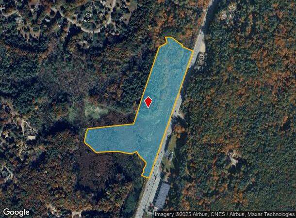
450 Washington St, Wrentham, MA 02093


NEARBY LISTINGS FOR SALE OR LEASE
Property Detail
450 Washington St
WREN-000008O-000007-000018
Norfolk
Commercialacreage
Massachusetts
AE
18
25021C0341E
17.24 AC
2025
I-95 Corridor South
2025
Boston
441204
Boston-Cambridge-Newton, MA-NH
DEMOGRAPHICS near 450 Washington St
1 Mile
3 Mile
5 Mile
2024 Total Population
1,445
20,462
73,304
2029 Population
1,430
20,381
72,860
Pop Growth 2024-2029
(1.04%)
(0.40%)
(0.61%)
Average Age
43
42
41
2024 Total Households
549
7,860
27,883
HH Growth 2024-2029
(1.09%)
(0.42%)
(0.68%)
Median Household Inc
$130,660
$112,070
$114,389
Avg Household Size
2.60
2.50
2.60
2024 Avg HH Vehicles
2.00
2.00
2.00
Median Home Value
$522,638
$575,159
$555,150
Median Year Built
1975
1973
1978
Nearby Places
Map Layers
Map Styles
 Street
 Aerial
- Restaurants
- Banks
- Shops
- Fitness
- Groceries
PUBLIC TRANSPORTATION
COMMUTER RAIL
Foxboro (Special Events Only) (Foxboro Line (Special Events Only) - Massachusetts Bay Transportation Authority Commuter Rail (Purple Line))
DRIVE
WALK
Distance
Foxboro (Special Events Only) (Foxboro Line (Special Events Only) - Massachusetts Bay Transportation Authority Commuter Rail (Purple Line))
5 min
3.5 mi
Norfolk (Franklin Line - Massachusetts Bay Transportation Authority Commuter Rail (Purple Line))
DRIVE
WALK
Distance
Norfolk (Franklin Line - Massachusetts Bay Transportation Authority Commuter Rail (Purple Line))
9 min
5.3 mi
AIRPORT
Rhode Island Tf Green International
DRIVE
WALK
Distance
Rhode Island Tf Green International
46 min
30.9 mi
General Edward Lawrence Logan International
DRIVE
WALK
Distance
General Edward Lawrence Logan International
46 min
32.4 mi
Freight Ports
Port of Boston
DRIVE
WALK
Distance
Port of Boston
43 min
27.0 mi
SALE & LEASE HISTORY
LISTING DATE
SALE/LEASE

Nov 08, 2018
For Sale
Nearby Properties
Address
Land Use
TOTAL SIZE
Lot Size
Zoning
Address
Land Use
TOTAL SIZE
Lot Size
Zoning
52,064 SF
87.51 AC
CI
Address
Land Use
TOTAL SIZE
Lot Size
Zoning
204,502 SF
40.65 AC
Address
Land Use
TOTAL SIZE
Lot Size
Zoning
14,317 SF
411.17 AC
R-43
Address
Land Use
TOTAL SIZE
Lot Size
Zoning
96,596 SF
17.01 AC
C-2 80
Address
Land Use
TOTAL SIZE
Lot Size
Zoning
231,487 SF
33.15 AC
R-30
Address
Land Use
TOTAL SIZE
Lot Size
Zoning
19,742 SF
58.34 AC
R-43
Address
Land Use
TOTAL SIZE
Lot Size
Zoning
41.28 AC
Address
Land Use
TOTAL SIZE
Lot Size
Zoning
83,014 SF
129.67 AC
Address
Land Use
TOTAL SIZE
Lot Size
Zoning
86,116 SF
22.50 AC
Address
Land Use
TOTAL SIZE
Lot Size
Zoning
126,484 SF
1.61 AC
Address
Land Use
TOTAL SIZE
Lot Size
Zoning
125,778 SF
35.60 AC
Address
Land Use
TOTAL SIZE
Lot Size
Zoning
28.55 AC
CC
Address
Land Use
TOTAL SIZE
Lot Size
Zoning
142,040 SF
18.16 AC
CI
Address
Land Use
TOTAL SIZE
Lot Size
Zoning
113,750 SF
10.50 AC
Address
Land Use
TOTAL SIZE
Lot Size
Zoning
7.86 AC
Address
Land Use
TOTAL SIZE
Lot Size
Zoning
22 AC
CI
Address
Land Use
TOTAL SIZE
Lot Size
Zoning
202,800 SF
20.33 AC
Address
Land Use
TOTAL SIZE
Lot Size
Zoning
24.29 AC
Address
Land Use
TOTAL SIZE
Lot Size
Zoning
74,159 SF
4.21 AC
Address
Land Use
TOTAL SIZE
Lot Size
Zoning
11.97 AC
Address
Land Use
TOTAL SIZE
Lot Size
Zoning
10,984 SF
8.52 AC
B-1 10
Address
Land Use
TOTAL SIZE
Lot Size
Zoning
132,952 SF
13.64 AC
Address
Land Use
TOTAL SIZE
Lot Size
Zoning
141,049 SF
22.77 AC
CI
Address
Land Use
TOTAL SIZE
Lot Size
Zoning
246,854 SF
31.90 AC
Address
Land Use
TOTAL SIZE
Lot Size
Zoning
91,216 SF
1.18 AC
Address
Land Use
TOTAL SIZE
Lot Size
Zoning
21,796 SF
2.74 AC
Address
Land Use
TOTAL SIZE
Lot Size
Zoning
117,428 SF
2.81 AC
Address
Land Use
TOTAL SIZE
Lot Size
Zoning
38.97 AC
Address
Land Use
TOTAL SIZE
Lot Size
Zoning
102,591 SF
4.21 AC
R-43
Address
Land Use
TOTAL SIZE
Lot Size
Zoning
4.13 AC
The World's #1 Commercial Real Estate Marketplace
Connect with us
© 2025 CoStar Group
The information above has been obtained from sources believed reliable. While we do not doubt its accuracy we have not verified it and make no guarantee, warranty or representation about it. It is your responsibility to independently confirm its accuracy and completeness. Any projections, opinions, assumptions, or estimates used are for example only and do not represent the current or future performance of the property. The value of this transaction to you depends on tax and other factors which should be evaluated by your tax, financial, and legal advisors. You and your advisors should conduct a careful, independent investigation of the property to determine to your satisfaction the suitability of the property for your needs.