Property Record
4500 34Th St N, Saint Petersburg, FL 33714


NEARBY LISTINGS FOR SALE OR LEASE
-
-
View all Saint Petersburg listings for sale on LoopNet.com
Property Detail
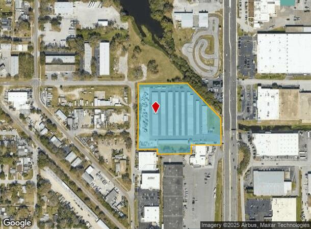
4500 34Th St N
03-31-16-00000-410-0200
From Ne Cor Of Se 1/4 Th S
Publicstorage
FROM NE COR OF SE 1/4 TH S 418.92FT & W 70FT FOR POB TH W 203.7FT TH S 58.7FT TH W 228.23FT TH N 30FT TH W 131.1FT TH N 447.62FT TH E 333.33FT TH S45DE 328.96 FT TH S 181.18FT TO POB CONT 5.24AC
AE
Pinellas
12103C0208J
Florida
2024
5.18 AC
2025
South Pinellas
024703
Tampa/St Petersburg
65,600 SF
Tampa-St. Petersburg-Clearwater, FL
DEMOGRAPHICS near 4500 34Th St N
1 Mile
3 Mile
5 Mile
2024 Total Population
17,344
129,679
299,643
2029 Population
17,361
129,815
300,182
Pop Growth 2024-2029
+ 0.10%
+ 0.10%
+ 0.18%
Average Age
42
43
44
2024 Total Households
7,353
58,087
136,410
HH Growth 2024-2029
(0.07%)
+ 0.02%
+ 0.02%
Median Household Inc
$41,851
$60,310
$59,872
Avg Household Size
2.20
2.10
2.10
2024 Avg HH Vehicles
2.00
2.00
2.00
Median Home Value
$158,880
$235,445
$257,271
Median Year Built
1967
1964
1968
Nearby Places
Map Layers
Map Styles
 Street
 Aerial
- Restaurants
- Banks
- Shops
- Fitness
- Groceries
PUBLIC TRANSPORTATION
AIRPORT
St Pete-Clearwater International
DRIVE
WALK
Distance
St Pete-Clearwater International
22 min
9.6 mi
Tampa International
DRIVE
WALK
Distance
Tampa International
29 min
18.8 mi
Sarasota/Bradenton International
DRIVE
WALK
Distance
Sarasota/Bradenton International
52 min
35.7 mi
Freight Ports
Port Manatee
DRIVE
WALK
Distance
Port Manatee
38 min
28.3 mi
Nearby Properties
Address
Land Use
TOTAL SIZE
Lot Size
Zoning
Address
Land Use
TOTAL SIZE
Lot Size
Zoning
478,217 SF
9.84 AC
Address
Land Use
TOTAL SIZE
Lot Size
Zoning
447,664 SF
34.44 AC
Address
Land Use
TOTAL SIZE
Lot Size
Zoning
346,420 SF
17.95 AC
Address
Land Use
TOTAL SIZE
Lot Size
Zoning
372,436 SF
22.30 AC
Address
Land Use
TOTAL SIZE
Lot Size
Zoning
404,063 SF
12.98 AC
Address
Land Use
TOTAL SIZE
Lot Size
Zoning
404,899 SF
35.35 AC
Address
Land Use
TOTAL SIZE
Lot Size
Zoning
358,681 SF
11.70 AC
Address
Land Use
TOTAL SIZE
Lot Size
Zoning
240,736 SF
58.40 AC
Address
Land Use
TOTAL SIZE
Lot Size
Zoning
359,527 SF
19.65 AC
Address
Land Use
TOTAL SIZE
Lot Size
Zoning
324,579 SF
16.97 AC
Address
Land Use
TOTAL SIZE
Lot Size
Zoning
309,526 SF
36.85 AC
C2
Address
Land Use
TOTAL SIZE
Lot Size
Zoning
300,546 SF
6.49 AC
Address
Land Use
TOTAL SIZE
Lot Size
Zoning
261,995 SF
17.08 AC
Address
Land Use
TOTAL SIZE
Lot Size
Zoning
170,146 SF
17.78 AC
Address
Land Use
TOTAL SIZE
Lot Size
Zoning
267,649 SF
17.86 AC
Address
Land Use
TOTAL SIZE
Lot Size
Zoning
193,194 SF
13.53 AC
Address
Land Use
TOTAL SIZE
Lot Size
Zoning
360,137 SF
37.64 AC
AE
Address
Land Use
TOTAL SIZE
Lot Size
Zoning
188,833 SF
1.77 AC
Address
Land Use
TOTAL SIZE
Lot Size
Zoning
172,600 SF
20.57 AC
Address
Land Use
TOTAL SIZE
Lot Size
Zoning
172,768 SF
15.05 AC
RPD20
Address
Land Use
TOTAL SIZE
Lot Size
Zoning
125,218 SF
13.51 AC
Address
Land Use
TOTAL SIZE
Lot Size
Zoning
88,793 SF
13.78 AC
IL
Address
Land Use
TOTAL SIZE
Lot Size
Zoning
175,547 SF
15.81 AC
Address
Land Use
TOTAL SIZE
Lot Size
Zoning
113,365 SF
13.32 AC
Address
Land Use
TOTAL SIZE
Lot Size
Zoning
269,582 SF
16.72 AC
Address
Land Use
TOTAL SIZE
Lot Size
Zoning
226,561 SF
24.34 AC
Address
Land Use
TOTAL SIZE
Lot Size
Zoning
116,358 SF
12.74 AC
Address
Land Use
TOTAL SIZE
Lot Size
Zoning
248,572 SF
15.22 AC
PSP
Address
Land Use
TOTAL SIZE
Lot Size
Zoning
116,080 SF
12.42 AC
Address
Land Use
TOTAL SIZE
Lot Size
Zoning
99,589 SF
41.77 AC
The World's #1 Commercial Real Estate Marketplace
Connect with us
© 2025 CoStar Group
The information above has been obtained from sources believed reliable. While we do not doubt its accuracy we have not verified it and make no guarantee, warranty or representation about it. It is your responsibility to independently confirm its accuracy and completeness. Any projections, opinions, assumptions, or estimates used are for example only and do not represent the current or future performance of the property. The value of this transaction to you depends on tax and other factors which should be evaluated by your tax, financial, and legal advisors. You and your advisors should conduct a careful, independent investigation of the property to determine to your satisfaction the suitability of the property for your needs.