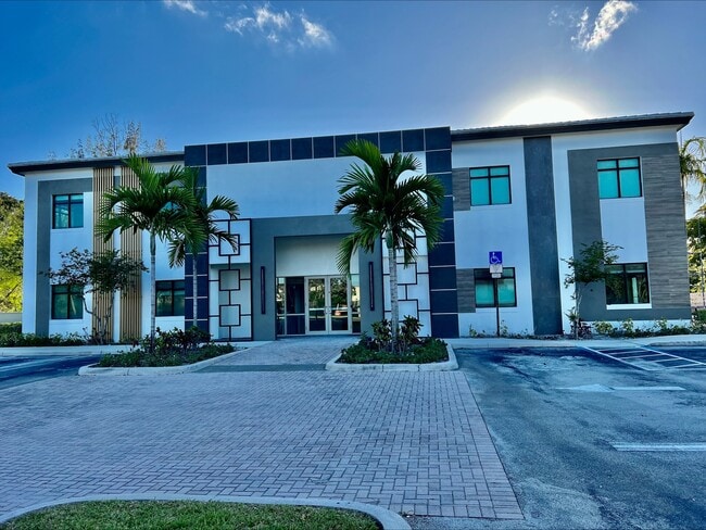
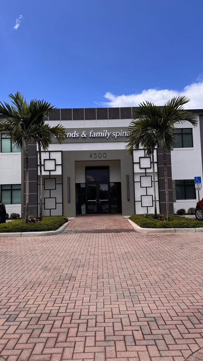
Property Record
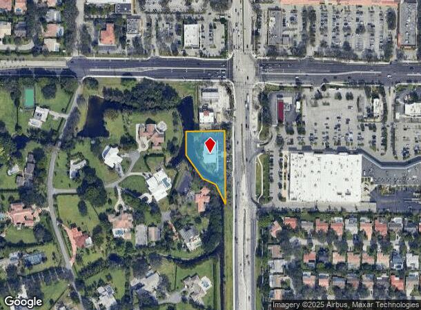
4500 N University Dr, Coral Springs, FL 33065
Current Lease Availabilities
NEARBY LISTINGS FOR SALE OR LEASE
Property Detail
4500 N University Dr
Fort Lauderdale-Pompano Beach-Deerfield Beach, FL
Coral Springs Hills 59-41 B
48-41-16-01-0692
CORAL SPRINGS HILLS 59-41 B PART OF PARCEL A DESCD AS,COMM AT NE COR OF SEC 16,S ALG E/L 298.65,W 60 TO POB,S 368.45,W 40 TO MOST SLY COR PARCEL A,NWLY 107.56,NW 70.00,NW 148.85,NLY 121.38,E 236.48 TO POB,LESS PT INCD IN PARCEL C OF PB 63-44 B
Officebuilding
Broward
AE
Florida
12099C1150F
2
2024
1.08 AC
2025
NW Broward/Coral Springs
020311
South Florida
10,661 SF
DEMOGRAPHICS near 4500 N University Dr
1 Mile
3 Mile
5 Mile
2024 Total Population
14,997
124,464
299,208
2029 Population
14,754
122,051
295,689
Pop Growth 2024-2029
(1.62%)
(1.94%)
(1.18%)
Average Age
38
38
39
2024 Total Households
5,159
41,850
105,081
HH Growth 2024-2029
(2.21%)
(2.54%)
(1.64%)
Median Household Inc
$71,060
$85,570
$78,723
Avg Household Size
2.80
2.80
2.70
2024 Avg HH Vehicles
2.00
2.00
2.00
Median Home Value
$457,930
$422,216
$374,963
Median Year Built
1983
1986
1986
Nearby Places
- Restaurants
- Banks
- Shops
- Fitness
- Groceries
PUBLIC TRANSPORTATION
COMMUTER RAIL
Pompano Beach (Tri-County Commuter - South Florida Regional Transportation Authority (Tri-Rail))
DRIVE
WALK
Distance
Pompano Beach (Tri-County Commuter - South Florida Regional Transportation Authority (Tri-Rail))
17 min
8.5 mi
AIRPORT
Fort Lauderdale/Hollywood International
DRIVE
WALK
Distance
Fort Lauderdale/Hollywood International
38 min
22.7 mi
Palm Beach International
DRIVE
WALK
Distance
Palm Beach International
50 min
37.8 mi
Miami International
DRIVE
WALK
Distance
Miami International
57 min
42.5 mi
Freight Ports
Port Everglades
DRIVE
WALK
Distance
Port Everglades
37 min
21.4 mi
Nearby Properties
Address
Land Use
TOTAL SIZE
Lot Size
Zoning
Address
Land Use
TOTAL SIZE
Lot Size
Zoning
447,756 SF
45.30 AC
BCRM-5
Address
Land Use
TOTAL SIZE
Lot Size
Zoning
457,406 SF
21.26 AC
MC
Address
Land Use
TOTAL SIZE
Lot Size
Zoning
640,399 SF
2.41 AC
Address
Land Use
TOTAL SIZE
Lot Size
Zoning
641,010 SF
29.99 AC
RM-20
Address
Land Use
TOTAL SIZE
Lot Size
Zoning
399,296 SF
20.23 AC
RM-40
Address
Land Use
TOTAL SIZE
Lot Size
Zoning
451,337 SF
33.01 AC
R-3A
Address
Land Use
TOTAL SIZE
Lot Size
Zoning
344,358 SF
23.27 AC
RM-20
Address
Land Use
TOTAL SIZE
Lot Size
Zoning
572,683 SF
38.41 AC
IRD
Address
Land Use
TOTAL SIZE
Lot Size
Zoning
278,336 SF
15.85 AC
RM-20
Address
Land Use
TOTAL SIZE
Lot Size
Zoning
354,535 SF
33.95 AC
RM-15
Address
Land Use
TOTAL SIZE
Lot Size
Zoning
345,189 SF
9.66 AC
RM-30
Address
Land Use
TOTAL SIZE
Lot Size
Zoning
421,001 SF
44.62 AC
CF
Address
Land Use
TOTAL SIZE
Lot Size
Zoning
345,021 SF
13.79 AC
RM-20
Address
Land Use
TOTAL SIZE
Lot Size
Zoning
293,096 SF
11.84 AC
RM-20
Address
Land Use
TOTAL SIZE
Lot Size
Zoning
260,897 SF
12.62 AC
RM-20
Address
Land Use
TOTAL SIZE
Lot Size
Zoning
311,836 SF
13.92 AC
RM-30
Address
Land Use
TOTAL SIZE
Lot Size
Zoning
157,914 SF
15.11 AC
B-3
Address
Land Use
TOTAL SIZE
Lot Size
Zoning
401,920 SF
16.93 AC
RM-15
Address
Land Use
TOTAL SIZE
Lot Size
Zoning
440,886 SF
23.17 AC
IRD
Address
Land Use
TOTAL SIZE
Lot Size
Zoning
271,043 SF
19.02 AC
RM-20
Address
Land Use
TOTAL SIZE
Lot Size
Zoning
349,250 SF
19.90 AC
CF
Address
Land Use
TOTAL SIZE
Lot Size
Zoning
242,692 SF
17.25 AC
RM-20
Address
Land Use
TOTAL SIZE
Lot Size
Zoning
202,587 SF
11.01 AC
R-3A
Address
Land Use
TOTAL SIZE
Lot Size
Zoning
353,516 SF
33.96 AC
CF-E
Address
Land Use
TOTAL SIZE
Lot Size
Zoning
123,317 SF
10.48 AC
B-2
Address
Land Use
TOTAL SIZE
Lot Size
Zoning
209,123 SF
15.26 AC
RM-20
Address
Land Use
TOTAL SIZE
Lot Size
Zoning
22.25 AC
IRD
Address
Land Use
TOTAL SIZE
Lot Size
Zoning
182,867 SF
17.91 AC
RM-15
Address
Land Use
TOTAL SIZE
Lot Size
Zoning
293,533 SF
10.04 AC
RM-20
Address
Land Use
TOTAL SIZE
Lot Size
Zoning
150,273 SF
12.20 AC
DT-MU
The World's #1 Commercial Real Estate Marketplace
Connect with us
© 2025 CoStar Group
The information above has been obtained from sources believed reliable. While we do not doubt its accuracy we have not verified it and make no guarantee, warranty or representation about it. It is your responsibility to independently confirm its accuracy and completeness. Any projections, opinions, assumptions, or estimates used are for example only and do not represent the current or future performance of the property. The value of this transaction to you depends on tax and other factors which should be evaluated by your tax, financial, and legal advisors. You and your advisors should conduct a careful, independent investigation of the property to determine to your satisfaction the suitability of the property for your needs.