Property Record
4500 Directors Rd, Jacksonville, FL 32220


Save to a Folder
{{folder.Name}}
{{folder.ListingIds.length}} Properties
{{folder.ListingIds.length}} Property
Create a New Folder
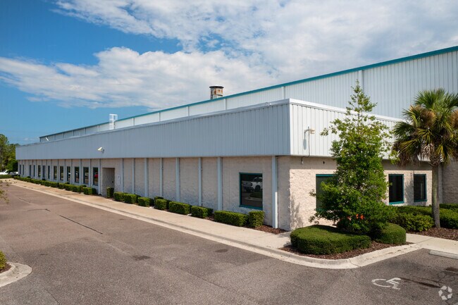
Property Detail
4500 Directors Rd
003328-0510
56-38 32-1S-25E 120.00 WESTLAKE INDUSTRIAL PARK UNIT ONE LOT 1
Warehouse
Duval
PUD
Florida
B and X Area of moderate flood hazard, usually the area between the limits of the 100-year and 500-year floods.
1
2025
120 AC
2026
West Side
010601
Jacksonville (Florida)
496,042 SF
Jacksonville, FL
NEARBY LISTINGS FOR SALE OR LEASE
DEMOGRAPHICS near 4500 Directors Rd
1 mile
3 mile
5 mile
2025 Total Population
350
5,953
31,015
2030 Population
383
6,582
33,472
Pop Growth 2025-2030
+ 9.43%
+ 10.57%
+ 7.92%
Average Age
44
42
41
2025 Total Households
139
2,242
11,436
HH Growth 2025-2030
+ 9.35%
+ 10.79%
+ 8.15%
Median Household Inc
$109,539
$90,246
$77,755
Avg Household Size
2.50
2.60
2.60
2025 Avg HH Vehicles
2.00
2.00
2.00
Median Home Value
$367,499
$333,884
$305,061
Median Year Built
2000
2002
1996
Nearby Places
Map Layers
Map Styles
 Street
 Aerial
Layers
 Traffic
 Biking
Places
Listings with unknown addresses are not visible on the map
- Restaurants
- Banks
- Shops
- Fitness
- Groceries
PUBLIC TRANSPORTATION
COMMUTER RAIL
Jacksonville (Silver Meteor - Amtrak, Silver Star - Amtrak)
Drive
Walk
Distance
Jacksonville (Silver Meteor - Amtrak, Silver Star - Amtrak)
18 min
8.5 mi
AIRPORT
Jacksonville International
Drive
Walk
Distance
Jacksonville International
32 min
17.6 mi
Freight Ports
Jacksonville Port
Drive
Walk
Distance
Jacksonville Port
29 min
14.6 mi
Nearby Properties
Address
Land Use
TOTAL SIZE
Lot Size
Zoning
Address
Land Use
TOTAL SIZE
Lot Size
Zoning
1,013,036 SF
51.67 AC
PUD
Address
Land Use
TOTAL SIZE
Lot Size
Zoning
973,797 SF
105.79 AC
PUD
Address
Land Use
TOTAL SIZE
Lot Size
Zoning
773,866 SF
68.14 AC
PUD
Address
Land Use
TOTAL SIZE
Lot Size
Zoning
842,398 SF
46.49 AC
PUD
Address
Land Use
TOTAL SIZE
Lot Size
Zoning
470,302 SF
250.89 AC
PUD
Address
Land Use
TOTAL SIZE
Lot Size
Zoning
491,247 SF
30.77 AC
PUD
Address
Land Use
TOTAL SIZE
Lot Size
Zoning
449,967 SF
23.08 AC
IL
Address
Land Use
TOTAL SIZE
Lot Size
Zoning
548,235 SF
64.22 AC
PUD
Address
Land Use
TOTAL SIZE
Lot Size
Zoning
435,150 SF
21.92 AC
PUD
Address
Land Use
TOTAL SIZE
Lot Size
Zoning
421,500 SF
43.21 AC
PUD
Address
Land Use
TOTAL SIZE
Lot Size
Zoning
449,367 SF
26.16 AC
PUD
Address
Land Use
TOTAL SIZE
Lot Size
Zoning
414,674 SF
21.03 AC
PUD
Address
Land Use
TOTAL SIZE
Lot Size
Zoning
401,680 SF
39.78 AC
PUD
Address
Land Use
TOTAL SIZE
Lot Size
Zoning
267,204 SF
25.05 AC
PUD
Address
Land Use
TOTAL SIZE
Lot Size
Zoning
343,650 SF
9.45 AC
PUD
Address
Land Use
TOTAL SIZE
Lot Size
Zoning
307,322 SF
19.31 AC
PUD
Address
Land Use
TOTAL SIZE
Lot Size
Zoning
311,382 SF
18.57 AC
PUD
Address
Land Use
TOTAL SIZE
Lot Size
Zoning
273,608 SF
23.15 AC
PUD
Address
Land Use
TOTAL SIZE
Lot Size
Zoning
168,619 SF
33.09 AC
PUD
Address
Land Use
TOTAL SIZE
Lot Size
Zoning
249,082 SF
31.28 AC
PUD
Address
Land Use
TOTAL SIZE
Lot Size
Zoning
237,368 SF
14.55 AC
PUD
Address
Land Use
TOTAL SIZE
Lot Size
Zoning
263,550 SF
29.32 AC
PUD
Address
Land Use
TOTAL SIZE
Lot Size
Zoning
235,950 SF
18.10 AC
PUD
Address
Land Use
TOTAL SIZE
Lot Size
Zoning
272,690 SF
39.15 AC
PUD
Address
Land Use
TOTAL SIZE
Lot Size
Zoning
1,265.67 AC
PUD
Address
Land Use
TOTAL SIZE
Lot Size
Zoning
197,164 SF
13.35 AC
PUD
Address
Land Use
TOTAL SIZE
Lot Size
Zoning
187,242 SF
18.73 AC
PUD
Address
Land Use
TOTAL SIZE
Lot Size
Zoning
216,022 SF
15.36 AC
PUD
Address
Land Use
TOTAL SIZE
Lot Size
Zoning
296,575 SF
16.24 AC
PUD
The World's #1 Commercial Real Estate Marketplace
Connect with us
© 2026 CoStar Group
The information above has been obtained from sources believed reliable. While we do not doubt its accuracy we have not verified it and make no guarantee, warranty or representation about it. It is your responsibility to independently confirm its accuracy and completeness. Any projections, opinions, assumptions, or estimates used are for example only and do not represent the current or future performance of the property. The value of this transaction to you depends on tax and other factors which should be evaluated by your tax, financial, and legal advisors. You and your advisors should conduct a careful, independent investigation of the property to determine to your satisfaction the suitability of the property for your needs.