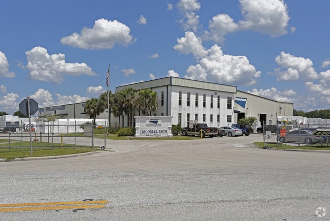
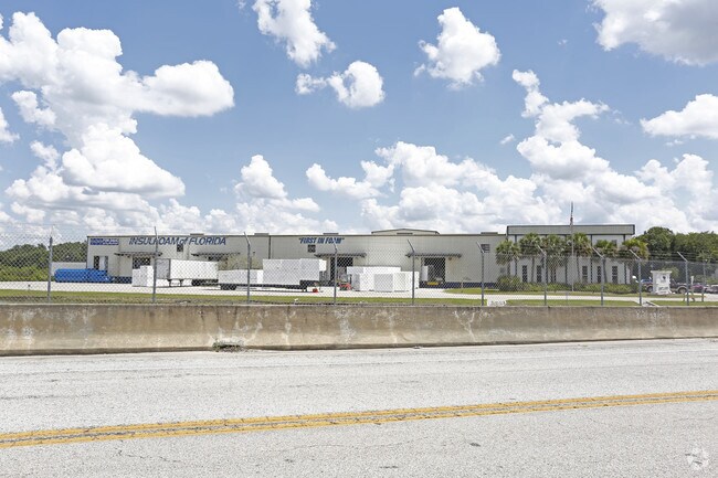
Property Record
4500 Frontage Rd S, Lakeland, FL 33815


NEARBY LISTINGS FOR SALE OR LEASE
Property Detail
4500 Frontage Rd S
Lakeland-Winter Haven, FL
Hibiscus Gardens Tr Pk
23-28-20-000000-034010
SW1/4 OF NW1/4 LESS R/W FOR I-4 & LESS W 373 FT OF S1/2 OF SW1/4 OF NW1/4 & LESS R/W FOR SR 570 AS DESC IN OR 3515-715
Lightindustrial
Polk
A
Florida
12105C0291G
3
2024
26.30 AC
2025
Polk County
012004
Tampa/St Petersburg
86,705 SF
DEMOGRAPHICS near 4500 Frontage Rd S
1 Mile
3 Mile
5 Mile
2024 Total Population
1,124
17,401
78,994
2029 Population
1,332
20,750
93,227
Pop Growth 2024-2029
+ 18.51%
+ 19.25%
+ 18.02%
Average Age
39
41
41
2024 Total Households
457
6,665
30,718
HH Growth 2024-2029
+ 18.38%
+ 19.49%
+ 18.33%
Median Household Inc
$54,673
$55,780
$52,809
Avg Household Size
2.50
2.50
2.50
2024 Avg HH Vehicles
1.00
2.00
2.00
Median Home Value
$169,999
$197,895
$184,463
Median Year Built
1977
1982
1983
Nearby Places
Map Layers
Map Styles
 Street
 Aerial
- Restaurants
- Banks
- Shops
- Fitness
- Groceries
PUBLIC TRANSPORTATION
COMMUTER RAIL
DRIVE
WALK
Distance
11 min
5.9 mi
AIRPORT
Tampa International
DRIVE
WALK
Distance
Tampa International
47 min
34.7 mi
SALE & LEASE HISTORY
LISTING DATE
SALE/LEASE

Nov 30, 2018
For Sale
Feb 07, 2018
For Sale
Nearby Properties
Address
Land Use
TOTAL SIZE
Lot Size
Zoning
Address
Land Use
TOTAL SIZE
Lot Size
Zoning
2,095,234 SF
102.45 AC
PUD
Address
Land Use
TOTAL SIZE
Lot Size
Zoning
1,210,880 SF
405.82 AC
PUD
Address
Land Use
TOTAL SIZE
Lot Size
Zoning
1,494,080 SF
116.77 AC
Address
Land Use
TOTAL SIZE
Lot Size
Zoning
518,028 SF
195.69 AC
Address
Land Use
TOTAL SIZE
Lot Size
Zoning
705,615 SF
33.05 AC
Address
Land Use
TOTAL SIZE
Lot Size
Zoning
711,568 SF
42.87 AC
PD
Address
Land Use
TOTAL SIZE
Lot Size
Zoning
595,473 SF
47.29 AC
Address
Land Use
TOTAL SIZE
Lot Size
Zoning
711,568 SF
43.33 AC
PD
Address
Land Use
TOTAL SIZE
Lot Size
Zoning
723,962 SF
47.49 AC
I
Address
Land Use
TOTAL SIZE
Lot Size
Zoning
655,123 SF
45.28 AC
Address
Land Use
TOTAL SIZE
Lot Size
Zoning
1,004,426 SF
93.42 AC
C4
Address
Land Use
TOTAL SIZE
Lot Size
Zoning
520,806 SF
25.62 AC
Address
Land Use
TOTAL SIZE
Lot Size
Zoning
492,960 SF
22.09 AC
Address
Land Use
TOTAL SIZE
Lot Size
Zoning
602,125 SF
43.97 AC
Address
Land Use
TOTAL SIZE
Lot Size
Zoning
599,280 SF
35.27 AC
GI
Address
Land Use
TOTAL SIZE
Lot Size
Zoning
566,274 SF
33.79 AC
GI
Address
Land Use
TOTAL SIZE
Lot Size
Zoning
417,890 SF
14.59 AC
Address
Land Use
TOTAL SIZE
Lot Size
Zoning
387,165 SF
37 AC
I2
Address
Land Use
TOTAL SIZE
Lot Size
Zoning
568,801 SF
37.13 AC
C4
Address
Land Use
TOTAL SIZE
Lot Size
Zoning
220,510 SF
37.56 AC
I
Address
Land Use
TOTAL SIZE
Lot Size
Zoning
172,176 SF
8.93 AC
RE2
Address
Land Use
TOTAL SIZE
Lot Size
Zoning
349,920 SF
22.21 AC
Address
Land Use
TOTAL SIZE
Lot Size
Zoning
297,600 SF
27.53 AC
XX
Address
Land Use
TOTAL SIZE
Lot Size
Zoning
300,411 SF
18.77 AC
I
Address
Land Use
TOTAL SIZE
Lot Size
Zoning
441,480 SF
24.28 AC
Address
Land Use
TOTAL SIZE
Lot Size
Zoning
309,334 SF
41.64 AC
Address
Land Use
TOTAL SIZE
Lot Size
Zoning
221,500 SF
19.54 AC
XX
Address
Land Use
TOTAL SIZE
Lot Size
Zoning
451,505 SF
30.12 AC
GI
Address
Land Use
TOTAL SIZE
Lot Size
Zoning
215,557 SF
13.27 AC
I
Address
Land Use
TOTAL SIZE
Lot Size
Zoning
200,200 SF
17.40 AC
XX
The World's #1 Commercial Real Estate Marketplace
Connect with us
© 2026 CoStar Group
The information above has been obtained from sources believed reliable. While we do not doubt its accuracy we have not verified it and make no guarantee, warranty or representation about it. It is your responsibility to independently confirm its accuracy and completeness. Any projections, opinions, assumptions, or estimates used are for example only and do not represent the current or future performance of the property. The value of this transaction to you depends on tax and other factors which should be evaluated by your tax, financial, and legal advisors. You and your advisors should conduct a careful, independent investigation of the property to determine to your satisfaction the suitability of the property for your needs.