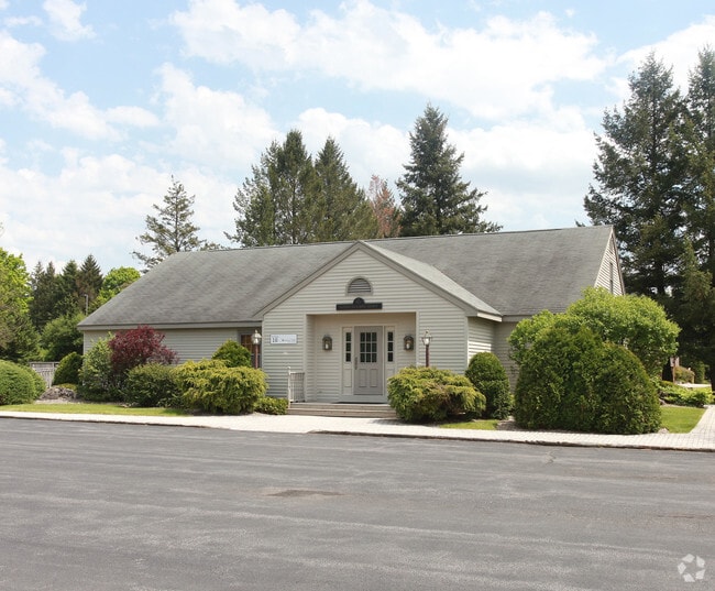
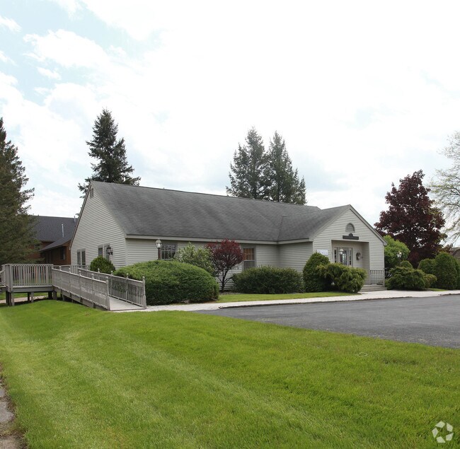
Property Record
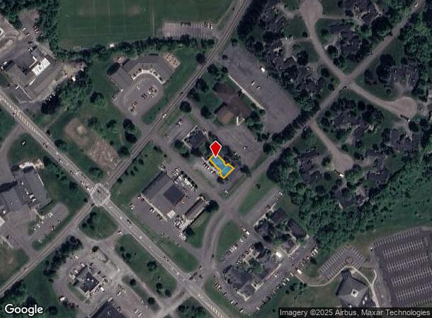
4600 Enders Rd, Manlius, NY 13104
NEARBY LISTINGS FOR SALE OR LEASE
Property Detail
4600 Enders Rd
313889-117-002-0001-003-008-0000
FL 98 FORMER BLDG C-9
Officebuilding
Onondaga
X
New York
36067C0377F
3.008
2025
0.09 AC
2024
SE Outer Onondaga County
015202
Syracuse
4,784 SF
Syracuse, NY
DEMOGRAPHICS near 4600 Enders Rd
1 Mile
3 Mile
5 Mile
2024 Total Population
5,272
17,173
30,614
2029 Population
5,176
16,752
29,886
Pop Growth 2024-2029
(1.82%)
(2.45%)
(2.38%)
Average Age
41
42
44
2024 Total Households
1,932
6,617
12,348
HH Growth 2024-2029
(1.97%)
(2.69%)
(2.59%)
Median Household Inc
$115,920
$119,133
$112,465
Avg Household Size
2.70
2.60
2.40
2024 Avg HH Vehicles
2.00
2.00
2.00
Median Home Value
$314,147
$286,640
$274,836
Median Year Built
1983
1976
1974
Nearby Places
- Restaurants
- Banks
- Shops
- Fitness
- Groceries
PUBLIC TRANSPORTATION
AIRPORT
Syracuse Hancock International
DRIVE
WALK
Distance
Syracuse Hancock International
31 min
19.5 mi
Freight Ports
Albany, NY Port
DRIVE
WALK
Distance
Albany, NY Port
169 min
136.6 mi
Nearby Properties
Address
Land Use
TOTAL SIZE
Lot Size
Zoning
Address
Land Use
TOTAL SIZE
Lot Size
Zoning
293,638 SF
58.90 AC
R1
Address
Land Use
TOTAL SIZE
Lot Size
Zoning
151,628 SF
38.98 AC
RA
Address
Land Use
TOTAL SIZE
Lot Size
Zoning
6.24 AC
RA
Address
Land Use
TOTAL SIZE
Lot Size
Zoning
15,240 SF
12.46 AC
R1
Address
Land Use
TOTAL SIZE
Lot Size
Zoning
6,936 SF
13.18 AC
R2
Address
Land Use
TOTAL SIZE
Lot Size
Zoning
26,508 SF
4.38 AC
C
Address
Land Use
TOTAL SIZE
Lot Size
Zoning
103,965 SF
6.03 AC
R2
Address
Land Use
TOTAL SIZE
Lot Size
Zoning
401,546 SF
24 AC
C
Address
Land Use
TOTAL SIZE
Lot Size
Zoning
5,376 SF
8.91 AC
R2
Address
Land Use
TOTAL SIZE
Lot Size
Zoning
60,621 SF
5.63 AC
C1
Address
Land Use
TOTAL SIZE
Lot Size
Zoning
60,300 SF
3.70 AC
IND
Address
Land Use
TOTAL SIZE
Lot Size
Zoning
43,620 SF
33.82 AC
R1
Address
Land Use
TOTAL SIZE
Lot Size
Zoning
13,225 SF
1.48 AC
R2
Address
Land Use
TOTAL SIZE
Lot Size
Zoning
59,066 SF
3.46 AC
R2
Address
Land Use
TOTAL SIZE
Lot Size
Zoning
12,787 SF
1.52 AC
C
Address
Land Use
TOTAL SIZE
Lot Size
Zoning
9,616 SF
6.40 AC
R5
Address
Land Use
TOTAL SIZE
Lot Size
Zoning
Address
Land Use
TOTAL SIZE
Lot Size
Zoning
28,037 SF
40.68 AC
C
Address
Land Use
TOTAL SIZE
Lot Size
Zoning
45,285 SF
5.33 AC
C1
Address
Land Use
TOTAL SIZE
Lot Size
Zoning
36,072 SF
2.27 AC
C
Address
Land Use
TOTAL SIZE
Lot Size
Zoning
28,334 SF
3.97 AC
IND
Address
Land Use
TOTAL SIZE
Lot Size
Zoning
1,776 SF
14.74 AC
C
Address
Land Use
TOTAL SIZE
Lot Size
Zoning
35,188 SF
20.90 AC
C
Address
Land Use
TOTAL SIZE
Lot Size
Zoning
9,102 SF
2.08 AC
C
Address
Land Use
TOTAL SIZE
Lot Size
Zoning
37,000 SF
2.54 AC
R1
Address
Land Use
TOTAL SIZE
Lot Size
Zoning
15,186 SF
2.57 AC
RM
Address
Land Use
TOTAL SIZE
Lot Size
Zoning
37,659 SF
2.76 AC
C
Address
Land Use
TOTAL SIZE
Lot Size
Zoning
13,256 SF
17.25 AC
C
Address
Land Use
TOTAL SIZE
Lot Size
Zoning
56,580 SF
9.59 AC
IND
Address
Land Use
TOTAL SIZE
Lot Size
Zoning
3,408 SF
5.12 AC
R5
The World's #1 Commercial Real Estate Marketplace
Connect with us
© 2025 CoStar Group
The information above has been obtained from sources believed reliable. While we do not doubt its accuracy we have not verified it and make no guarantee, warranty or representation about it. It is your responsibility to independently confirm its accuracy and completeness. Any projections, opinions, assumptions, or estimates used are for example only and do not represent the current or future performance of the property. The value of this transaction to you depends on tax and other factors which should be evaluated by your tax, financial, and legal advisors. You and your advisors should conduct a careful, independent investigation of the property to determine to your satisfaction the suitability of the property for your needs.